Related Research Articles

Palakkad is one of the 14 districts in the Indian state of Kerala. It was carved out from the southeastern region of the former Malabar District on 1 January 1957. It is located at the centre of Kerala. It is the largest district in the state since 2006. The city of Palakkad is the district headquarters. Palakkad is bordered on the northwest by the Malappuram district, on the southwest by the Thrissur district, on the northeast by Nilgiris district, and on the east by Coimbatore district of Tamil Nadu. The district is nicknamed "The granary of Kerala". Palakkad is the gateway to Kerala due to the presence of the Palakkad Gap, in the Western Ghats. The 2,383 m high Anginda peak, which is situated in the border of Palakkad district, Nilgiris district, and Malappuram district, in Silent Valley National Park, is the highest point of elevation in Palakkad district. Palakkad city is located just 50 km away from Coimbatore, a major city in Tamil Nadu state.
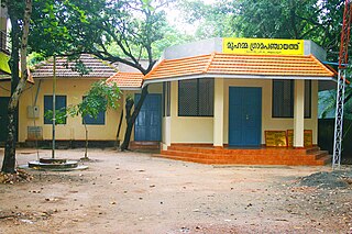
Gram Panchayat is a basic village-governing institute in Indian villages. It is a democratic structure at the grass-roots level in India. It is a political institute, acting as cabinet of the village. The Gram Sabha work as the general body of the Gram Panchayat. The members of the Gram Panchayat are elected directly by the people.

Purba Medinipur district is an administrative unit in the Indian state of West Bengal. It is the southernmost district of Medinipur division – one of the five administrative divisions of West Bengal. The headquarters in Tamluk. It was formed on 1 January 2002 after the Partition of Medinipur into Purba Medinipur and Paschim Medinipur which lies at the northern and western border of it. The state of Odisha is at the southwest border; the Bay of Bengal lies in the south; the Hooghly river and South 24 Parganas district to the east; Howrah district to the north-east; Paschim Medinipur district to the west.

Tiruchirappalli District is one of the 38 districts, located along the Kaveri River, in Tamil Nadu, India. The headquarters of the district is the city of Tiruchirappalli.

Panchayati Raj is the system of local self-government of villages in rural India as opposed to urban and suburban municipalities.

Paschim Medinipur district is one of the districts of the state of West Bengal, India. It was formed on 1 January 2002 after the Partition of Midnapore into Paschim Medinipur and Purba Medinipur. On 4 April 2017, the Jhargram subdivision was converted into a district. GDP of West Midnapore district is 12 billion USD.
Pottassery-II is a village in the Palakkad district, state of Kerala, India. It is administered by the Tachampara gram panchayat and the Kanjirampuzha gram panchayat. The village contains the places of Mundakkunnu, Kanjiram, and Pottassery.
Valiyavallampathy is a village in the Palakkad district, state of Kerala, India. It forms a part of the area administered by the Kozhinjampara gram panchayat.

Chottanikkara is a town and southern suburb of the city of Kochi, Kerala, India. In local administration, it is a panchayat which consists of Chottanikkara, Kanayannur, Eruvely, Kureekkad, Vattukkunnu, Palace Square and Kottayathupara villages. Chottanikkara is also a part of urban agglomeration of City of Kochi.
Pedda Amberpet is a Municipality in Rangareddy district, Telangana, India. It comes under Hayathnagar Mandal.
Kozhinjampara may refer to:
Ararah is a Gram panchayat in Hajipur in the Vaishali district, state of Bihar, India.
Bahuara is a Gram Panchayat in Hajipur, Vaishali district, Bihar.
Chakunda urf milki is a Gram panchayat in hajipur, vaishali district, bihar.
Gadai Sarai is a Gram panchayat in Hajipur, vaishali District, Bihar.
Kashipur chakbibi is a gram panchayat in Hajipur, Vaishali district, Bihar, India.
Pahetiya is a Gram panchayat in hajipur, vaishali district, bihar.
Panapur langa is a Gram panchayat in hajipur, vaishali district, bihar.

The Uttarakhand State Election Commission is an autonomous, independent, constitutional and statutory authority of the Indian state of Uttarakhand. It was formed on 30 July 2001 under the Constitution of India through the provisions of the 73rd and 74th Amendments Act of 1992.
References
- ↑ "Reports of National Panchayat Directory". Ministry of Panchayati Raj. Archived from the original on 8 December 2014. Retrieved 1 January 2014.