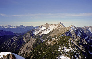
The Kitzbühel Alps are a mountain range of the Central Eastern Alps surrounding the town of Kitzbühel in Tyrol, Austria. Geologically they are part of the western slate zone.

Hunter Mountain is in the towns of Hunter and Lexington, just south of the village of Hunter, in Greene County, New York, United States. At approximately 4,040 feet (1,231 m) in elevation, it is the highest peak in the county and the second-highest peak in the Catskill Mountains.

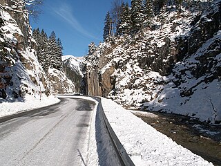
Crocker Mountain is a 4,228 ft (1,289 m) peak located in Carrabassett Valley, Franklin County, Maine, in the United States. Crocker Mountain is the fourth highest mountain in the state after the Katahdins and Sugarloaf Mountain, and is part of the Appalachian Mountains. Crocker Mountain is traversed by the Appalachian Trail (AT), a 2,170 mi (3,490 km) National Scenic Trail from Georgia to Maine.

Sugarloaf Mountain is a ski mountain located in Carrabassett Valley, Franklin County, Maine. It is the third highest peak in the state, after Mount Katahdin's Baxter and Hamlin peaks. Sugarloaf is flanked to the south by Spaulding Mountain.
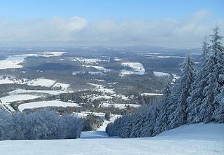
Elk Hill, also known as North Knob at its highest point or Elk Mountain, is a mountain in Herrick Township, Susquehanna County, Pennsylvania. It is the highest peak in eastern Pennsylvania, east of the Susquehanna River, as well as the highest peak on the Allegheny Plateau. Elk Hill rises conspicuously above the surrounding landscape. The mountain actually has two peaks; the main summit of North Knob is 2,693 feet (821 m), and the lower summit known as South Knob is 2,602 feet (793 m). It is home to Elk Mountain Ski Area which has a 1,000 feet (305 m) vertical drop and 27 ski trails.

The Ellmauer Halt (2,344 m) is the highest peak in the mountain massif of the Wilder Kaiser in the Kaiser range in the Austrian state of Tyrol. To the east is the summit of the Kapuzenturm, a striking and isolated rock pinnacle. In 1883 the first summit cross was erected on the mountain top.

The Alpspitze is a mountain, 2,628 m, in Bavaria, Germany. Its pyramidal peak is the symbol of Garmisch-Partenkirchen and is one of the best known and most attractive mountains of the Northern Limestone Alps. It is made predominantly of Wetterstein limestone from the Upper Triassic.

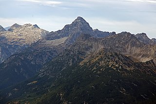
The Hocheisspitze is a 2,523 m high mountain in the Berchtesgaden Alps, over which the border between Germany and Austria runs. It is also the highest mountain in the eponymous Hocheis Group that belongs to the Hochkalter Massif.
The Hochvogel is a 2,592-metre-high (8,504 ft) mountain in the Allgäu Alps. The national border between Germany and Austria runs over the summit. Although only the thirteenth highest summit in the Allgäu Alps, the Hochvogel dominates other parts of Allgäu Alps and the other ranges in the immediate neighbourhood. This is due to the fact that the majority of the higher peaks are concentrated in the central and western part of the Allgäu Alps. The Hochvogel stands on its own in the eastern part of the mountain group; the nearest neighbouring summits are 200 to 300 metres lower. Experienced climbers can ascend the summit on two marked routes.

The Östliche Karwendelspitze is a mountain formed from Wetterstein limestone in the Karwendel mountains on the border between Bavaria and Tyrol. It is the highest mountain of the Northern Karwendel chain and the highest German peak in the Karwendel. It was first climbed by Hermann von Barth on 4 July 1870.

The Kröndlhorn is a 2,444 m above sea level (AA) high mountain in the Kitzbühel Alps in Austria. It is one of the highest mountains on the main crest of the Kitzbühel Alps. The state border between Tyrol and Salzburger Land runs over its summit.

The Großer Krottenkopf is the highest mountain in the Allgäu Alps of Austria. It is 2,656 m (AA) and is part of a side branch of the Hornbach chain, which branches off the main chain of the Allgäu Alps and runs for about 15 km eastwards.

The Gurktal Alps are a mountain range of the Central Eastern Alps in Austria, named after the valley of the Gurk River.

The Grimming is an isolated peak in the Dachstein Mountains of Austria and one of the few ultra-prominent mountains of the Alps.

The Hafelekarspitze is a mountain in the so-called North Chain (Nordkette) north of Innsbruck in Austria.

The Daniel is a mountain in the Austrian state of Tyrol, and the highest peak in the Ammergau Alps, a range within the Northern Limestone Alps . Located near the villages of Ehrwald and Lermoos, it is a popular mountain with hikers. Its North Face is around 200 metres high and its South Face has a more schrofen-like character. With the almost equally high Upsspitze it forms a double summit. To the northwest is a neighbouring peak, the Hochschrutte.

The Kellenspitze, often also called the Kellespitze or Köllenspitze, at 2,238 m (AA) is the highest peak in the Tannheim Mountains. It lies in the Austrian state of Tyrol. Originally the mountain was known locally as the Metzenarsch, but when in 1854 Marie Frederica of Prussia visited the hunting lodge on the Tegelberg and was having the surrounding peaks pointed out, they called it after In der Kelle, the name of a strip of land at the foot of the mountain, because its original name referred to a Matz, in other words a prostitute, and seemed inappropriate.

The Kreuzkarspitze is a 2,587-metre-high Austrian mountain in the Hornbach chain of the Allgäu Alps.

The Vorderseespitze is a mountain in the Lechtal Alps, Tyrol, Austria. At 2,889 m (AA) it is the eighth highest peak in the Lechtal Alps. The Lech Valley Ridgeway runs over its southeastern flank from Kaiserjochhaus to the Ansbacher Hut. According to the literature it was first climbed in 1855 by locals from Kaisers in the Lech Valley.

The Sulzkogel is a mountain, 3,016 m (AA), in the Stubai Alps in the Austrian state of Tyrol.