Istria is the largest peninsula within the Adriatic Sea. Located at the top of the Adriatic between the Gulf of Trieste and the Kvarner Gulf, the peninsula is shared by three countries: Croatia, Slovenia, and Italy, 90% of its area being part of Croatia. Most of Croatian Istria is part of Istria County.

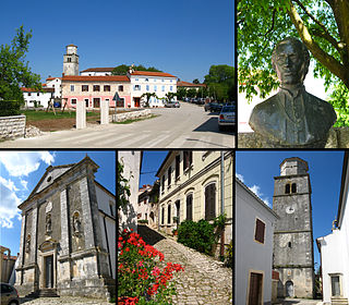
Roč is a village in Istria County, north-west Croatia. Administratively it belongs to the town of Buzet. Roč is considered a historic town rather than a village due to its rich cultural heritage.

Poreč is a town and municipality on the western coast of the Istrian peninsula, in Istria County, west Croatia. Its major landmark is the 6th-century Euphrasian Basilica, which was designated a UNESCO World Heritage Site in 1997.

Istria County is the westernmost county of Croatia which includes the majority of the Istrian peninsula.

Buje is a town situated in Istria, Croatia's westernmost peninsula.

Novigrad is a town in Istria County in western Croatia. It is also sometimes referred to as Novigrad Istarski to distinguish it from three other Croatian towns of the same name.

Žminj is a municipality and small town in Istria, Croatia, 15 km south of Pazin.

Brtonigla is a village and a municipality in the north-western part of Istria County, Croatia. Brtonigla is officially bilingual, with Croatian and Italian being equal; in 2011, 40% of the population declared themselves as ethnic Italians.

Gračišće is a village and municipality of Istria County in Croatia.

Karojba is a village and municipality in Istria, Croatia located 18 km north-west of Pazin.

Oprtalj is a village and municipality in Istria, Croatia. Oprtalj is a community in the central northern part of Istria County, situated across the Mirna river valley from the village of Motovun, about 20 km northwest of Pazin.

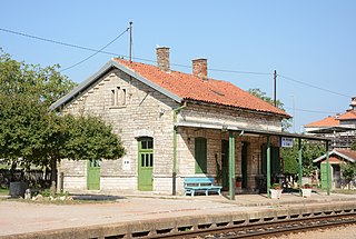
Pićan is a village and municipality in the central part of Istria, Croatia, 12 km southeast of Pazin; elevation 360 m. The chief occupations are agriculture and livestock breeding. It is situated on the D64 state road (Pazin-Kršan-Vozilići). There is a railway station on the former Lupoglav – Raša railway.

Svetvinčenat is a village and municipality in the south of the central part of Istria, Croatia, about 25 km southwest of Pazin and 25 km northeast of Pula.

Sveti Petar u Šumi is a village and municipality (općina) in Istria County, Croatia.

Tinjan is a village and municipality in Istria, Croatia.

Italians of Croatia are an autochthonous historical national minority recognized by the Constitution of Croatia. As such, they elect a special representative to the Croatian Parliament. There is the Italian Union of Croatia and Slovenia, which is a Croatian-Slovenian joint organization with its main site in Rijeka, Croatia and its secondary site in Koper, Slovenia.
Rakalj is a village in Croatia. It is part of the municipality of Marčana in Istria County.

The Proština rebellion was a rebellion by peasants in Istria, then a territory of the Kingdom of Italy, against the fascist government. It began in early February 1921 and was quelled on 5 April 1921. Almost at the same time, a miners' uprising known as the Labin Republic took place in the neighboring Labin region. It was one of the first anti-fascism uprisings in Europe.
Šegotići is a settlement in the Republic of Croatia, part of the Municipality of Marčana, Istria County.


