Krstinja

Last updated
Krstinja
Крстиња (Serbian) [1]
Village
CountryFlag of Croatia.svg  Croatia
County Karlovac County
Municipality Vojnić
Time zone CET (UTC+1)
  Summer (DST) CEST (UTC+2)

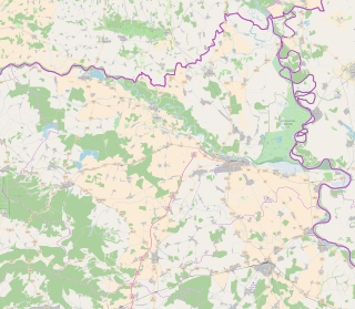
Krstinja (Serbian Cyrillic : Крстиња) is a village in Croatia. It is connected by the D216 highway.

The Serbian Cyrillic alphabet is an adaptation of the Cyrillic script for Serbo-Croatian, developed in 1818 by Serbian linguist Vuk Karadžić. It is one of the two alphabets used to write standard modern Serbian and Montenegrin, the other being Latin. In Croatian and Bosnian, only the Latin alphabet is used.

Village Small clustered human settlement smaller than a town

A village is a clustered human settlement or community, larger than a hamlet but smaller than a town, with a population ranging from a few hundred to a few thousand. Though villages are often located in rural areas, the term urban village is also applied to certain urban neighborhoods. Villages are normally permanent, with fixed dwellings; however, transient villages can occur. Further, the dwellings of a village are fairly close to one another, not scattered broadly over the landscape, as a dispersed settlement.

Croatia Republic in Central Europe

Croatia, officially the Republic of Croatia, is a country at the crossroads of Central and Southeast Europe, on the Adriatic Sea. It borders Slovenia to the northwest, Hungary to the northeast, Serbia to the east, Bosnia and Herzegovina, and Montenegro to the southeast, sharing a maritime border with Italy. Its capital, Zagreb, forms one of the country's primary subdivisions, along with twenty counties. Croatia has an area of 56,594 square kilometres and a population of 4.28 million, most of whom are Roman Catholics.

Coordinates: 45°15′N15°44′E / 45.250°N 15.733°E / 45.250; 15.733

Geographic coordinate system Coordinate system

A geographic coordinate system is a coordinate system that enables every location on Earth to be specified by a set of numbers, letters or symbols. The coordinates are often chosen such that one of the numbers represents a vertical position and two or three of the numbers represent a horizontal position; alternatively, a geographic position may be expressed in a combined three-dimensional Cartesian vector. A common choice of coordinates is latitude, longitude and elevation. To specify a location on a plane requires a map projection.

Related Research Articles

Kaptol, Požega-Slavonia County municipality of Croatia

Kaptol is a village in central Slavonia, Croatia. It is located on the slopes of Papuk mountain, east of Velika and northeast of Požega. The population of the municipality is 3,472, with 1,409 people in Kaptol itself, 97% are Croats.

Zagreb Indoors tennis tournament

The Zagreb Indoors was a men's tennis event on the ATP Tour held in the Croatian capital of Zagreb. From 2009-2015, it was a part of the ATP 250 Series and offered 250 ranking points. The tournament was played on a fast and hard indoor surface (RuKort) and featured both men's singles and men's doubles tournament.

Kneževi Vinogradi Municipality in Baranya, Croatia

Kneževi Vinogradi is a village and municipality in Croatia. It is situated in the Osijek-Baranja County, on the southern slopes of Bansko Brdo, 11 km southeast of Beli Manastir. Its elevation is 103 m. Chief occupations of villagers include farming, viticulture, livestock breeding and dairy industry.

Okučani municipality of Croatia

Okučani is a village in western Slavonia, Croatia.

Berek, Croatia Municipality in Bjelovar-Bilogora County, Croatia

Berek is a municipality in Bjelovar-Bilogora County, Croatia. There are 1,443 inhabitants, of which 90% are Croats.

Rovišće is a village and a municipality in Bjelovar-Bilogora County, Croatia. There are 4,822 inhabitants, 1,196 in the village itself, of which 97% are Croats.

Vânători is a commune located in Vrancea County, Romania. It is composed of seven villages: Balta Raței, Jorăști, Mirceștii Noi, Mirceștii Vechi, Petrești, Rădulești and Vânători.

Andrijaševci Municipality in Slavonia, Croatia

Andrijaševci is a village and the eponymous municipality in Vukovar-Srijem County in eastern Croatia. The 2011 census listed a total of 4,075 inhabitants in the municipality's two settlements:

Kotlina, Baranja Village in Baranya, Croatia

Kotlina is a settlement in the region of Baranja, Croatia. Administratively, it is located in the Kneževi Vinogradi municipality within the Osijek-Baranja County. Population is 334 people.

Rakov Potok is a village in Croatia. It is connected by the D1 highway.

Donja Brusovača is a village in Croatia. It is connected by the D216 highway. Croatian village, 8 kilometers from the border with Bosnia with mainly Serbian inhabitants, mainly elder people.

Gornji Laduč is a village in Croatia. It is connected by the D225 highway.

Prigorje Brdovečko is a village in Croatia. It is connected by the D225 highway.

Gračac Slavetićki is a settlement in the Jastrebarsko administrative area of Zagreb County, Croatia. As of 2011 it had a population of 5.

Plešivica is a settlement in the Jastrebarsko administrative area of Zagreb County, Croatia. As of 2011 it had a population of 292 people.

Bobovica, Croatia is a settlement (naselje) in the Samobor administrative territory of Zagreb County, Croatia. As of 2011 it had a population of 285 people.

Galgovo is a settlement (naselje) in the Samobor administrative territory of Zagreb County, Croatia. As of 2011 it had a population of 686 people.

Kladje is a settlement (naselje) in the Samobor administrative territory of Zagreb County, Croatia. As of 2011 it had a population of 829 people.

Klake, Croatia is a settlement (naselje) in the Samobor administrative territory of Zagreb County, Croatia. As of 2011 it had a population of 237 people.

Konšćica is a settlement (naselje) in the Samobor administrative territory of Zagreb County, Croatia. As of 2011 it had a population of 289 people.

References

  1. Government of Croatia (October 2013). "Peto izvješće Republike Hrvatske o primjeni Europske povelje o regionalnim ili manjinskim jezicima" (PDF) (in Croatian). Council of Europe. p. 36. Retrieved 2 December 2016.