The administrative divisions of India are subnational administrative units of India; they are composed of a nested hierarchy of administrative divisions.

Girdharpur is a village in Bareilly district of the Indian state of Uttar Pradesh. It is 3 kilometers away from State Highway 37 and lies within the coordinates 28°42'51.60"N & 79°27'46"E.
Bhadehari is a village in Kerakat nagar panchayat, Jaunpur, Uttar Pradesh, India.

Usia is a village in Kamsaar, Uttar Pradesh, India. It lies southeast of Ghazipur and east of Dildarnagar, close to the Bihar State border. Most of the inhabitants live in an area of 378 acres. The village is home to 25,000 people, made up of 13,000 men and 12,000 women. In which 8000 Rajputs men and womens are present and the high demandful peasants. The population increased by 21.4% from 1991 - 2001. Scheduled castes comprise 83% of the population. The literacy rate is 83% among men and 63% among women. The land spread of Usia is almost 26 km² in Ghazipur District. Almost 8500 Kamsaar Pathans lived in the village as of 2011 Census.
Khalilpur Amru is a village situated on the Moradabad-Haridwar highway (SH49) in the Moradabad district of Uttar Pradesh state, India. It forms part of the Bhikanpur gram panchayat. According to the 2011 census of India, its population was 1,366, comprising 699 males and 667 females.
Eshipur is a village in Pindra Tehsil of Varanasi district in the Indian state of Uttar Pradesh. Eshipur has its own gram panchayat in the same name as the village. The village is about 27 kilometers North-West of Varanasi city, 284 kilometers South-East of state capital Lucknow and 802 kilometers South-East of the national capital Delhi.

Umarpur is a village in Bachhrawan block of Rae Bareli district, Uttar Pradesh, India. As of 2011, its population is 2,333, in 395 households. It is located 8 km from Bachhrawan, the block headquarters, and the main staple foods are wheat and rice. It has one primary school and no healthcare facilities.

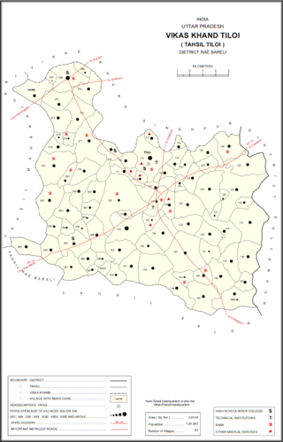
Rajamau is a village in Tiloi block of Rae Bareli district, Uttar Pradesh, India. As of 2011, its population is 2,171, in 329 households. It has one primary school and no healthcare facilities.

Rahwan is a village in Harchandpur block of Rae Bareli district, Uttar Pradesh, India. As of 2011, its population was 4,292, in 802 households. It has 3 primary schools and one medical clinic.

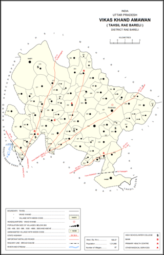
Oya is a village in Amawan block of Rae Bareli district, Uttar Pradesh, India. As of 2011, its population is 1,635, in 309 households. It has one primary school and no healthcare facilities.

Kola Haibatpur is a village in Rahi block of Rae Bareli district, Uttar Pradesh, India. It is located 12 km from Rae Bareli, the district headquarters. As of 2011, it has a population of 1,826 people, in 346 households. It has one primary school and no healthcare facilities.

Tala Gopalpur is a village in Rahi block of Rae Bareli district, Uttar Pradesh, India. It is located 9 km from Rae Bareli, the district headquarters. As of 2011, it has a population of 1,902 people, in 347 households. It has one primary school and no healthcare facilities.

Suraj Kunda is a village in Rahi block of Rae Bareli district, Uttar Pradesh, India. It is located 11 km from Rae Bareli, the district headquarters. As of 2011, it has a population of 2,196 people, in 455 households. It has one primary school and no healthcare facilities.

Sultanpur Aima is a village in Rahi block of Rae Bareli district, Uttar Pradesh, India. It is located 5 km from Rae Bareli, the district headquarters. As of 2011, it has a population of 448 people, in 78 households. It has one primary school and no healthcare facilities.

Khagipur Sandwa is a village in Rahi block of Rae Bareli district, Uttar Pradesh, India. It is located 10 km from Rae Bareli, the district headquarters. As of 2011, it has a population of 2,020 people, in 375 households. It has one primary school and no healthcare facilities.

Fakhrul Hasan Khera is a village in Rahi block of Rae Bareli district, Uttar Pradesh, India. It is located 8 km from Rae Bareli, the district headquarters. As of 2011, it has a population of 731 people, in 117 households.

Sarai Muhammad Sharif is a village in Rahi block of Rae Bareli district, Uttar Pradesh, India. It is located 9 km from Rae Bareli, the district headquarters. As of 2011, it has a population of 1,400 people, in 271 households. It has one primary school and no healthcare facilities.

Jamalpur Nankari is a village in Rahi block of Rae Bareli district, Uttar Pradesh, India. It is located 4 km from Rae Bareli, the district headquarters. As of 2011, it has a population of 1,203 people, in 242 households. It has one primary school and no healthcare facilities.

Bandramau is a village in Rahi block of Rae Bareli district, Uttar Pradesh, India. It is located 8 km from Rae Bareli, the district headquarters. As of 2011, it has a population of 3,101 people, in 543 households. It has one primary school and no healthcare facilities.

Newada is a village in Unchahar block of Raebareli district, Uttar Pradesh, India. It is located 29 km from Raebareli, the district headquarters. As of 2011, it has a population of 814 people, in 137 households.


