You can help expand this article with text translated from the corresponding article in German. (March 2009)Click [show] for important translation instructions.
|
Kumhausen | |
|---|---|
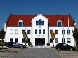 Town hall | |
 Coat of arms | |
Location of Kumhausen within Landshut district  | |
 Kumhausen  Kumhausen | |
| Coordinates: 48°30′N12°10′E / 48.500°N 12.167°E | |
| Country | Germany |
| State | Bavaria |
| Admin. region | Niederbayern |
| District | Landshut |
| Subdivisions | 5 Ortsteile |
| Government | |
| • Mayor (2020–26) | Thomas Huber [1] (FW) |
| Area | |
• Total | 37.07 km2 (14.31 sq mi) |
| Highest elevation | 510 m (1,670 ft) |
| Lowest elevation | 437 m (1,434 ft) |
| Population (2023-12-31) [2] | |
• Total | 5,711 |
| • Density | 150/km2 (400/sq mi) |
| Time zone | UTC+01:00 (CET) |
| • Summer (DST) | UTC+02:00 (CEST) |
| Postal codes | 84036 |
| Dialling codes | 08743 |
| Vehicle registration | LA |
| Website | www.kumhausen.de |
Kumhausen is a municipality in the district of Landshut in Bavaria in Germany.
