Adlkofen

Last updated

Adlkofen
Pfarrkirche St. Thomas Adlkofen.JPG
Church of Saint Thomas in Adlkofen
Wappen von Adlkofen.svg
Coat of arms
Location of Adlkofen within Landshut district
Adlkofen in LA.svg
Germany adm location map.svg
Red pog.svg
Adlkofen
Bavaria location map.svg
Red pog.svg
Adlkofen
Coordinates: 48°33′N12°16′E / 48.550°N 12.267°E / 48.550; 12.267 Coordinates: 48°33′N12°16′E / 48.550°N 12.267°E / 48.550; 12.267
Country Germany
State Bavaria
Admin. region Niederbayern
District Landshut
Government
   Mayor (202026) Rosa-Maria Maurer [1]
Area
  Total47.82 km2 (18.46 sq mi)
Elevation
499 m (1,637 ft)
Population
 (2020-12-31) [2]
  Total4,378
  Density92/km2 (240/sq mi)
Time zone UTC+01:00 (CET)
  Summer (DST) UTC+02:00 (CEST)
Postal codes
84166
Dialling codes 08707
Vehicle registration LA
Website www.adlkofen.de

Adlkofen is a municipality in the South Bavarian district of Landshut.

Contents

Geography

Geographical location

Adlkofen lies only 8 km east of Landshut and south of the valley of the Isar.

Neighbouring local authorities

Administrative divisions

The political authority of Adlkofen has 95 officially labelled districts.: [3]

History

The name Adlkofen was mentioned for the first time as the county of Adalahkevva in a document issued by the Kaiser Otto I shortly before his death in 973 in Merseburg. He gave with it his personal property in Beutelhausen, which lay in the county of Adlkofen, to Niedermünster Abbey in Regensburg. The settlement name of Aetelkouen was also mentioned for the first time in a document from 1252. Since 1762 the written name “Adlkofen” has been used. The name is determined from the personal name of Adelo (or Adalhoh), with which the suffix -hofen (Ansiedlung, Hof (courtyard)) was combined. In Adlkofen secular rule was present very early on. In 1687 Wolfstein was handed over to Adlkofen, where it remained under the management of a local magistrate of the district court of Teisbach until 1803. The magistrate performed judicial functions over all people who were not subjects of Hofsmarkherren. He oversaw four administrations, named Reichersdorf, Frauenberg, Günzkofen und Hohenegglkofen. From these old administrative units in 1812, new political municipalities were created. Hofmarks exist to this day in Deutenkofen, Göttlkofen und Günzkofen. Only in the 17th century was a 3-storey castle built in Deutenkofen. However, a noble family never lived there permanently. Societal relations were decisively moulded by the pastor.(?)

Buildings

Churches

The municipality of Adlkofen is divided in three parishes: Adlkofen, Reichlkofen and Jenkofen. The church of Adlkofen was built in 1733 in its present form. The church of Reichlkofen was built in 1876 and the church of Jenkofen was built in 1422. There are also churches in some of the smaller villages like in Günzkofen or Deutenkofen.

School and kindergarten

Adlkofen belongs to the oldest school places in the district of Landshut. Even in 1635 there used to live family of teachers in the municipality. The school building was renovated in 1991 and expanded from eight to ten classes. Since the school year 2005/2006 there are only taught four grades.

The first Kindergarten existed between 1939 and 1944 for the children of the farmers during harvest season. On the initiative of some parents in 1973 there was established a pre-school Kindergarten in the school building. In 1977 a Kindergarten building was built at its present place and was expanded in 1993

Twin town

Literature

Related Research Articles

Ergoldsbach Place in Bavaria, Germany

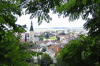
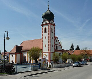
Ergoldsbach is a municipality in Bavaria, about 20 km north of Landshut and 80 km northeast of Munich in Germany.

Stadtroda Place in Thuringia, Germany

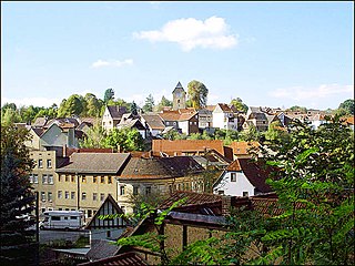
Stadtroda is a town of 6,653 people (2017), located in Thuringia, Germany. Stadtroda lies on the river Roda, a tributary of the Saale. The former municipalities Bollberg and Quirla were merged into Stadtroda in January 2019.

Essenbach Place in Bavaria, Germany

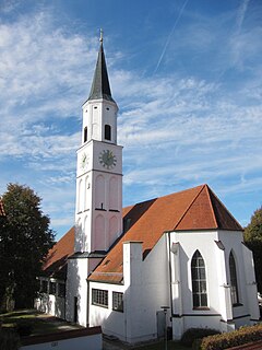
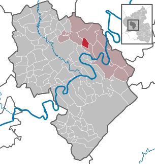
Essenbach is a municipality in the district of Landshut, in Bavaria, Germany. It is situated 9 km northeast of Landshut.

Geisenhausen Place in Bavaria, Germany

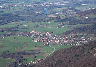
Geisenhausen is a municipality with market town status in the district of Landshut, in Bavaria, Germany. It is situated 14 km southeast of Landshut in the valley of the Kleine Vils.

Hochdorf, Esslingen Place in Baden-Württemberg, Germany

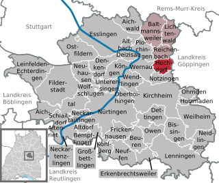
Hochdorf is a municipality in the district of Esslingen in Baden-Württemberg in southern Germany. Mayor: 1986 - 31.3.2009: Roland Erhardt, since 1.4.2009: Gerhart Kuttler

Sailauf Place in Bavaria, Germany

Sailauf is a municipality in the Aschaffenburg district in the Regierungsbezirk of Lower Franconia (Unterfranken) in Bavaria, Germany. It has a population of around 3,600.

Langenbach, Bavaria Place in Bavaria, Germany

Langenbach is a municipality in the district of Freising in Bavaria in Germany.

Bayerbach bei Ergoldsbach Place in Bavaria, Germany

Bayerbach is a municipality in the district of Landshut in Bavaria in Germany.

Buch am Erlbach Place in Bavaria, Germany

Buch is a municipality in the district of Landshut in Bavaria in Germany.

Furth, Lower Bavaria Place in Bavaria, Germany

Furth bei Landshut is a municipality in the district of Landshut in Bavaria in Germany.

Niederaichbach Place in Bavaria, Germany

Niederaichbach is a municipality in the district of Landshut in Bavaria in Germany.

Tiefenbach, Landshut Place in Bavaria, Germany

Tiefenbach is a municipality in the district of Landshut in Bavaria in Germany. The river Isar flows through the municipality.

Neuburg am Inn Place in Bavaria, Germany

Neuburg am Inn is a municipality in the district of Passau in Bavaria in Germany.

Nußdorf am Inn Place in Bavaria, Germany

Nußdorf am Inn is a municipality in the district of Rosenheim in the state of Bavaria in Germany. Nußdorf consists of 23 boroughs and is a tourist destination in the Inn Valley between the Heuberg Wendelstein mountains on the Tyrol border. Nußdorf town center has Baroque churches and traditional farm houses.

Zeilarn Place in Bavaria, Germany

Zeilarn is a municipality in the district of Rottal-Inn in Bavaria, Germany.

Halfing Place in Bavaria, Germany

Halfing is a municipality in the district of Rosenheim in Bavaria in Germany. It is located in the western part of the Chiemgau area, half-way between Chiemsee and Wasserburg am Inn.

Kinderbeuern Place in Rhineland-Palatinate, Germany

Kinderbeuern is an Ortsgemeinde – a municipality belonging to a Verbandsgemeinde, a kind of collective municipality – in the Bernkastel-Wittlich district in Rhineland-Palatinate, Germany.

Nentershausen, Hesse Place in Hesse, Germany

Nentershausen is a community in Hersfeld-Rotenburg district in northeastern Hesse, Germany.

Sankt Johann, Mainz-Bingen Place in Rhineland-Palatinate, Germany

Sankt Johann is an Ortsgemeinde – a municipality belonging to a Verbandsgemeinde, a kind of collective municipality – in the Mainz-Bingen district in Rhineland-Palatinate, Germany.

Schondorf Place in Bavaria, Germany

Schondorf am Ammersee is a municipality in the district Landsberg am Lech, Bavaria, Germany and is a member of the municipal association Schondorf am Ammersee The municipal association based in Schondorf.

References