Kurówko, West Pomeranian Voivodeship

Last updated
Kurówko
Settlement
Country Flag of Poland.svg Poland
Voivodeship West Pomeranian
County Koszalin County
Gmina Bobolice

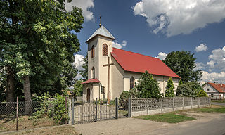
Kurówko [kuˈrufkɔ] (German : Kurower Mühle) [1] is a settlement in the administrative district of Gmina Bobolice, within Koszalin County, West Pomeranian Voivodeship, in north-western Poland. [2]

German language West Germanic language

German is a West Germanic language that is mainly spoken in Central Europe. It is the most widely spoken and official or co-official language in Germany, Austria, Switzerland, South Tyrol (Italy), the German-speaking Community of Belgium, and Liechtenstein. It is also one of the three official languages of Luxembourg and a co-official language in the Opole Voivodeship in Poland. The languages which are most similar to German are the other members of the West Germanic language branch: Afrikaans, Dutch, English, the Frisian languages, Low German/Low Saxon, Luxembourgish, and Yiddish. There are also strong similarities in vocabulary with Danish, Norwegian and Swedish, although those belong to the North Germanic group. German is the second most widely spoken Germanic language, after English.

Human settlement Community of any size, in which people live

In geography, statistics and archaeology, a settlement, locality or populated place is a community in which people live. The complexity of a settlement can range from a small number of dwellings grouped together to the largest of cities with surrounding urbanized areas. Settlements may include hamlets, villages, towns and cities. A settlement may have known historical properties such as the date or era in which it was first settled, or first settled by particular people.

Gmina Bobolice is an urban-rural gmina in Koszalin County, West Pomeranian Voivodeship, in north-western Poland. Its seat is the town of Bobolice, which lies approximately 37 kilometres (23 mi) south-east of Koszalin and 145 km (90 mi) north-east of the regional capital Szczecin.

Before 1945 the area was part of Germany. For the history of the region, see History of Pomerania.

Germany Federal parliamentary republic in central-western Europe

Germany, officially the Federal Republic of Germany, is a country in Central and Western Europe, lying between the Baltic and North Seas to the north, and the Alps to the south. It borders Denmark to the north, Poland and the Czech Republic to the east, Austria and Switzerland to the south, France to the southwest, and Luxembourg, Belgium and the Netherlands to the west.

History of Pomerania aspect of history

The history of Pomerania starts shortly before 1000 AD with ongoing conquests by newly arrived Polans rulers. Before that the area was recorded nearly 2000 years ago as Germania, and in modern-day times Pomerania is split between Germany and Poland. The name Pomerania comes from the Slavic po more, which means Land at the Sea.

Related Research Articles

Assam Himalaya is a traditional designation for the portion of the Himalaya range between the eastern border of Bhutan, on the west, and the Great Bend of the Tsangpo River, on the east. The highest peak of this range is Namcha Barwa. Other high peaks include Gyala Peri, sister peak to Namcha Barwa; Kangto, and Nyegyi Kangsang. The area is still poorly surveyed in general, and little visited by outsiders. It is located in the eastern side. The name "Assam Himalaya" is misleading, as some parts of this range are in southeastern Tibet, while other parts are in Bhutan and the Indian regions and states of northern Assam, Sikkim, and Arunachal Pradesh.

Porz 7th District of Cologne in North Rhine-Westphalia, Germany

Porz is a city district or Stadtbezirk of Cologne, Germany. It is situated on the right side of the Rhine in the south-east of the city. Porz is the largest borough of Cologne by area at 78,87 km² and has 107,500 inhabitants.

Prince of Wales Halt railway station was a short-lived station on the Romney, Hythe and Dymchurch Railway in Kent, England.

Biernacice, Lower Silesian Voivodeship Village in Lower Silesian, Poland

Biernacice is a village in the administrative district of Gmina Ziębice, within Ząbkowice Śląskie County, Lower Silesian Voivodeship, in south-western Poland. Prior to 1945 it was in Germany.

Warda is an unincorporated community in northern Fayette County, Texas, United States. Although it is unincorporated, Warda has a post office, with the ZIP code of 78960.

Jasionka, Rzeszów County Village in Subcarpathian, Poland

Jasionka is a village in the administrative district of Gmina Trzebownisko, within Rzeszów County, Subcarpathian Voivodeship, in south-eastern Poland. It lies approximately 4 kilometres (2 mi) north of Trzebownisko and 10 km (6 mi) north of the regional capital Rzeszów.

Drzewiec is a settlement in the administrative district of Gmina Jastrowie, within Złotów County, Greater Poland Voivodeship, in west-central Poland.

Lipinki, Lubusz Voivodeship Village in Lubusz, Poland

Lipinki is a village in the administrative district of Gmina Sława, within Wschowa County, Lubusz Voivodeship, in western Poland. It lies approximately 5 kilometres (3 mi) south-west of Sława, 18 km (11 mi) west of Wschowa, and 40 km (25 mi) east of Zielona Góra.

Bogumiłów, Lubusz Voivodeship Village in Lubusz, Poland

Bogumiłów is a village in the administrative district of Gmina Żary, within Żary County, Lubusz Voivodeship, in western Poland. It lies approximately 12 kilometres (7 mi) south-west of Żary and 54 km (34 mi) south-west of Zielona Góra.

Prędocin, Opole Voivodeship Village in Opole, Poland

Prędocin is a village in the administrative district of Gmina Skarbimierz, within Brzeg County, Opole Voivodeship, in south-western Poland.

Gręboszów, Opole Voivodeship Village in Opole, Poland

Gręboszów is a village in the administrative district of Gmina Domaszowice, within Namysłów County, Opole Voivodeship, in south-western Poland. It lies approximately 8 kilometres (5 mi) east of Namysłów and 45 km (28 mi) north of the regional capital Opole.

Szałamaje Settlement in Pomeranian, Poland

Szałamaje is a settlement in the administrative district of Gmina Czersk, within Chojnice County, Pomeranian Voivodeship, in northern Poland. It lies approximately 9 kilometres (6 mi) north-east of Czersk, 38 km (24 mi) north-east of Chojnice, and 69 km (43 mi) south-west of the regional capital Gdańsk.

Trąbki Małe, Pomeranian Voivodeship Village in Pomeranian, Poland

Trąbki Małe is a village in the administrative district of Gmina Trąbki Wielkie, within Gdańsk County, Pomeranian Voivodeship, in northern Poland. It lies approximately 3 kilometres (2 mi) north-east of Trąbki Wielkie, 11 km (7 mi) south-west of Pruszcz Gdański, and 21 km (13 mi) south of the regional capital Gdańsk.

Deksyty Village in Warmian-Masurian, Poland

Deksyty is a village in the administrative district of Gmina Górowo Iławeckie, within Bartoszyce County, Warmian-Masurian Voivodeship, in northern Poland, close to the border with the Kaliningrad Oblast of Russia. It lies approximately 6 kilometres (4 mi) east of Górowo Iławeckie, 15 km (9 mi) west of Bartoszyce, and 54 km (34 mi) north of the regional capital Olsztyn.

Krzewsk Village in Warmian-Masurian, Poland

Krzewsk is a village in the administrative district of Gmina Markusy, within Elbląg County, Warmian-Masurian Voivodeship, in northern Poland. It lies approximately 3 kilometres (2 mi) east of Markusy, 5 km (3 mi) south of Elbląg, and 77 km (48 mi) north-west of the regional capital Olsztyn.

Marszewo, Goleniów County Village in West Pomeranian, Poland

Marszewo is a village in the administrative district of Gmina Goleniów, within Goleniów County, West Pomeranian Voivodeship, in north-western Poland. It lies approximately 6 kilometres (4 mi) north-east of Goleniów and 27 km (17 mi) north-east of the regional capital Szczecin.

Bochlin, West Pomeranian Voivodeship Village in West Pomeranian, Poland

Bochlin is a village in the administrative district of Gmina Nowogard, within Goleniów County, West Pomeranian Voivodeship, in north-western Poland. It lies approximately 10 kilometres (6 mi) north-west of Nowogard, 27 km (17 mi) north-east of Goleniów, and 48 km (30 mi) north-east of the regional capital Szczecin.

Mulch is an unincorporated community in Richmond County, in the U.S. state of Virginia.

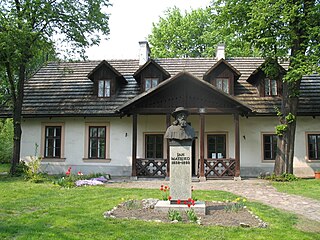
Dworek Jana Matejki w Krzesławicach

Dworek Jana Matejki w Krzesławicach is a museum in Kraków, Poland. It was established in 1965 in Krzesławice, Lesser Poland Voivodeship.

Karuba, Estonia is a village in Lääneranna Parish, Pärnu County in southwestern Estonia.

References


Coordinates: 54°03′19″N16°34′15″E / 54.05528°N 16.57083°E / 54.05528; 16.57083

Geographic coordinate system Coordinate system

A geographic coordinate system is a coordinate system that enables every location on Earth to be specified by a set of numbers, letters or symbols. The coordinates are often chosen such that one of the numbers represents a vertical position and two or three of the numbers represent a horizontal position; alternatively, a geographic position may be expressed in a combined three-dimensional Cartesian vector. A common choice of coordinates is latitude, longitude and elevation. To specify a location on a plane requires a map projection.