
Akola is a city in the Vidarbha region in the Indian state of Maharashtra. It is the third-largest city in Vidarbha, situated about 290 miles (580 km) east of the state capital, Mumbai, and 140 miles (250 km) west of the second capital, Nagpur. Akola is the administrative headquarters of Akola District, located in Amravati Division. Akola is governed by the Akola Municipal Corporation.

Buldhana district is located in the Amravati division of Maharashtra, India . The name of the district is probably derived from Bhil Thana. It is situated at the western border of Vidarbha region and is 500 km away from the state capital, Mumbai. The district has towns and cities like Shegaon, Jalgaon Jamod, Malkapur, Khamgaon, Lonar, Mehkar, and Chikhli. It is surrounded by Madhya Pradesh in the north, Akola, Washim, and Amravati districts on the east, Jalna district on the south, and Jalgaon and Aurangabad districts on the west. Latitudes are 19.51° to 21.17° N and longitudes are 75.57° to 76.59° E. Bounded on the north by Madhya Pradesh state, to the east by Akola and Washim, to the south by Parbhani and Jalna districts, and to the west by Jalna and Jalgaon districts.
Amravati district is a district of Maharashtra state in central India. Amravati is the administrative headquarters of the district.

Bilaspur is a town and a municipal council in Bilaspur district in the state of Himachal Pradesh, India.

Washim is a district in Maharashtra, India. The headquarters is at Washim. The area of the district is 5,150 km².

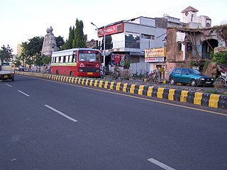
Murtizapur is a Municipal council and one of the taluka of district of Akola of Amravati division of Vidarbha region of Maharashtra.
The Vaan River is a river of central India. It is tributary of Purna River, which is major tributary of Tapti River. It is also spelled as Wan or Van. It is also known as Waanganga.

Akola is a district in the Indian state of Maharashtra. The city of Akola is the district headquarters. Akola district forms the central part of Amravati Division, which was the former British Raj Berar Province.
Anjangaon is a city and a municipal council in Amravati district in the state of Maharashtra, India. Anjangaon City got the status of Municipal Council in 1930. It is the first municipal council established in Amravati district & the second biggest council as well. Anjangaon Surji Tehsil was established in 1981. It is technically made up of two main zones, Anjangaon and Surji, on either side of Shahanur River, and is called Anjangaon-Surji in combination.
Chikhli is a city and a municipal council in Buldana district in Vidarbha Region of Maharashtra state, India. It is located on the Pune-Nagpur highway. It is situated at the westernmost border of Vidarbha region of Maharashtra and is 500 km from the state capital, Mumbai. Chikhli has the largest population in buldhana district and is the biggest taluka. Chikhli is situated on the border of the Marathwada Region and Vidharbha Regions of Maharashtra. Chikhli is the nearest municipal council to the district place Buldana, approximately 25 km only. Also in addition, there is a cotton factory in Chikhli which provide employment to many people who comes in this city for employment purpose. MIDC is located on Nagpur-Pune highway where many small scale, middle scale and some large scale firms of automotive, chemical, fibres and plastic, iron casting and other sectors are situated. Textile park was sanctioned near city and land acquisition and other government processes are going on regarding this.
Morshi is the second largest town in the Amravati district of Maharashtra. It is located 55 km north-east of Amravati, Situated very close to Madhya Pradesh Border, in the scenic southern foothills of Satpura ranges. Morshi and the surrounding region is also known for the cultivation of famous Nagpur oranges.

Rau is a suburb and a nagar panchayat in Indore district in the Indian state of Madhya Pradesh. It is a part of the Indore Metropolitan Region.
Sangole or (Sangola) is a city with a municipal council in Solapur district in the Indian state of Maharashtra. It is situated near Holy city Pandharpur. It is located at the intersection of state highways SH-161, SH-3, and SH-71.
Telhara is a town and a municipal council in Akola district in the Indian state of Maharashtra. Telhara is called the Cotton City; it is one of the largest cotton-producing subdistrict in Vidarbha Region. The town is also known for the vibrant Varhadi language.
Shahapur is a historic place near Balapur near Akola, Maharashtra. At present it is a small town in the Khamgaon Tehsil of Buldhana District.

Bhusawal railway division is one of the five railway divisions of the Central Railway (India) zone of Indian Railways, located at Bhusawal in the Jalgaon district of Maharashtra state in western India. The other railway divisions are: Mumbai CSMT, Nagpur, Solapur and Pune. There are 115 railway stations in the Bhusawal railway division.
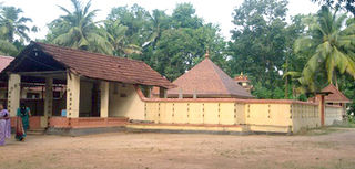
Pallippad is a village near Haripad in Alappuzha district in the Indian state of Kerala. The name Pallipad is believed to be derived from the Buddhist terminology. The famous River Achankovil Aar pass by Pallipad before it reaches veeyapuram. the village has abundant water resource, small lakes and water paths which connects to Alapuzha.
Shahanur is the river in Western Vidarbha region of Maharashtra state in India. It is a tributary of Purna river. It flows through the Anjangaon Surji 444705 Amravati district and Akola district.

The Morna River is a river of Western India. It is one of the chief tributaries of Purna River and empties in it at Andura Village in Akola District, Maharashtra.

