Kaduru also known as Kadur is a town and a Taluk in Chikkamagaluru district, in Karnataka with an area of 2,813 m2 (30,280 sq ft). It is located at 13.553345°N 76.011260°E.located in the rain shadow region of western ghats,most of the taluk is dry unlike much of the district.Kadur is known for Arecanut production.

Kanakapura is a city and the headquarters and A city in the Ramanagara district of Karnataka on the banks of the Arkavathi river and the administrative center of the taluk of the same name. Previously belonged to Bangalore Rural District. It was formerly the largest constituency in the country. The taluk is very widespread (1,553 km2 [600 sq mi]). It is located among the lush green forests of the state of Karnataka. The town is a tourism hotspot and an often visited tourist favorite in the entire state of Karnataka, as it has something for everyone ranging from avid trekkers to history buffs and wildlife enthusiasts.The forest area in this taluk is very wide and about half of the Bannerghatta National Park is located in our Kanakapura area.Kodihalli wildlife range and harohalli wildlife range its division.The Kaveri Wildlife Sanctuary consists of two main zones namely the Sangam Wildlife range, the Mugur Wildlife range

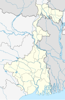
Guriahati is a census town in the Cooch Behar I CD block in the Cooch Behar Sadar subdivision of the Cooch Behar district in the Indian state of West Bengal.

Haldibari is a city and a municipality in the Mekhliganj subdivision of the Cooch Behar district in the Indian state of West Bengal.

Killiyoor is a panchayat town in Kanniyakumari district in the Indian state of Tamil Nadu.

Kodigenahalli is a census town in Tumkur district in the Indian state of Karnataka.

Konnur is a municipal council in the Belagavi District of Karnataka, India. It is located at 16.2°N 74.75°E and has an average elevation of 606 metres (1988 feet).
is a panchayat town in Koppal district in the Indian state of Karnataka.

Madhugiri is a city in Tumkur district in the Indian state of Karnataka. The city derives its name from a hillock, Madhu-giri (honey-hill) which is to the south of the place. Madhugiri is one of the 34 educational districts of the Karnataka state.

Sadasivpet is a town in sangareddy district of the Indian state of Telangana.

Salumbar is a statutory town in Udaipur district in the Indian state of Rajasthan.

Sarenga is a census town in Sankrail CD Block of Howrah Sadar subdivision in Howrah district in the Indian state of West Bengal. It is a part of Kolkata Urban Agglomeration.

Jokatte is a census town in Dakshina Kannada district in the Indian state of Karnataka.

Uravakonda is a census town in Anantapur district of the Indian state of Andhra Pradesh. It is the headquarters of Uravakonda mandal in Anantapur revenue division. The town is a constituent of urban agglomeration.
Vedasanthoor is a panchayat town in Dindigul district Located at Indian state of Tamil Nadu. Vedasanthoor town is 21 km (13 mi) from Dindigul city, 25 km (16 mi) from Oddanchatram town, and 82 km (51 mi) from Madurai.

Vijayapur is a town in Devanahalli taluk and Bangalore Rural district in the Indian state of Karnataka. Vijayapura's old name is Vadigenahalli. Local villagers still refer Vijayapura as Vadigenahalli.

Shikaripur or Shikaripura is a town in Shimoga district in the Indian state of Karnataka. It is the headquarters of Shikaripur taluk.

Raya is a town and a nagar panchayat in the Mathura district of the Indian state of Uttar Pradesh.

Shirahatti is a panchayat town in Gadag district in the Indian state of Karnataka.

Korhalli is a large village located in Sindagi Taluk in Bijapur District of Karnataka State, India.


