(now part of [[Katori, Chiba|Katori]])"},"founder":{"wt":""},"named_for":{"wt":""},"seat_type":{"wt":""},"seat":{"wt":""},"government_footnotes":{"wt":""},"leader_party":{"wt":""},"leader_title":{"wt":"Mayor"},"leader_name":{"wt":""},"leader_title1":{"wt":"Vice Mayor"},"leader_name1":{"wt":""},"total_type":{"wt":""},"unit_pref":{"wt":"Metric\n"},"area_magnitude":{"wt":""},"area_footnotes":{"wt":""},"area_total_km2":{"wt":"29.05"},"area_land_km2":{"wt":""},"area_water_km2":{"wt":""},"area_water_percent":{"wt":""},"area_note":{"wt":""},"elevation_footnotes":{"wt":""},"elevation_m":{"wt":""},"population_footnotes":{"wt":""},"population_total":{"wt":"5,179"},"population_as_of":{"wt":"April 1, 2005"},"population_density_km2":{"wt":"178"},"population_est":{"wt":""},"pop_est_as_of":{"wt":""},"timezone1":{"wt":"[[Japan Standard Time|JST]]"},"utc_offset1":{"wt":"+09:00\n"},"postal_code_type":{"wt":""},"postal_code":{"wt":""},"area_code_type":{"wt":""},"area_code":{"wt":""},"blank_name_sec1":{"wt":"City hall address"},"blank_info_sec1":{"wt":""},"website":{"wt":""},"footnotes":{"wt":""},"module":{"wt":"{{Infobox place symbols| embedded=yes\n | tree = [[Satsuki azalea]]\n | flower = \n | bird = \n | flowering_tree = \n | butterfly = \n | fish = \n | other_symbols = \n}}"}},"i":0}}]}" id="mwAg">Former municipality in Kantō, Japan
Kurimoto 栗源町 | |
---|---|
Former municipality | |
![]() Location of Kurimoto in Chiba Prefecture | |
Coordinates: 35°48′36″N140°30′07″E / 35.81000°N 140.50194°E | |
Country | Japan |
Region | Kantō |
Prefecture | Chiba Prefecture |
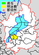
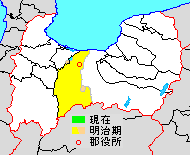
District | Katori |
Merged | March 27, 2006 (now part of Katori) |
Area | |
• Total | 29.05 km2 (11.22 sq mi) |
Population (April 1, 2005) | |
• Total | 5,179 |
• Density | 178/km2 (460/sq mi) |
Time zone | UTC+09:00 (JST) |
Symbols | |
Tree | Satsuki azalea |
Kurimoto (栗源町, Kurimoto-machi) was a town located in Katori District, Chiba Prefecture, Japan.
Kurimoto Village was established on April 1, 1889. It was raised to town status on April 10, 1924.
On March 27, 2006, Kurimoto, along with the city of Sawara, and the towns of Omigawa and Yamada (both from Katori District), was merged to create the city of Katori, [1] and thus no longer exists as an independent municipality.
In November 2005 (the last data available before its merger into Katori), the town had an estimated population of 5,179 and a population density of 178 persons per km2. Its total area was 29.05 km2.
Nomura was a town located in Higashiuwa District, Ehime Prefecture, Japan.
Yatsushiro is a district located in Kumamoto Prefecture, Japan.
Chikujō is a district located in Fukuoka Prefecture, Japan.
Hata is a district located in Kōchi Prefecture, Japan.
Yoshino was a town located in Itano District, Tokushima Prefecture, Japan.
Donari was a town located in Itano District, Tokushima Prefecture, Japan.
Awa was a district located in Tokushima Prefecture, Japan.
Miwa was a town located in Futami District, Hiroshima Prefecture, Japan.
Yasu was a district located in Shiga Prefecture, Japan.
Haguri District was a district located in Aichi Prefecture, Japan.
Nakashima was a district located in Aichi Prefecture, Japan, which existed until 2005.
Asaba was a town located in Iwata District, Shizuoka Prefecture, Japan.
Nei was a district located in Toyama Prefecture, Japan.
Omigawa was a town located in Katori District, Chiba Prefecture, Japan.
Yamada was a town located in Katori District, Chiba Prefecture, Japan.
Hikata was a town located in Katori District, Chiba Prefecture, Japan.
Unakami was a town located in Kaijō District, Chiba Prefecture, Japan.
Iioka was a town located in Kaijō District, Chiba Prefecture, Japan.
Kaijō was a district located in Chiba Prefecture, Japan.
Kayabe is a district located in Oshima Subprefecture, Hokkaido, Japan.