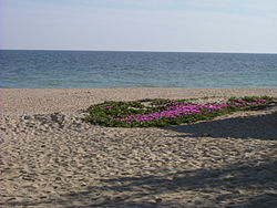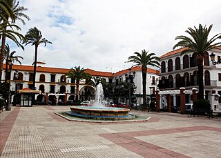
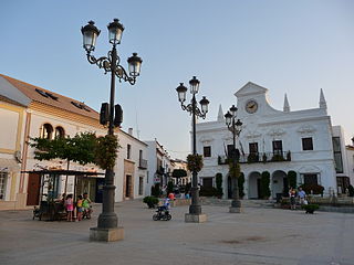
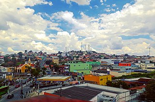
Lepe is a Spanish town in the province of Huelva, in the autonomous community of Andalusia. It is near the Portuguese border. According to the 2009 census, the city has a population of 25,886 inhabitants.

Ayer Tawar is a town in Manjung District, Perak, Malaysia. Its name came from Air Tawar, which literally means "fresh water" in the Malay language. As of the year 2020, it has a total population of 3,050.
Tando Jam is a town and a municipal committee of Hyderabad District in the Sindh province of Pakistan. It lies on the east of Hyderabad Taluka, about 12 kilometres northeast of the city center. As of 2017, Its population is 71,760.
Cartaya is a Spanish locality and municipality in the Province of Huelva,. In 2010 it had 18,415 inhabitants. Its surface area is 226.4 km2 and has a density of 81.34 people per km2.
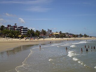
Parnamirim is a city in the state of Rio Grande do Norte, Brazil, next to the state capital city of Natal and part of its metropolitan area.

Betim is a town in Minas Gerais, Brazil. The city belongs to the mesoregion Metropolitan of Belo Horizonte (BH) and to the microregion of Belo Horizonte. It is the fifth largest city in Minas Gerais and one of the 50 largest cities in the Southeast of Brazil.
Ribeirão das Neves is a Brazilian municipality located in the state of Minas Gerais. The city belongs to the mesoregion Metropolitana de Belo Horizonte and to the microregion of Belo Horizonte. Most residents commute to Belo Horizonte. The population in 2020 was 338,197.

Wandoor is a town in Nilambur Taluk, Malappuram District, Kerala, India. It is located on the southeast of Chaliyar River, about 24 kilometres northeast of the district seat Malappuram, and 8 km south of the taluk seat Nilambur. In the year 2011, the town has a population of 50,973.

The characteristics of United States rainfall climatology differ significantly across the United States and those under United States sovereignty. Late summer and fall tropical cyclones bring precipitation which falls across the Gulf and Atlantic states. During the winter, and spring, Pacific storm systems bring Hawaii and the western United States most of their precipitation. Low pressure systems moving up the East coast bring cold season precipitation to the Mid-West and Northeast states, as well as Great Salt Lake and the Finger Lakes region. The snow to liquid ratio across the contiguous United States averages 13:1, meaning 13 inches (330 mm) of snow melts down to 1 inch (25 mm) of water.
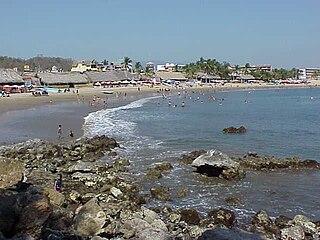
San Patricio, also known as Melaque, is an urban locality in Cihuatlán, Jalisco, Mexico. As of the year 2020, it has a total population of 6,958.
Zaraza is a Venezuelan city and the capital of Pedro Zaraza Municipality, located in eastern Guárico in the region of Los Llanos. It is named after a Venezuelan soldier who fought with Gregor MacGregor.

Ihuatzio, which translates to "Land of Coyotes" in the Purépecha language, is a town located near Lake Pátzcuaro in the Mexican state of Michoacán. It was once the capital of the Purépecha kingdom. It was the capital until the change to Tzintzuntzan. As of the year 2020, it has a total population of 3,950.

Güicán de la Sierra, also known as Nuestra Señora de la Candelaria de Güicán, is a town and municipality in the Colombian Department of Boyacá. It is close to the national natural park El Cocuy National Park. As of the year 2020, it has a total population of 6,426.
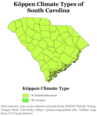
South Carolina has a humid subtropical climate, with hot summers throughout most of the State. But, an exception does occur in the Blue Ridge Mountains, as outlier pockets of an Oceanic Climate do exist. Mild winters predominate in the eastern and southern part of the state, but cool to occasionally cold winters are the standard in the northwestern area of the state, especially areas at or above 600 feet in elevation. On average, between 40 and 80 inches of precipitation falls annually across the state, potentially even in excess of 100 inches in portions of the Appalachian temperate rainforest. Tropical cyclones, and afternoon thunderstorms due to hot and humid conditions, contribute to precipitation during the summer and sometimes fall months, while extratropical cyclones contribute to precipitation during the fall, winter, and spring months. The coast experiences nearly all of their tropical weather impacts from storms coming directly from the Atlantic coast. The northwestern area of the state can receive impacts from both Atlantic basin storms moving westward from the coast and also occasionally very heavy rainfall and flooding from storms originating from the Gulf of Mexico that move inland towards the northeast after making landfall from the Florida Panhandle to Louisiana.
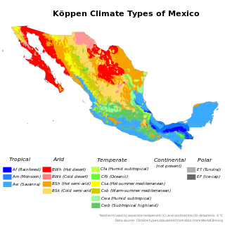
The climate of Mexico is very varied. The Tropic of Cancer effectively divides the country into temperate and tropical zones. Land that is north of the twenty-fourth parallel experiences lower temperatures during the winter months. South of the twenty-fourth parallel, temperatures are fairly consistent all year round and vary solely as a function of elevation. The north of the country usually receives less precipitation than the south.
Chinchali is a village in Raybag Taluk, Belagavi District, Karnataka, India. It is located near the state boundary with Maharashtra, approximately 84 kilometres north of the district seat Belgaum, and 10 kilometres northeast of the taluk seat Raibag. In the year 2011, the village has a population of 18,986.
Oju is a local government area in Benue State, Nigeria. It borders Obi and Gwer East in the north, Konshisha and Yala in the east, Izzi and Ebonyi in the south, and Ado in the west. As of 2022, its total population is 243,300.
Cedral is a town and municipality in the Mexican state of San Luis Potosí in central Mexico. As of the year 2020, it has a total population of 19,840.

The Torre del Catalán is a watchtower located in Lepe, in the province of Huelva (Spain), declared Bien de Interés Cultural.
Coyula is a locality in Tonalá, Jalisco, Mexico. It is part of the Guadalajara Metropolitan Area. As of 2020, it has a total population of 64,886.