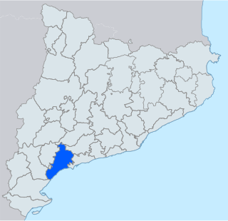
Baix Camp is a comarca located in the region of Camp de Tarragona, in Catalonia.The capital is the city of Reus.
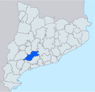
Conca de Barberà is a comarca (county) in the region of Camp de Tarragona, Catalonia, Spain. Its total area is 650.24 km2 (251.1 sq mi), and its capital is Montblanc.

Northern Catalonia, North Catalonia or French Catalonia is the formerly Catalan-speaking and cultural territory ceded to France by Spain through the signing of the Treaty of the Pyrenees in 1659 in exchange of France's effective renunciation on the formal protection that it had given to the recently founded Catalan Republic. The area corresponds roughly to the modern French département of the Pyrénées-Orientales which were historically part of Catalonia since the old County of Barcelona, and lasted during the times of the Crown of Aragon and the Principality of Catalonia until they were given to France by Spain.

Cornudella de Montsant is a municipality in the comarca of the Priorat in Catalonia, Spain. It is situated in the north-west of the comarca below the Montsant range and the Prades Mountains. The Siurana reservoir is on the territory of the municipality and supplies its drinking water.

Arbolí is a municipality in the comarca of the Baix Camp in Catalonia, Spain. It is situated in the west of the comarca in the Prades mountains. A local road links the village with the C-242 road.

Mont-ral is a municipality in the comarca of Alt Camp, Tarragona, Catalonia, Spain.

La Riba is a municipality in the comarca of Alt Camp, Tarragona, Catalonia, in north-eastern Spain.
Mola del Guerxet is a mountain of Catalonia, Spain. It has an elevation of 1,121 metres above sea level.

Vilaverd is a municipality in the comarca of the Conca de Barberà in Catalonia, Spain.
Serra de la Llena, also known as Serra la Llena, is a mountain chain straddling the municipal terms of Vilanova de Prades, La Pobla de Cérvoles (Garrigues) and Ulldemolins (Priorat), in Catalonia, Spain. These mountains have characteristic large and rounded rocky outcrops.
Prades Mountains, also known as Muntanyes de Prades, is a large calcareous mountain massif straddling the comarcas of Alt Camp, Baix Camp, Conca de Barberà, Garrigues and Priorat, in Catalonia, Spain. They are a Site of Community Importance.
Alforja is a municipality in the comarca of Baix Camp, in the province of Tarragona, Catalonia, Spain.
Vilanova de Prades is a municipality in the comarca of Conca de Barberà, in the province of Tarragona, Catalonia, Spain. It is a popular holiday resort located at high altitude atop the Serra de la Llena, close to the area where this mountain range meets the Prades Mountains.

Prades is a municipality in the comarca of Baix Camp, in the province of Tarragona, Catalonia, Spain.

Serra de Llaberia is a mountain chain in Catalonia, Spain located between the Prades and the Tivissa-Vandellòs Mountains.

Serra de la Mussara is a mountain range of Catalonia, Spain. It is a subrange of the Prades Mountains. Located north of the town of Vilaplana, Its highest point La Mussara has an elevation of 1,055.6 metres (3,463 ft) above sea level; other important peaks are Punta del Sec, Tossal Rodó and La Puntota.

Vilaplana is a municipality in the comarca of Baix Camp, in the province of Tarragona, Catalonia, Spain.

L'Aleixar is a municipality in the comarca of Baix Camp, in the province of Tarragona, Catalonia, Spain.
L'Albiol is a municipality in the comarca of Baix Camp, in the province of Tarragona, Catalonia, Spain.

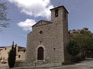
Almoster is a village in the province of Tarragona and autonomous community of Catalonia, Spain. According to the 2008 census, its population was of 1,339 inhabitants.

