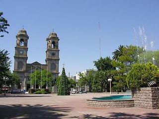
Florida is a department of Uruguay. Its capital is Florida. It is located in the south of the central part of the country with Durazno Department to its north, the departments of Treinta y Tres and Lavalleja to its east, Canelones Department to its south and the departments of Flores and San José to its west.

Durazno is the capital city of the department of Durazno in Uruguay. Durazno is characterized by being the most central city of Uruguay. It has a population of more than 30,000 inhabitants. In the past it was the capital of Uruguay; today the capital is Montevideo.
Trinidad is the capital city of Flores in southern Uruguay. It has a population of 21,429. Formerly it was called Santísima Trinidad de los Porongos, or simply Porongos. Its inhabitants are known as trinitarios or also as porongueros because the city is located near the Porongos stream.
Rivera Department is a department of the northern region of Uruguay. It has an area of 9,370 km2 (3,620 sq mi) and a population of 103,493. Its capital is the city of Rivera. It borders Brazil to the north and east, Cerro Largo Department to the southeast, Tacuarembó Department to the south and west and Salto Department to the northwest.

Paso de los Toros is a city of the Tacuarembó Department in Uruguay.
La Floresta is a city and resort on the Costa de Oro of the Canelones Department in Uruguay.
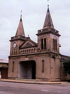
Villa del Carmen or Carmen is a town in Durazno Department of central Uruguay, the third largest populated place in the department, after Durazno and Sarandí del Yí.
Quebracho is a small town (villa) in Paysandú Department in Uruguay.

Blanquillo is a village in the Durazno Department of central Uruguay.
Carlos Reyles is a village in the Durazno Department of central Uruguay.
Sarandí del Yí is a city in the Durazno Department of central Uruguay.

Sarandí Grande is a city in the north of the Florida Department of central Uruguay.

Cerro Chato is a town in central Uruguay that is divided in three parts belonging to Durazno Department, Florida Department, and Treinta y Tres Department.
Capilla del Sauce is a small town in the north part of Florida Department of central Uruguay.

La Paloma is a small city in the Rocha Department of southeastern Uruguay.

San Gregorio de Polanco is a small city in the Tacuarembó Department of northern-central Uruguay.

Route 5 is a national route of Uruguay. In 1975, it was assigned the name Brigadier General Fructuoso Rivera, a national hero of Uruguay. It is one of the most important highways in country, along with Route 3, connecting Montevideo in the south with Rivera in the north and passing through the centre of the country. The road is approximately 501 kilometres (311 mi) in length. Upon reaching Santana do Livramento, the road joins federal highway BR-158.

Route 6 is a national route of Uruguay. In 1981, it was assigned the name Joaquín Suárez. It connects Montevideo with the northeast of Rivera Department, at Vichadero, with an extension reaching the border with Brazil. The road is approximately 428 kilometres long till Vichadero.

Route 8 is a national route of Uruguay. In 1975, it was assigned the name Brigadier General Juan Antonio Lavalleja, a national hero of Uruguay. It connects Montevideo with Aceguá in the northeast.

The municipality of Sarandí del Yí is one of the municipalities of Durazno Department, Uruguay. Its seat is the city of Sarandí del Yí.

