San Jorge, Uruguay

Last updated
San Jorge
Village
Uruguay location map.svg
Red pog.svg
San Jorge
Location in Uruguay
Coordinates: 32°50′35″S55°53′45″W / 32.84306°S 55.89583°W / -32.84306; -55.89583 Coordinates: 32°50′35″S55°53′45″W / 32.84306°S 55.89583°W / -32.84306; -55.89583
CountryFlag of Uruguay.svg  Uruguay
Department Durazno Department
Population
 (2011)
  Total502
Time zone UTC -3
Dial plan +598 436 (+5 digits)

San Jorge is a village or populated centre in the Durazno Department of central Uruguay.

Contents

Location

The village is located on Route 100, about 76 kilometres (47 mi) northeast of its junction with Route 14 and 76 kilometres (47 mi) northeast of the department capital city of Durazno.

History

San Jorge was established as a British enclave in the 19th century. The estancia San Jorge was a centre of industrial and agricultural modernization: land was fenced off to secure private property, afforestation took place, there were advances in cattle breeding techniques, and a flour mill was constructed. In 1897, residents of San Jorge were the first British riders to play polo on Uruguayan soil. [1]

Since 2004, the village has held the Encuentro Británico-Oriental, an annual festival featuring a parade, horseback riding contests, music, stands selling handcrafted goods, as well as a tour to historical points of interest. [1]

Geography

The artificial lake Lago Rincón del Bonete is 13 kilometres (8.1 mi) north of the village and the stream Arroyo Chileno 13 kilometres (8.1 mi) to the east. This stream flows in a wide vale that floods when the lake has high waters. Because of this, the circumventing road connecting the village with its nearby town of Blanquillo is about 56 kilometres (35 mi) long. The nearest populated place to San Jorge is the village Aguas Buenas, 7 kilometres (4.3 mi) to the southeast.

Population

In 2011 San Jorge had a population of 502. [2]

YearPopulation
1963182
1975173
1985230
1996376
2004545
2011502

Source: Instituto Nacional de Estadística de Uruguay [3]

Related Research Articles

<span class="mw-page-title-main">Paso de los Toros</span> City in Tacuarembó, Uruguay

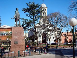
Paso de los Toros is a city of the Tacuarembó Department in Uruguay.

Villa del Carmen or Carmen is a town in Durazno Department of central Uruguay, the third largest populated place in the department, after Durazno and Sarandí del Yí.

<span class="mw-page-title-main">Pando, Uruguay</span> City & Municipality in Canelones, Uruguay

Pando is a city in the Canelones Department of Uruguay. It is an important commercial and industrial centre which has become part of the wider metropolitan area of Montevideo.

<span class="mw-page-title-main">Tarariras</span> City in Colonia, Uruguay

Tarariras, is a small city in the south of the Colonia Department of southern Uruguay.

Sequiera is a village ("pueblo") in the south of the Artigas Department in northwestern Uruguay.

Estación Tapia or Tapia is a village or populated centre in the Canelones Department of southern Uruguay.

Totoral del Sauce is a village or populated centre in the Canelones Department of southern Uruguay.

Ombúes de Lavalle is a small city located in the north of Colonia Department in southwestern Uruguay. It is named after the Argentine General Juan Lavalle. The term «Ombúes» is the Spanish plural for «Ombú», a tree originary of the Pampas region, in southern South America, and a national symbol of both Argentina and Uruguay.

<span class="mw-page-title-main">Blanquillo, Uruguay</span> Village in Durazno Department, Uruguay

Blanquillo is a village in the Durazno Department of central Uruguay.

Carlos Reyles is a village in the Durazno Department of central Uruguay.

La Paloma is a village in the Durazno Department of central Uruguay.

<span class="mw-page-title-main">Sarandí del Yí</span> City in Durazno, Uruguay

Sarandí del Yí is a city in the Durazno Department of central Uruguay.

Lapuente is a village, or populated centre, in the Rivera Department of northeastern Uruguay.

<span class="mw-page-title-main">José Enrique Rodó, Uruguay</span> Town in Soriano Department, Uruguay

José Enrique Rodó is a small town in the Soriano Department of western Uruguay.

Villa Darwin is a village or populated centre in the Soriano Department of western Uruguay.

Las Toscas is a village or populated centre in the Tacuarembó Department of northern-central Uruguay.

<span class="mw-page-title-main">Paso Bonilla</span> Village in Tacuarembó Department, Uruguay

Paso Bonilla is a village or populated centre in the Tacuarembó Department of northern-central Uruguay.

Paso del Cerro is a village or populated centre in the Tacuarembó Department of northern-central Uruguay.

<span class="mw-page-title-main">San Gregorio de Polanco</span> City in Tacuarembó Department, Uruguay

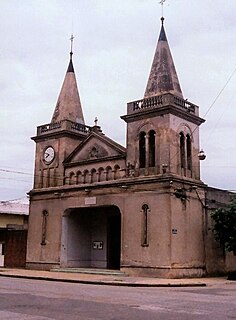
San Gregorio de Polanco is a small city in the Tacuarembó Department of northern-central Uruguay.

References

  1. 1 2 Stanham, Victoria, ed. (October 2022). "Encuentro Británico-Oriental" (PDF). Contact. The British Society in Uruguay: 37. Retrieved 30 November 2022.
  2. "Censos 2011 Durazno (needs flash plugin)". INE. 2012. Retrieved 31 August 2012.
  3. "1963–1996 Statistics / A" (DOC). Instituto Nacional de Estadística de Uruguay. 2004. Retrieved 27 June 2011.