
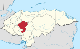
Francisco Morazán is one of the departments of Honduras.
Copán is one of the departments in the western part of Honduras. The departmental capital is the town of Santa Rosa de Copán. The department is well known for its tobacco and fine cigars.
Atlántida is a department located on the north Caribbean shore of Honduras. The capital is the port city of La Ceiba.
Intibucá is one of the 18 departments in the Republic of Honduras. Intibucá covers a total surface area of 1,186.1 square miles (3,072 km2). Its capital is the city of La Esperanza, in the municipality of La Esperanza.

Choluteca is one of the 18 departments (departamentos) into which Honduras is divided. The departmental capital is the city of Choluteca. The Choluteca River runs through the department.
Colón is one of the 18 departments into which Honduras is divided. It was created in 1881. The departmental capital is Trujillo, and the other main city is Tocoa. Trujillo was the site of the first Catholic mass on the American mainland, held when Christopher Columbus reached the Honduran shore in 1502.
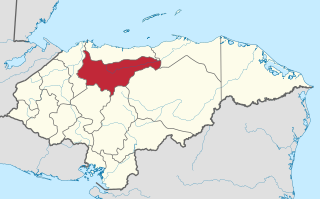
Comayagua is one of the 18 departments (departamentos) into which Honduras is divided. The departmental capital is Comayagua.

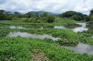
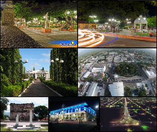
Cortés is one of the 18 departments of Honduras. The department covers an area of 3,954 km2 and, in 2015, had an estimated population of 1,612,762, making it the most populous in Honduras. The Merendón Mountains rise in western Cortés, but the department is mostly a tropical lowland, the Sula Valley, crossed by the Ulúa and Chamelecon rivers.

El Paraíso is one of the 18 departments (departamentos) into which Honduras is divided.
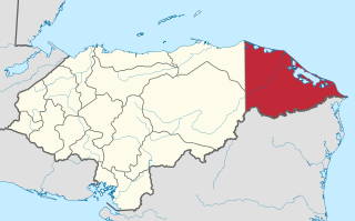
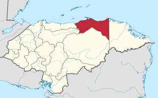
Gracias a Dios is one of the 18 departments (departamentos) into which Honduras is divided. The departmental capital is Puerto Lempira; until 1975 it was Brus Laguna.

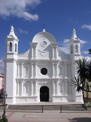
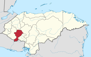
Lempira is one of the 18 departments in Honduras. located in the western part of the country, it is bordered by the departments of Ocotepeque and Copán to the west, Intibucá to the east, and Santa Bárbara to the north. To its south lies the El Salvador–Honduras border. The departmental capital is Gracias.

Ocotepeque is one of the 18 departments of Honduras, Central America, located in the West and bordering both El Salvador and Guatemala. It was formed in 1906 from part of Copán department. The capital and main city is Nueva Ocotepeque.

Olancho is the largest of all the 18 departments into which Honduras is divided. The department covers a total surface area of 24,057 km² and has an estimated 2015 population of 537,306 inhabitants.

Santa Bárbara is one of the 18 departments (departamentos) into which Honduras is divided. The departmental capital is Santa Bárbara.
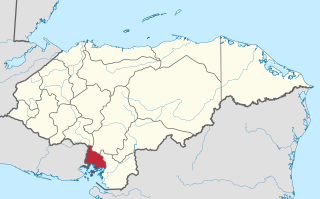
Valle is one of the 18 departments into which Honduras is divided.
Yoro is one of the 18 departments into which Honduras is divided. The department contains rich agricultural lands, concentrated mainly on the valley of the Aguan River and the Sula Valley, on opposite ends. The departmental capital is Yoro. The department covers a total surface area of 7,939 km2 and, in 2005, had an estimated population of 503,886 people. It is famous for the Lluvia de Peces, a tradition by which fish fall from the sky during very heavy rains.

Panama is a province of Panama. It is the location of the national capital Panama City, which also serves as the provincial capital. The governor of the province is Mayín Correa, appointed by President José Raul Mulino.
Chiquimula is one of the 22 departments of Guatemala, in Central America. The departmental capital is also called Chiquimula. The department was established by decree in 1871, and forms a part of the southeastern region of Guatemala. Physically, it is mountainous, with a climate that varies between tropical and temperate, depending on the location.
San Francisco de la Paz is a municipality in the centre of the Honduran department of Olancho.

José Ballivián is a province of the Beni Department in northern Bolivia. It is named for José Ballivián, a general and former president of Bolivia who lived from 1805 until 1852. The province has a north-south extent. To the west the province is bounded by the Beni River, to the east it borders on the Yacuma Province of the Beni Department.
