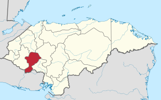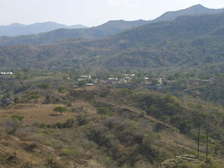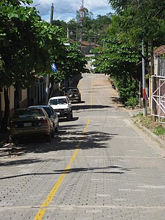
Intibucá is one of the 18 departments in the Republic of Honduras. Intibucá covers a total surface area of 1,186.1 square miles (3,072 km2). Its capital is the city of La Esperanza, in the municipality of La Esperanza.

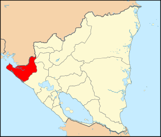
Chinandega is a department in Nicaragua, located on the border with Honduras. It covers an area of 4,822 km² and has a population of 441,897. The capital is the city of Chinandega.

Jinotega is a department of Nicaragua. Its departmental head is Jinotega. It is located in the north of the country, on the border with Honduras.
La Paz is the capital city of the La Paz Department of Honduras. The town, founded in 1792, has a population of 30,020.

San Antonio de Flores is a municipality in the Honduran department of Choluteca.
San Antonio is a municipality in the Honduran department of Copán.

San Miguelito is a municipality in the Honduran department of Francisco Morazán.

Valle de Ángeles is a municipality in the Honduran department of Francisco Morazán.
Marcala is a town, with a population of 14,360, and a municipality in the Honduran department of La Paz. The region is known for its coffee production, boasting the first "protected origin denomination" for coffee. Marcala has been designated as a center of Lenca Trail, a government and United Nations sponsored development effort to encourage tourism to Lenca communities. It offers visitors perspective on the culture of indigenous people and provides new markets for their traditional crafts.
Santiago de Puringla is a municipality in the Honduran department of La Paz. The municipality is situated on a plain bordered by the River Puringla. South of the municipality runs the River Lepasale.

La Virtud is a municipality in the Honduran department of Lempira.
El Negrito is a town, with a population of 12,790, and a municipality in the department of Yoro, Honduras.
Morazán is a town, with a population of 19,880, and a municipality in the Honduran department of Yoro. This political division of 47,435 people is in the north, located between the city of Yoro and the municipality of El Negrito, north of the Nico Pijol National Park.
Concepción del Norte is a municipality in the Honduran department of Santa Bárbara.
Naranjito is a municipality in the Honduran department of Santa Bárbara. It is 920 meters above sea level.
Caridad is a municipality in the Honduran department of Valle.
Cahabón is a municipality in the Guatemalan department of Alta Verapaz. It is situated at 250m above sea level. It contains 31,425 people. It covers a terrain of 900km2. The annual festival is September 1-September 8.

Chinandega is a city and the departmental seat of Chinandega department in Nicaragua. It is also the administrative centre of the surrounding municipality of the same name. It is Nicaragua's 2nd most important city (economy) and 6th largest city, with a population of 114,417, and a total of 137,170 in the municipality. It is located about 134 kilometres (83 mi) northwest of Managua and about 72 kilometres (45 mi) southwest of El Guasaule, on the border with Honduras. Chinandega is situated about 20 kilometres (12 mi) from the Pacific Ocean.

Santa Eufemia del Barco is a municipality located in the province of Zamora, Castile and León, Spain. According to the 2004 census (INE), the municipality has a population of 279 inhabitants.

San Juan de Cinco Pinos, colloquially known as Cinco Pinos, is a town and a municipality in the north of the Chinandega Department in Nicaragua, situated between San Pedro del Norte and Santo Tomás del Norte.


