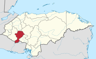
Intibucá is one of the 18 departments in the Republic of Honduras. Intibucá covers a total surface area of 1,186.1 square miles (3,072 km2). Its capital is the city of La Esperanza, in the municipality of La Esperanza.

Ahuachapán is a city, and municipality, and the capital of the Ahuachapán Department in western El Salvador. The municipality, including the city, covers an area of 244.84 km² and as of 2007 has a population of 110,511 people. Situated near the Guatemalan border, it is the westernmost city in the country and is the center of an agricultural region producing primarily coffee.

Santa Bárbara, with a population of 28,750, is the capital city of the Santa Bárbara Department of Honduras and the municipal seat of Santa Bárbara Municipality.

Nacaome, with a population of 1900, is the capital city of the Valle department of Honduras and the municipal seat of Nacaome Municipality. It is a manufacturing and commercial center located on the banks of the Nacaome River.

El Progreso is a city, with a population of 119,260, and a municipality located in the Honduran department of Yoro.
Las Lajas is a town, with a population of 11,030, and a municipality in the Honduran department of Comayagua.

Valle de Ángeles is a municipality in the Honduran department of Francisco Morazán.
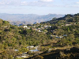
Concepción is a municipality in the Honduran department of Intibucá.
Chinacla is a municipality in the Honduran department of La Paz.
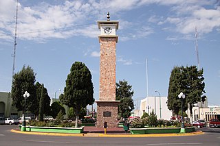
Marcala is a town, with a population of 14,360, and a municipality in the Honduran department of La Paz. The region is known for its coffee production, boasting the first "protected origin denomination" for coffee. Marcala has been designated as a center of Lenca Trail, a government and United Nations sponsored development effort to encourage tourism to Lenca communities. It offers visitors perspective on the culture of indigenous people and provides new markets for their traditional crafts.
Opatoro is a municipality in the Honduran department of La Paz.
San Antonio del Norte is a municipality in the Honduran department of La Paz.
Santa Ana is a municipality in the Honduran department of La Paz, known for its high crime rate.

La Iguala is a municipality in the Honduran department of Lempira.

Lepaera is a municipality in the Honduran department of Lempira. It has tropical climate all year round.
Piraera is one of the municipalities of Lempira department in Honduras. It is located on one of the branches of "Congolón" mountain, it is 105 km away from the city of Gracias.
El Negrito is a town, with an urban population of 12,790 (2020), and a municipality in the department of Yoro, Honduras.
Santa Rita is a town and a municipality in the Honduran department of Yoro. The Humuya River passes through it.
San Esteban is a municipality in the northeast of the Honduran department of Olancho, west of Dulce Nombre de Culmí, east of Gualaco and north of Catacamas. Costa Rican author Oscar Núñez Oliva set his 2000 novel Los Gallos de San Esteban in the municipality.
Delicias is a city in the Mexican state of Chihuahua and serves as the seat of the municipality of the same name. It is located southeast of the state capital, Chihuahua. Delicias was declared an official municipality of the state of Chihuahua on January 7, 1935. Delicias is a small industrial city and a major agricultural center located in the Conchos River Valley. As of 2015, the city of Delicias had a population of 148,045 inhabitants, while the metropolitan area had a population of 223,993 inhabitants. It was founded on 30 April 1933, making it one of Mexico's youngest cities. The municipality of Delicias is one of the smallest in the state in terms of size area.

