La Virginia

Last updated • 1 min readFrom Wikipedia, The Free Encyclopedia
La Virginia
Municipality and town
Rio Cauca at dusk near La Virginia.JPG
Cauca River. Between Cartago and La Virginia, Risaralda, Colombia.
Flag of La Virginia (Risaralda).svg
Escudo de La Virginia.svg
Colombia - Risaralda - La Virginia.svg
Location of the municipality and town of La Virginia in the Risaralda Department of Colombia.
CountryFlag of Colombia.svg  Colombia
Department Risaralda Department
Elevation
899 m (2,949 ft)
Population
 (2023)
  Total28,488
Time zone UTC-5 (Colombia Standard Time)

La Virginia (Spanish pronunciation: [laβiɾˈxinja] is a town and municipality in the Department of Risaralda, Colombia. About 50 km away from the capital Pereira. [1] In 2023 the town had an estimated population of 28,488. [2]

Contents

History

Founded in 1959 by Francisco Jaramillo, Pedro Martínez and Leonardo Villa, among others. This Municipality was in its beginnings a Palenque for black fugitives from slavery. The initial hamlet was called Sopinga and then Nigricia in the mid-19th century. On November 27, 1959, La Virginia was declared a municipality, since it previously belonged to Belalcazar, Caldas. [3]

Climate

La Virginia has an average annual temperature of 23°C. [1]

Climate data for La Virginia (Bomehia La), elevation 970 m (3,180 ft), (1981–2010)
MonthJanFebMarAprMayJunJulAugSepOctNovDecYear
Mean daily maximum °C (°F)30.6
(87.1)
31.0
(87.8)
30.6
(87.1)
29.9
(85.8)
29.6
(85.3)
29.7
(85.5)
30.3
(86.5)
30.7
(87.3)
30.5
(86.9)
29.5
(85.1)
29.2
(84.6)
29.6
(85.3)
30.1
(86.2)
Daily mean °C (°F)24.1
(75.4)
24.3
(75.7)
24.2
(75.6)
23.9
(75.0)
23.8
(74.8)
23.9
(75.0)
24.1
(75.4)
24.4
(75.9)
23.9
(75.0)
23.4
(74.1)
23.4
(74.1)
23.7
(74.7)
23.9
(75.0)
Mean daily minimum °C (°F)19.1
(66.4)
19.3
(66.7)
19.3
(66.7)
19.5
(67.1)
19.5
(67.1)
19.1
(66.4)
18.8
(65.8)
18.7
(65.7)
18.8
(65.8)
18.9
(66.0)
19.1
(66.4)
19.1
(66.4)
19.1
(66.4)
Average precipitation mm (inches)109.3
(4.30)
105.7
(4.16)
176.0
(6.93)
210.5
(8.29)
247.2
(9.73)
148.4
(5.84)
131.0
(5.16)
122.2
(4.81)
161.3
(6.35)
184.6
(7.27)
216.7
(8.53)
139.4
(5.49)
1,952.3
(76.86)
Average precipitation days131317202017141316202016197
Average relative humidity (%)74737578807874727477787776
Mean monthly sunshine hours 198.4166.6170.5141.0148.8150.0182.9186.0162.0151.9156.0179.81,993.9
Mean daily sunshine hours 6.45.95.54.74.85.05.96.05.44.95.25.85.5
Source: Instituto de Hidrologia Meteorologia y Estudios Ambientales [4]

Related Research Articles

<span class="mw-page-title-main">Cartago, Valle del Cauca</span> Municipality and city in Valle del Cauca Department, Colombia

Cartago is a city in southwestern Colombia, about 187 miles (301 km) west of Bogotá. It is in the extreme northern portion of the Valle del Cauca. It is located very close to the city of Pereira, Risaralda about a 20-minute drive. It is the sixth largest city in Valle after Cali, Palmira, Buenaventura, Tuluá and Jamundí. Per the 2018 Colombian census, Cartago's population was 142,902.

<span class="mw-page-title-main">Montenegro, Quindío</span> Municipality and town in Quindío Department, Colombia

Montenegro is a municipality in the western part of the department of Quindío, Colombia. It is located 10 km west of the departmental capital Armenia. In 2023 it had an estimated population of 38,240.

<span class="mw-page-title-main">Dosquebradas</span> Municipality and town in Risaralda Department, Colombia

Dosquebradas is the second largest city and a municipality in the Risaralda Department, Colombia. As of 2023, with a population of approximately 225,540 inhabitants. The city is connected by the César Gaviria Trujillo Viaduct to Pereira, the capital of the department.

<span class="mw-page-title-main">Guática</span> Municipality and town in Risaralda Department, Colombia

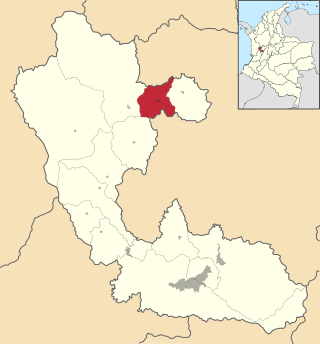
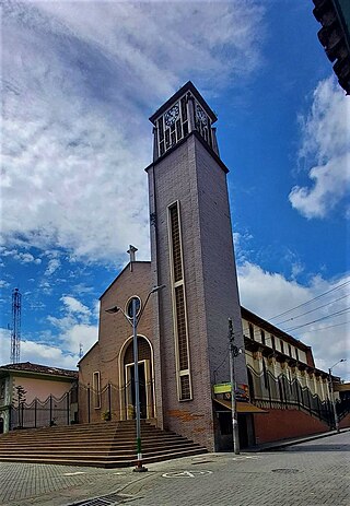
Guática is a town and municipality in the Risaralda Department of Colombia, about 93 km away from the capital Pereira. In 2023 the town had an estimated population of 12,423.

<span class="mw-page-title-main">Circasia, Quindío</span> Municipality and town in Quindío Department, Colombia

Circasia is a municipality in the northern part of the department of Quindío, Colombia. It's located 7 km north of the department's capital Armenia. Located within the Colombian coffee growing axis, the historic center of Circasia was made part of the "Coffee Cultural Landscape" UNESCO World Heritage Site in 2011.

<span class="mw-page-title-main">Salento, Quindío</span> Municipality and town in Quindío, Colombia

Salento is a town and municipality in the north-east of the department of Quindío, Colombia. The municipality covers an area of 377.67 km2. It was the first settlement in Quindío of the modern era, and the first municipality founded in the department. The town of Salento itself is located 24 km northeast of the departmental capital Armenia. In 2023 the municipality of Salento had an estimated population of 9,748.It has a wide variety of tourist attractions including the Cocora Valley where one can find a landscape full of nature, such as the Barranquero or Momotus aequatorialis, a commonly seen bird, take ecological walks and enjoy the landscapes of this town.

<span class="mw-page-title-main">Calarcá</span> Municipality and town in Quindío Department, Colombia

Calarcá is a municipality in the eastern part of the department of Quindío, Colombia. It is located 4 km east of the departmental capital Armenia. Its nickname is La Villa del Cacique in homage of its writers. The city was founded in 1886 by Segundo Henao during the time of colonization by people from Antioquia. It is the second most populated city in Quindío, after Armenia.

<span class="mw-page-title-main">La Tebaida</span> Municipality and town in Quindío Department, Colombia

La Tebaida is a municipality in the western part of the department of Quindío, Colombia. It's located 17 km southwest of the departmental capital Armenia. In 2023 La Tebaida had an estimated population of 35,010.

<span class="mw-page-title-main">Filandia, Quindío</span> Municipality and town in Quindío, Colombia

Filandia is a town and municipality in the northern part of the department of Quindío, Colombia. It's located on the west side of Cordillera Central of the Andes mountain range running through central Colombia, 26 km north of the departmental capital Armenia. In 2023 the estimated population of Filandia was 12,596 inhabitants.

<span class="mw-page-title-main">Santa Rosa de Cabal</span> Place in Risaralda, Colombia

Santa Rosa de Cabal is a town and municipality in the Department of Risaralda, Colombia. About 14 km away from the capital Pereira. In 2023 the town had an estimated population of 79,840.

<span class="mw-page-title-main">Belén de Umbría</span> Municipality and town in Risaralda Department, Colombia

Belén de Umbría is a town and municipality in the Department of Risaralda, Colombia. At a distance of approximately 70 kilometers from the capital Pereira. In 2023 the town had an estimated population of 25,276.

<span class="mw-page-title-main">Marsella</span> Municipality and town in Risaralda Department, Colombia

Marsella or Marseille is a town and municipality in the Department of Risaralda in Colombia. About 30 km away from the capital Pereira. In 2023 the town had an estimated population of 17,208.

<span class="mw-page-title-main">Galapa</span> Municipality and town in Caribbean, Colombia

Galapa is a municipality and town in the Colombian department of Atlántico.

<span class="mw-page-title-main">Apía, Risaralda</span> Place in Risaralda, Colombia

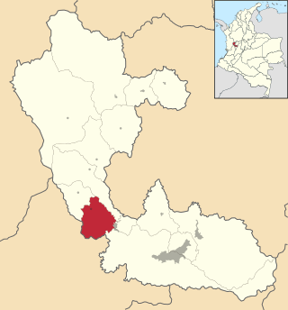
Apía is a town and municipality in the Department of Risaralda, Colombia. It's located at an elevation of 1,630 metres, about 60 km away from district capital Pereira in the valley of the Apia river. For 2023 it has approximately 12,613 inhabitants. The town has excellent views over Cerro Tatamá, which is part of Tatamá National Natural Park.

<span class="mw-page-title-main">Balboa, Risaralda</span> Municipality and town in Risaralda Department, Colombia

Balboa is a town and municipality in the Department of Risaralda, Colombia, with a distance of approximately 53 kilometers from the capital Pereira. In 2023, the town had an estimated population of 6,510.

<span class="mw-page-title-main">La Celia</span> Municipality and town in Risaralda Department, Colombia

La Celia is a town and municipality in the Department of Risaralda, Colombia. About 67 km away from the capital Pereira. In 2023 the town had an estimated population of 7,642.

<span class="mw-page-title-main">Mistrató</span> Municipality and town in Risaralda Department, Colombia

Mistrato is a town and municipality in the Department of Risaralda, Colombia. About 86 km away from the capital Pereira. In 2023 the town had an estimated population of 17,527.

<span class="mw-page-title-main">Pueblo Rico, Risaralda</span> Municipality and town in Risaralda Department, Colombia

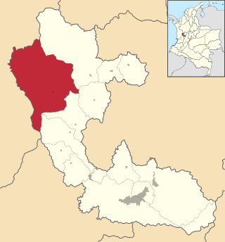
Pueblo Rico is a town and municipality in the Department of Risaralda, Colombia. About 97 km away from the capital Pereira. In 2023 the town had an estimated population of 12,423.

<span class="mw-page-title-main">Quinchía</span> Town and Municipality in Risaralda, Colombia

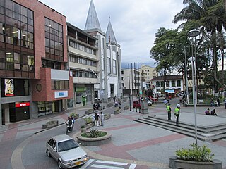
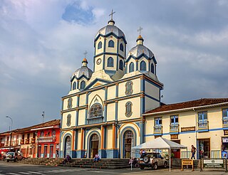
Quinchía, also known as Villa de los Cerros, is a town and municipality in the Department of Risaralda, Colombia. About 110 km away from the capital Pereira. In 2023 the town had an estimated population of 27,890.

<span class="mw-page-title-main">Santuario, Risaralda</span> Municipality and town in Risaralda Department, Colombia

Santuario is a town and municipality in the Department of Risaralda, Colombia. About 64 km away from the capital Pereira. In 2023 the town had an estimated population of 12,826.

References

  1. 1 2 "La Virginia – Risaralda un destino lleno de vida" (in Spanish). Retrieved 2023-09-27.
  2. Telefónicas, Telencuestas-Encuestas. "Cuántos habitantes tiene La Virginia, Risaralda en 2023". Telencuestas (in Spanish). Retrieved 2023-09-27.
  3. Risaralda, Gobernación de (2016-09-28). "La Virginia". Gobernación de Risaralda (in Spanish). Retrieved 2023-09-27.
  4. "Promedios Climatológicos 1981–2010" (in Spanish). Instituto de Hidrologia Meteorologia y Estudios Ambientales. Archived from the original on 15 August 2016. Retrieved 17 June 2024.

Commons-logo.svg Media related to La Virginia, Risaralda at Wikimedia Commons

4°55′N75°50′W / 4.917°N 75.833°W / 4.917; -75.833