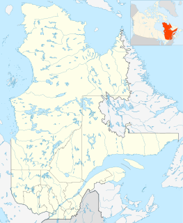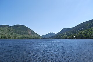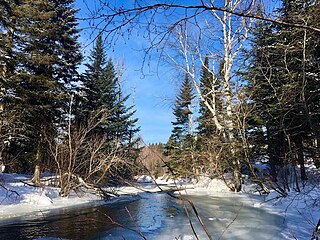
Zec du Lac-au-Sable is a "zone d'exploitation contrôlée" (zec) located in the unorganized territory of Mont-Élie, in Charlevoix-Est Regional County Municipality, in administrative region of Capitale-Nationale, Quebec, Canada.

The petit lac Ha! Ha! is a freshwater lake in the Ferland-et Boilleau municipality, in the administrative region of Saguenay-Lac-Saint-Jean, in the province of Quebec, in Canada. Little Ha Lake! Ha! is located on the east side of Lake Ha! Ha! into which it drains.
The Jacob River is a tributary of the north shore of the Malbaie River flowing generally southward successively into zec du Lac-au-Sable into the unorganized territory of Mont-Élie, in the city of La Malbaie and in the city of Clermont at the end of the course, in Charlevoix-Est Regional County Municipality, in Quebec, Canada.

The Snigole River is a tributary of the north shore of the Malbaie River flowing generally to the south, especially in the zec du Lac-au-Sable in the unorganized territory of Mont-Élie, then in the territory of Clermont at the end of the route, in the Charlevoix-Est Regional County Municipality, in Quebec, Canada.
The Baie des Rochers River is a tributary of the northwest shore of the St. Lawrence River, flowing into the town of Saint-Siméon, in the Charlevoix-Est Regional County Municipality, in the Capitale-Nationale administrative region, Quebec, Canada. The course of this river goes through the village of Baie-des-Rochers before going to the Bay of Rochers, in the St. Lawrence River.

The Noire River is a tributary of the North-West shore of Saint Lawrence River flowing north-east of La Malbaie, in the municipality of Saint-Siméon, in Charlevoix-Est Regional County Municipality, in Quebec, in Canada.

The rivière Noire du Milieu is a tributary of the south shore of the Noire River, flowing entirely into the unorganized territory of Mont-Élie, Quebec, in the Charlevoix-Est Regional County Municipality, in Capitale-Nationale, in Quebec, Canada. The upper part is in the zec des Martres, around Plongeon Lake.

The Rivière Noire Sud-Ouest is a tributary of the south shore of the Noire River flowing, entirely in the unorganized territory from Mont-Élie in Charlevoix-Est Regional County Municipality, in Quebec, Canada.

The Deschênes River is a tributary of the south shore of the Petit Saguenay River flowing into the unorganized territory of Sagard in the Charlevoix-Est Regional County Municipality, Quebec, Canada.

The Petit Saguenay River is a watercourse flowing in Quebec, Canada, in:

The Brébeuf Lake is a body of water tributary of the Saint-Jean River. It is in the municipality of Rivière-Éternité, Quebec, Canada.

The Éternité Lake is a body of water tributary of the Éternité River and the Saguenay River. It is located in the municipality of Rivière-Éternité, in the Le Fjord-du-Saguenay Regional County Municipality of the administrative region of Saguenay–Lac-Saint-Jean, in the province of Quebec, in Canada. The Éternité Lake straddles the townships of Brébeuf and Hébert. This lake is integrated into the zec du Lac-au-Sable, a controlled exploitation zone.

The rivière à la Catin is a tributary of the Cami River, flowing in the municipality of L'Anse-Saint-Jean and Rivière-Éternité, in the Fjord-du-Saguenay, in the administrative region of Saguenay–Lac-Saint-Jean, in the province from Quebec, to Canada. The course of the Catin river crosses the zec du Lac-Brébeuf.

The "ruisseau Épinglette" is a tributary of the Cami River, flowing in the municipality of L'Anse-Saint-Jean, in the Fjord-du-Saguenay, in the administrative region of Saguenay-Lac-Saint-Jean, in the province of Quebec, in Canada. The course of the "Épinglette steam" crosses the zec du Lac-Brébeuf.

The Emmuraillé Lake is a body of water crossed in its eastern part by the Petit Saguenay River, in the unorganized territory of Sagard, in the Charlevoix-Est Regional County Municipality of the administrative region of Capitale-Nationale, in Quebec, in Canada.

The Lac au Bouleau is a body of water crossed from south to north by the Petit Saguenay River, in the unorganized territory of Mont-Élie, in the Charlevoix-Est Regional County Municipality of the administrative region Capitale-Nationale, in Quebec, in Canada.

The lac Bazile is a body of water on the hydrographic side of the Petit Saguenay River, in the unorganized territory of Mont-Élie, in the Charlevoix-Est Regional County Municipality of the administrative region Capitale-Nationale, in Quebec, in Canada.

The Moncouche Lake is a freshwater body of the watershed of the rivière aux Sables, flowing in the unorganized territory of Mont-Valin, in the Le Fjord-du-Saguenay Regional County Municipality, in the administrative region of the Saguenay–Lac-Saint-Jean, in the province of Quebec, in Canada. Most of the area is included in the northwestern part of the territory of zec Martin-Valin, in the township of Garreau. Forestry is the main economic activity in the sector. Recreational and tourist activities come second.

The Brûlée River is a tributary of the Portneuf River, flowing on the northwest shore of the Saint Lawrence River, in the Province of Quebec, in Canada. The course of this river crosses the administrative regions of:
The Rivière à l'Ours is a tributary of the rivière des Aulnaies, flowing on the northwest bank of the Saint Lawrence River, successively in the municipalities of Bégin and Saint-Ambroise, in the Fjord-du-Saguenay, in the region administrative Saguenay–Lac-Saint-Jean, in the Province of Quebec, in Canada.


