Brighton and Hove is a city and unitary authority area, ceremonially in East Sussex, England. There are multiple villages alongside the seaside resorts of Brighton and Hove in the district. It is administered by Brighton and Hove City Council, which is currently under Labour majority control.

Falmer is a small village and civil parish in the Lewes District of East Sussex, England, lying between Brighton and Lewes, approximately five miles (8 km) north-east of the former. It is also the site of Brighton & Hove Albion's Falmer Stadium.

The South Downs are a range of chalk hills in the south-eastern coastal counties of England that extends for about 260 sq mi (670 km2) across the south-eastern coastal counties of England from the Itchen valley of Hampshire in the west to Beachy Head, in the Eastbourne Downland Estate, East Sussex, in the east. The Downs are bounded on the northern side by a steep escarpment, from whose crest there are extensive views northwards across the Weald. The South Downs National Park forms a much larger area than the chalk range of the South Downs, and includes large parts of the Weald.
Piddinghoe is a village and civil parish in the Lewes District of East Sussex, England. It is located in the valley of the River Ouse between Lewes and Newhaven, five miles (8 km) south of the former, downstream of Southease.

Hamsey is a village and civil parish in the Lewes district of East Sussex, England. The parish covers a large area and also consists of the villages Offham and Cooksbridge. The main centres of population in the parish are now Offham and Cooksbridge. Around the main settlements are enlarged fields, isolated old cottages and farms. The winding and undulating parish lanes between banks, old hedge rows, trees, flowery verges and ditches are popular with cyclists and give good views of the Downs. In 2011 the parish had a population of 632.

Kingston near Lewes is a village and civil parish in the Lewes District of East Sussex, England. The village is mentioned in the Domesday Book and is located two miles (3.2 km) south of Lewes and is nestled in the South Downs. The parish is par of two Sites of Special Scientific Interest: the Lewes Brooks and Kingston Escarpment and Iford Hill.
St Ann Without is a civil parish in the Lewes District of East Sussex, England. It covers an area to the west of the town of Lewes, including Long Hill.

Newtimber is a small village and civil parish in the Mid Sussex District of West Sussex, England. It is located north-west of Brighton. The parish also includes the hamlet of Saddlescombe. The parish lies almost wholly with the South Downs National Park, with the exception of a small section of the parish north of the B2117 road. The planning authority for Newtimber is therefore the South Downs National Park Authority (SDNPA), the statutory planning authority for the National Park area. The downland scarp, which includes Newtimber Hill, Newtimber Holt, Saddlescombe chalk quarry and Summer Down, is mostly part of the Beeding Hill to Newtimber Hill, designated Site of Special Scientific Interest.

Pyecombe is a village and civil parish in the Mid Sussex District of West Sussex, England. Pyecombe is located 7 miles (11 km) to the north of Brighton. The civil parish covers an area of 887 hectares and has a population of 200, increasing at the 2011 Census to a population of 237.
Woodingdean is an eastern suburb of the city of Brighton and Hove, East Sussex, separated from the main part of the city by downland and the Brighton Racecourse. The name Woodingdean came from Woodendean Farm which was situated in the south end of what is now Ovingdean.

Hangleton is a suburb of Brighton and Hove, in the ceremonial county of East Sussex, England. The area was developed in the 1930s after it was incorporated into the Borough of Hove, but has ancient origins: its parish church was founded in the 11th century and retains 12th-century fabric; the medieval manor house is Hove's oldest secular building. The village became depopulated in the medieval era and the church fell into ruins, and the population in the isolated hilltop parish only reached 100 in the early 20th century; but rapid 20th-century development resulted in more than 6,000 people living in Hangleton in 1951 and over 9,000 in 1961. By 2013, the population exceeded 14,000.

Patcham is a suburb in the city of Brighton and Hove, in the ceremonial county of East Sussex, England. It is about 3 miles (5 km) north of the city centre. It is bounded by the A27 to the north, Hollingbury to the east and southeast, Withdean to the south and the Brighton Main Line to the west. The A23 passes through the area.

Ditchling Beacon is the highest point in East Sussex, England, with an elevation of 248 m (814 ft). It is south of Ditchling and to the north-east of Brighton. It is a large chalk hill with a particularly steep northern face, covered with open grassland and sheep-grazing areas. It is the third-highest point on the South Downs, behind Butser Hill and Crown Tegleaze.
Blackcap is a hill and nature reserve in East Sussex, England. It is on a peak of the South Downs, just south east of Plumpton and west of Lewes. The flatter landscape is made up of open ground with chalk paths, surrounded by thickets. The steeper ground leading up to the ridge is low-density woodland. The top is more open, with patches of pine woodland and gorse bushes.

Westdene is an area of the city of Brighton and Hove, East Sussex. It is an affluent northern suburb of the city, west of Patcham, the A23 and the London to Brighton railway line, north of Withdean and northeast of West Blatchington. It is on the Brighton side of the historic parish boundary between Brighton and Hove and is served by Preston Park railway station. It is known for its greenery and woodland and is very close to the South Downs, from which it is separated by the Brighton Bypass, and was built on the slopes of two hills.
The Brighton and Lewes Downs Biosphere Reserve is a UNESCO Biosphere Reserve located in Sussex on the southeast coast of England near the city of Brighton and Hove. Forming a central unit of the hills of the South Downs National Park, it is centred on the Brighton chalk block that lies between the River Adur in the west and the River Ouse in the east. Chalk downland makes up the principal terrestrial landscape of the area, bounded at each end by the two river valleys. The coastline is dominated by high chalk cliffs in the east and urbanized plains in the west, running to the estuary of the River Adur at Shoreham-by-Sea.

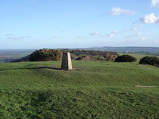
Beacon Hill is an 18.6-hectare (46-acre) Local Nature Reserve in Rottingdean, on the eastern outskirts of Brighton in East Sussex. It is owned and managed by Brighton and Hove Council.

Benfield Hill is an 11.8-hectare (29-acre) Local Nature Reserve (LNR) on the northern outskirts of Hove in East Sussex and is within the boundaries of the South Downs National Park. It is owned and managed by Brighton and Hove City Council.

Bevendean Down is a 64.6-hectare (160-acre) Local Nature Reserve in the Bevendean district in Brighton, East Sussex and is within the boundaries of the South Downs National Park. It is owned by Brighton and Hove Council and managed by tenant farmers and others. It is mainly chalk grassland and there are also areas of woodland and scrub. This site is in five separate blocks.

Beeding Hill to Newtimber Hill is a 321 ha (790-acre) biological and geological Downland Site of Special Scientific Interest (SSSI) north of Shoreham-by-Sea in West Sussex. It is a Nature Conservation Review site, Grade 2, and it includes Devil's Dyke Geological Conservation Review site.

