Benfield Hill

Last updated

Benfield Hill
Benfield Hill - geograph.org.uk - 1656357.jpg
Snow-covered Benfield Hill in January 2010
Benfield Hill
TypeLocal Nature Reserve
LocationHove, East Sussex
OS grid TQ 261 077
Area11.8 hectares (29 acres)
Managed byBrighton and Hove City Council

Benfield Hill is an 11.8-hectare (29-acre) Local Nature Reserve (LNR) on the northern outskirts of Hove in East Sussex and is within the boundaries of the South Downs National Park. [1] It is owned and managed by Brighton and Hove City Council. [2] [3]

Contents

Geography

The site lies between Brighton and Hove to the South and the Downs escarpment to the North. The Benfield Hill ridgeline itself runs between two dry valleys in the Upper and Middle Chalk. Wildlife of interest in the area include Glow-worms, Small Blue butterfly, Field fleawort and many other chalk grassland specialists. Two public rights of way run through the site: a public footpath crosses north-south over the brow and a bridleway runs along the bottom east slope. [4]

History

Like the rest of the South Downs, Benfield Hill was used for sheep farming for 6000 years. The result was the creation of a hugely biodiverse chalk grassland, which biologist call a rainforest in miniature because of the forty or so different flowers that can be found in a square metre. [5] [6] [7] Unfortunately, since the second world war most areas of the Downs are now intensively farmed and the rich wildlife these areas once supported has now gone. [8] However, unlike other areas, the rich, grazed, biodiverse chalk grassland of Benfield Hill has been maintained by the Benfield Wildlife and Conservation group, which was set up in 1991. Benfield Hill was designated as a Local Nature Reserve in 1993 as a result of their work and because the area has not been ploughed, fertilised or had pesticides added like the surrounding fields. [9]

The small area is one of only a few surviving remnants of pristine chalk grassland on the South Downs, despite the Downs geography, history and designation as National Park. Benfield Hill was designated a Local Nature Reserve in 1993. [4] Other designated chalk grassland LNR around Brighton and Hove include Beacon Hill, Bevendean Down, Ladies Mile and Whitehawk Hill. Designated chalk grassland Sites of Special Scientific Interest in and around Brighton and Hove include the steep slopes of Clayton to Upper Beeding Escarpment, Beeding Hill to Newtimber Hiil and Castle Hill. [5]

Conservation

Members of the active Benfield Wildlife and Conservation Group run activities on the Reserve each year such as guided walks and picnics. [2] There is a good working relationship with all the tenants of Benfield Valley and West Hove golf clubs. This relationship has allowed the shared grazing of the reserve and parts of the golf courses. [4]

Immediately to south of the A27 is a Local Wildlife Site known as Benfield Valley. It is an important corridor for nature and recreation within the Brighton and Hove metropolis. It has been threatened by planning proposals for housing, which the locals have successfully contested. [10]

Related Research Articles

<span class="mw-page-title-main">Brighton and Hove</span> City and unitary authority in England

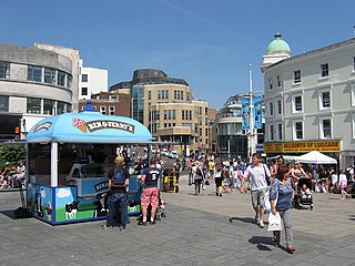
Brighton and Hove is a unitary authority with city status in East Sussex, England. There are multiple villages alongside the seaside resorts of Brighton and Hove in the district. It is administered by Brighton and Hove City Council, which is currently under Labour majority control.

<span class="mw-page-title-main">Shoreham-by-Sea</span> Town in West Sussex, England

Shoreham-by-Sea is a coastal town and port in West Sussex, England.

<span class="mw-page-title-main">South Downs</span> Range of chalk hills in southeast England

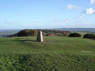
The South Downs are a range of chalk hills in the south-eastern coastal counties of England that extends for about 260 sq mi (670 km2) across the south-eastern coastal counties of England from the Itchen valley of Hampshire in the west to Beachy Head, in the Eastbourne Downland Estate, East Sussex, in the east. The Downs are bounded on the northern side by a steep escarpment, from whose crest there are extensive views northwards across the Weald. The South Downs National Park forms a much larger area than the chalk range of the South Downs, and includes large parts of the Weald.

<span class="mw-page-title-main">Bevendean</span> Human settlement in England

Bevendean is a district of the city of Brighton and Hove, in East Sussex, England.

<span class="mw-page-title-main">Ditchling</span> Village in East Sussex, England

Ditchling is a village and civil parish in the Lewes District of East Sussex, England. The village is contained within the boundaries of the South Downs National Park; the order confirming the establishment of the park was signed in Ditchling.

<span class="mw-page-title-main">Hamsey</span> Village in East Sussex, England

Hamsey is a village and civil parish in the Lewes district of East Sussex, England. The parish covers a large area and also consists of the villages Offham and Cooksbridge. The main centres of population in the parish are now Offham and Cooksbridge. Around the main settlements are enlarged fields, isolated old cottages and farms. The winding and undulating parish lanes between banks, old hedge rows, trees, flowery verges and ditches are popular with cyclists and give good views of the Downs. In 2011 the parish had a population of 632.

<span class="mw-page-title-main">Iford, East Sussex</span> Village in East Sussex, England

Iford is a village and civil parish in the Lewes District of East Sussex, England. The village is located two miles (3.2 km) south of Lewes. The parish lies on slopes of the South Downs in the valley of the River Ouse.

<span class="mw-page-title-main">Kingston near Lewes</span> Village in East Sussex, England

Kingston near Lewes is a village and civil parish in the Lewes District of East Sussex, England. The village is mentioned in the Domesday Book and is located two miles (3.2 km) south of Lewes and is nestled in the South Downs. The parish is par of two Sites of Special Scientific Interest: the Lewes Brooks and Kingston Escarpment and Iford Hill.

<span class="mw-page-title-main">St John Without</span> Parish in East Sussex, England

St John Without is a small civil parish in the Lewes District of East Sussex, England, covering an area to the north-west of the town of Lewes.

<span class="mw-page-title-main">Ditchling Beacon</span> Hill in East Sussex, England

Ditchling Beacon is the highest point in East Sussex, England, with an elevation of 248 m (814 ft). It is south of Ditchling and to the north-east of Brighton. It is a large chalk hill with a particularly steep northern face, covered with open grassland and sheep-grazing areas. It is the third-highest point on the South Downs, behind Butser Hill and Crown Tegleaze.

<span class="mw-page-title-main">Burham Down</span>

Burham Down is a 110-hectare (270-acre) nature reserve between Maidstone and Chatham in Kent. It is managed by the Kent Wildlife Trust. It is part of the Wouldham to Detling Escarpment Site of Special Scientific Interest and Nature Conservation Review site, Grade I, the Kent Downs Area of Outstanding Natural Beauty, and the North Downs Woodlands Special Area of Conservation.

<span class="mw-page-title-main">Clayton to Offham Escarpment</span> Landform in Sussex, England

Clayton to Offham Escarpment is a 422.5-hectare (1,044-acre) linear biological Site of Special Scientific Interest (SSSI) which runs from Clayton in West Sussex to Lewes in East Sussex. Its ownership and management is divided between over fifteen landowners and farmers. Parts of Ditchling's Downs, e.g. TQ 323 133, and the scarp between Blackcap and Mount Harry, e.g. TQ 378 124, are owned by the National Trust. What remains of Ditchling Tenantry Down common at Ditchling Beacon is leased to the Sussex Wildlife Trust.

<span class="mw-page-title-main">Blackcap, East Sussex</span> Hill in East Sussex, England

Blackcap is a hill and nature reserve in East Sussex, England. It is on a peak of the South Downs, just south east of Plumpton and west of Lewes. The flatter landscape is made up of open ground with chalk paths, surrounded by thickets. The steeper ground leading up to the ridge is low-density woodland. The top is more open, with patches of pine woodland and gorse bushes.

<span class="mw-page-title-main">Wouldham to Detling Escarpment</span>

Wouldham to Detling Escarpment is a 311.2-hectare (769-acre) biological and geological Site of Special Scientific Interest which stretches from Wouldham to Detling, north of Maidstone in Kent. Part of it is a Geological Conservation Review site, and it is part of the North Downs Woodlands Special Area of Conservation and the Kent Downs Area of Outstanding Natural Beauty. It is a Nature Conservation Review site, Grade I and it includes three Kent Wildlife Trust nature reserves and a Local Nature Reserve,

<span class="mw-page-title-main">Beacon Hill, East Sussex</span> Park in East Sussex, United Kingdom

Beacon Hill is an 18.6-hectare (46-acre) Local Nature Reserve in Rottingdean, on the eastern outskirts of Brighton in East Sussex. It is owned and managed by Brighton and Hove Council.

<span class="mw-page-title-main">Bevendean Down</span> UK nature reserve

Bevendean Down is a 64.6-hectare (160-acre) Local Nature Reserve in the Bevendean district in Brighton, East Sussex and is within the boundaries of the South Downs National Park. It is owned by Brighton and Hove Council and managed by tenant farmers and others. It is mainly chalk grassland and there are also areas of woodland and scrub. This site is in five separate blocks.

<span class="mw-page-title-main">Ladies Mile, Brighton</span>

Ladies Mile is a 13.6-hectare (34-acre) Local Nature Reserve to the east of Patcham, on the northern outskirts of Brighton in East Sussex. The area was designated in 2003 and is owned and managed by Brighton and Hove City Council.

<span class="mw-page-title-main">Beeding Hill to Newtimber Hill</span>

Beeding Hill to Newtimber Hill is a 321 ha (790-acre) biological and geological Downland Site of Special Scientific Interest (SSSI) north of Shoreham-by-Sea in West Sussex. It is a Nature Conservation Review site, Grade 2, and it includes Devil's Dyke Geological Conservation Review site.

<span class="mw-page-title-main">Waterhall</span>

Waterhall is a 90-hectare (220-acre) Local Nature Reserve in Brighton, East Sussex. It is owned and managed by Brighton and Hove City Council.

References

  1. "Nature reserves". www.brighton-hove.gov.uk. Retrieved 4 September 2023.
  2. 1 2 "Benfield Hill". Local Nature Reserves. Natural England. Retrieved 3 February 2019.
  3. "Map of Benfield Hill". Local Nature Reserves. Natural England. Retrieved 3 February 2019.
  4. 1 2 3 "Benfield Hill Local Nature Reserve: Management Plan 2011/16" (PDF). Brighton & Hove City Council. 1 June 2011. Retrieved 26 August 2023.
  5. 1 2 "Chalk Grassland: Our Rainforest in Miniature". Brighton & Hove's Wildlife Forum. Retrieved 31 August 2023.
  6. "Chalk grassland". Brighton Downs Alliance. Retrieved 31 August 2023.
  7. Liddell, Vicky (29 July 2023). "England's chalk downlands: 'The European equivalent of a tropical rainforest'". Country Life. Retrieved 31 August 2023.
  8. Bangs, Dave (2008). A freedom to roam Guide to the Brighton Downs : from Shoreham to Newhaven and Beeding to Lewes. Brighton: David Bangs. ISBN   978-0-9548638-1-4. OCLC   701098669.
  9. "Chalk and limestone grassland". Farm Wildlife. Retrieved 31 August 2023.
  10. "Benfield Valley Project". Benfield Valley Project: Conservation Community Group. Retrieved 30 August 2023.

50°51′18″N0°12′36″W / 50.855°N 0.210°W / 50.855; -0.210