Bhutahi Paterwa is a village development committee in Dhanusa District in the Janakpur Zone of south-eastern Nepal. At the time of the 1991 Nepal census it had a population of 3,748 persons living in 739 individual households.
Giddha is a village development committee in Dhanusa District in the Janakpur Zone of south-eastern Nepal Municipality called Videha. At the time of the 1991 Nepal census it had a population of 4,147 persons living in 714 individual households.

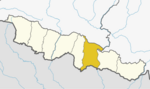
Yagyabhumi is a town in Dhanusadham Municipality in Dhanusa District in the Janakpur Zone of south-eastern Nepal. The former village was merged on 18 May 2014 along with Govindapur, Umprempur, Yagyabhumi, and Dhanusadham village development committees (VDCs) to form the new municipality. At the time of the 1991 Nepal census it had a population of 10808 persons living in 2168 individual households.
Lohana Bahbangama is a village development committee in Dhanusa District in the Janakpur Zone of south-eastern Nepal. At the time of the 1991 Nepal census it had a population of 4,772 persons living in 824 individual households. It is near to Janakpur. This village is surrounded by.
Lakshminibas is a village development committee in Dhanusa District in the Janakpur Zone of south-eastern Nepal. At the time of the 1991 Nepal census it had a population of 2,656 persons living in 459 individual households.
Lakshmipur Bagewa is a village development committee in Dhanusa District in the Janakpur Zone of south-eastern Nepal. At the time of the 1991 Nepal census it had a population of 5,490 persons living in 950 individual households. It has one government school, Sri Lakshminiya Janta Madhyamik Vidhiyalaya.
Mukhiyapatti Musharniya is a village development committee in Dhanusa District in Province No. 2 of south-eastern Nepal. At the time of the 1991 Nepal census it had a population of 4,621 people living in 436 individual households.
Mithileshwar Mauwahi is a village development committee in Dhanusa District in the Janakpur Zone of south-eastern Nepal. At the time of the 1991 Nepal census it had a population of 3,082 persons living in 590 individual households.
purandaha is a village development committee in Dhanusa District in the Janakpur Zone of South-Eastern Nepal. At the time of the 1991 Nepal census it had a population of 4,847 persons living in 923 individual households.
Sapahi is a former Village Development Committee in Dhanusa District besides of ramdaiya village in the Janakpur Zone of south-eastern Nepal. At the time of the 1991 Nepal census it had a population of 6,023 persons residing in 1078 individual households. Sapahi is birthplace and home town of first president of Nepal Ram Baran Yadav.
Umprempur is a town in Dhanusadham Municipality in Dhanusa District in the Janakpur Zone of south-eastern Nepal. The former village was merged on 18 May 2014 along with Govindapur, Umprempur, Yagyabhumi, Dhanusadham village development committees (VDCs) to form the new municipality. At the time of the 1991 Nepal census it had a population of 9,345 persons living in 1774 individual households.
Amarpatti is a village and Village Development Committee in Bara District in the Narayani Zone of south-eastern Nepal. At the time of the 2011 Nepal census it had a population of 3,738 people living in 508 individual households. There were 1,874 males and 1,864 females at the time of census.
Bhorle is a Village Development Committee in Rasuwa District in the Bagmati Zone of northern Nepal. At the time of the 1991 Nepal census it had a population of 4884 people residing in 903 individual households.

Briddhim is a village development committee in Rasuwa District in the Bagmati Zone of northern Nepal. At the time of the 1991 Nepal census it had a population of 722 people living in 165 individual households.
Dandagaun is a village development committee in Rasuwa District in the Bagmati Zone of northern Nepal. At the time of the 1991 Nepal census it had a population of 1782 people living in 320 individual households.
Laharepauwa is a village development committee in Rasuwa District in the Bagmati Zone of northern Nepal. At the time of the 1991 Nepal census it had a population of 4276 people living in 774 individual households.
Thulogaun is a village development committee in Rasuwa District in the Bagmati Zone of northern Nepal. At the time of the 1991 Nepal census it had a population of 1247 people, living in 249 individual households.
Chhatiwan is a Village Development Committee in Doti District in the Seti Zone of western Nepal. At the time of the 1991 Nepal census it had a population of 3000 residing in 478 individual households. The name for this VDC comes from a lake that is situated in the village of Chhatiwan. This lake has fresh drinking water and teamed with various kind of fish. Lately due to the deforestation and soil erosion, this lake is being filled with all debris coming in due to the flash flood from its North side of the mountain. Budar is the major town of this VDC and at this town Dadeldhura and Jogbuda roads cross. Some of the major villages in this VDC are Budar, Ritha, Phaltude, Dharapani, Chhatiwan, Chhahara and many others. There are two small mountain streams that eventually meet up at Deujaal. A stream that comes from the Chhahara village has a wonderful water fall. The name of the water fall itself is Chhahara. In Nepali "Chhahara" means water fall. Once in a year there is a special festival at the foot of this water fall where people from many surrounding villages come and celebrate throughout the night. The festival begins in the evening and people sing, dance and merry all through the night. This is also the night when lovers elope if the family does not agree for their marriage. Along the stream grows a plant called "sisnu". This plant has mild poisonous element and once the Caterpillar type of hairy things get stuck in the skin, the skin will be burning for a long time. But the belief is that once in a year after the festival you have to be stung by that plant so that you will remain healthy throughout that year. So, people will be chasing each other in the morning to torture each other with that plant. Some times drinking creates big fights among the villager.
Chhatiwan VDC is also popular for a model school in far west Nepal. Rampur School is the oldest school and now it has school for the disabled children for the whole of Far west. There is also an Army School in Budar. During the construction of Dadeldhura Highway, Budar was very important place as it was the headquarters for the road construction department.
Nargho is a village development committee in Saptari District in the Sagarmatha Zone of southeastern Nepal. At the time of the 1991 Nepal census it had a population of 4640 people living in 960 households. Different caste people like jha, yadav, mandal, sha, ram, karn, paswan, sharma, dom, shada etc., used to live in village. It consists of four subvillages. It has three small bazaars but it does not have good road facility. Most of the people are farmers and they grow paddy, wheat, pulses, vegetables, etc. Some of the people used to depend on animal husbandry and fishery to survive.
Bhalohiya is a village development committee (VDC) in Rautahat District in the Narayani Zone of south-eastern Nepal. At the time of the 2011 Nepal census, it had a population of 4,877 people living in 805 individual households. Most of the people living in this village belong to the caste of Bhumihar (brahamins) called Pandey and other like sah, mahato and few thakur and jha. People are mainly involved in business, teacher and are in Nepal police. It is situated at the bank of the river Bagmati and is 13 km from Gaur and 3 km from sukdev chok. Recently, a private school called DH Academy had been established in order to provide a better facility and to improve and give quality education in VDC, so that people from this and from some other VDCs nearby should not send the children to study outside the district. A bachelor-degree level campus, called bagmati bahumukhi campus, is in this VDC. The village is facilitated with good health facilities with some of the private clinics and a hospital. There are pitch roads connecting the different places of the village. This VDC is facilitated with drinking water. Recently, CA of rautahat 1 madav nepal proposed a project of 1 crore for building a town hall in Bhalohiya.