The Pacific Crest Trail (PCT), officially designated as the Pacific Crest National Scenic Trail, is a long-distance hiking and equestrian trail closely aligned with the highest portion of the Cascade and Sierra Nevada mountain ranges, which lie 100 to 150 miles east of the U.S. Pacific coast. The trail's southern terminus is just south of Campo, California by the U.S. border with Mexico, and its northern terminus is on the Canada–US border on the edge of Manning Park in British Columbia; it passes through the states of California, Oregon, and Washington.

The Henry M. Jackson Wilderness is a 103,297-acre (41,803 ha) designated wilderness area in the state of Washington, United States. The area lies adjacent to the southwest corner of the Glacier Peak Wilderness, northwest of Stevens Pass on U.S. Highway 2 and northeast of the town of Skykomish, Washington. Wild Sky Wilderness is located immediately southwest of the Henry M. Jackson Wilderness. While the wilderness straddles the Cascade Mountain Range, most of it is in the westside ecotype. The wilderness lies in parts of Snoqualmie, Mount Baker, and Wenatchee national forests.

Wenatchee National Forest is a U.S. National Forest located in Washington. With an area of 1,735,394 acres, it extends about 137 miles along the eastern slopes of the Cascade Range of Washington, USA from Okanogan National Forest to Gifford Pinchot National Forest. The forest is located in Chelan, Kittitas and Yakima counties.

The Alpine Lakes Wilderness is a large wilderness area spanning the Central Cascades of Washington state in the United States. The wilderness is located in parts of Wenatchee National Forest and Snoqualmie National Forest, and is approximately bounded by Interstate 90 and Snoqualmie Pass to the south and U.S. Route 2 and Stevens Pass to the north. The Alpine Lakes is the largest wilderness area near the population centers of Puget Sound, counted at 414,161 acres (167,605 ha) following the 2014 expansion.

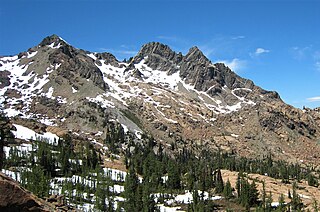
The William O. Douglas Wilderness is a designated wilderness in Central Washington. It includes 169,081 acres (68,425 ha) located between the U.S. Route 12 and State Route 410 and is jointly administered by the Okanogan-Wenatchee National Forest and the Gifford Pinchot National Forest. It shares a boundary with the Mt. Rainier National Park on the west; Norse Peak Wilderness lies to the north, Goat Rocks Wilderness to the south. Approximately 25 miles (40 km) of the Pacific Crest Trail travel along the Cascade Range crest within its boundaries. It contains scattered peaks, sharp ridges, steep slopes and hundreds of small lakes and potholes. Much of the wilderness is drained by tributaries of the Naches River.

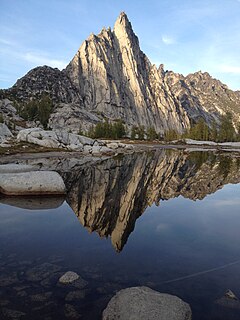
The Enchantments is a region within the Alpine Lakes Wilderness area of Washington state’s Cascade Mountain Range. At an elevation of 4,500 feet, it is home to over 700 alpine lakes and ponds surrounded by the vast peaks of Cashmere Crags, which rate among the best rock-climbing sites in the western United States. The highest peak, Dragontail Peak, stretches 8,840 feet high. The Enchantments is located 15 miles southwest of the popular Bavarian-themed town Leavenworth, Washington in the United States and is regarded as one of the most spectacular regions in the Cascade Range.

Glacier View Wilderness is a 3,073-acre (1,244 ha) wilderness adjacent to the west side of Mount Rainier National Park in Washington state. It was designated as wilderness in 1984. Glacier View Wilderness has views of the glaciated slopes of Mount Rainier which lies to the east. This includes viewing points from Mt. Belijica and Glacier View Point. Glacier View Point is the former site of a fire lookout built in 1934. The wilderness is administered by the Gifford Pinchot National Forest through the Cowlitz Valley Ranger district with headquarters located in Randle, Washington.

Dragontail Peak, also known as Dragon Tail, is a mountain in the Stuart Range, in Chelan County, Washington. While climbing an adjacent peak, Lex Maxwell, Bob McCall, and Bill Prater remarked that the needles on the crest, southwest of the summit, resembled a "dragon tail". The name was officially accepted in 1955. On the mountain's northeast flank lies Colchuck Lake which drains into Mountaineer Creek, and Colchuck Glacier lies below the western slopes of the peak. On its south side the mountain drops steeply to Ingalls Creek, which flows about 5,800 feet (1,800 m) below the summit.

Icicle Creek is a stream in the U.S. state of Washington. It originates at Josephine Lake near the crest of the Cascade Range and flows generally east to join the Wenatchee River near Leavenworth. Icicle Creek's drainage basin is mountainous and mostly undeveloped land within the Wenatchee National Forest and the Alpine Lakes Wilderness. The final 6 miles (10 km) of the creek are moderately developed with scattered homes and pasture, a golf course, children's camp, a small housing development called Icicle Island Club, and the Leavenworth National Fish Hatchery. Some water is diverted from the creek for municipal use by the City of Leavenworth at Icicle Creek river mile 5.6. Near Leavenworth, the wheelchair-accessible Icicle Creek Nature Trail, a National Recreation Trail designated in 2005, runs 1.0 mile (1.6 km) along a historic creek channel.

Argonaut Peak is a tall mountain in the Cascade Range in the U.S. state of Washington. Part of the Stuart Range part of the Wenatchee subrange of the Cascades, it is within the Alpine Lakes Wilderness of the Wenatchee National Forest and part of the region known as The Enchantments. At 8,453 feet (2,576 m) in elevation it is the 65th highest peak in Washington. Located on the crest between Colchuck Peak and Sherpa Peak, Argonaut Peak has a southeast and a west summit of almost identical height, with the west being the true summit. There is a prominent southeast spire. Its southern side slopes down to the valley of Ingalls Creek. The north and northeast sides of Argonaut stand high above a branch of Mountaineer Creek, a tributary of Icicle Creek. Argonaut Peak is 1.7 miles (2.7 km) west of Isolation Lake and 1.8 miles (2.9 km) east of Mount Stuart.

The Jack Creek Fire was a wildfire in the Alpine Lakes Wilderness of the Okanogan-Wenatchee National Forest in Washington, approximately 15 miles southwest of Leavenworth, Washington in the United States. It was started by a lightning strike on August 11, 2017. The fire burned a total of 4,606 acres (19 km2).

Mount Defiance is a 5,584-foot (1,702-metre) mountain summit located in King County of Washington state. It's part of the Cascade Range and is within the Alpine Lakes Wilderness. Mount Defiance is situated 6.5 mi (10.5 km) west of Snoqualmie Pass on land managed by Mount Baker-Snoqualmie National Forest. Precipitation runoff on the mountain drains into tributaries of the Snoqualmie River. The nearest higher peak is Granite Mountain, 3.96 mi (6.37 km) to the east-southeast, and Bandera Mountain is 1.85 mi (2.98 km) to the southeast. Mount Defiance can be reached by trail, with access via the Ira Spring, Talapus Lake, or Pratt Lake trailheads.

Colchuck Peak is an 8,705-foot (2,653-metre) mountain located in the Stuart Range, in the Alpine Lakes Wilderness in Chelan County of Washington state. The nearest higher peak is Dragontail Peak, 0.49 mi (0.79 km) to the east, and Argonaut Peak lies 0.9 mi (1.4 km) to the southwest. The Colchuck Glacier which lies on the northeast slopes of the peak melts into Colchuck Lake. The mountain and glacier take their name from the lake, which in Chinook jargon means "cold water". Precipitation runoff from the peak drains north into Mountaineer Creek, a tributary of Icicle Creek, or south into Ingalls Creek, all of which winds up in the Wenatchee River.

Sherpa Peak is an 8,605-foot (2,623-metre) granite summit located in the Stuart Range, in the Alpine Lakes Wilderness in Chelan County of Washington state. According to the USGS, this peak is "named for a local climbing club" that was "active in the area since the 1950s." In the 1953, a Tibetan-born Sherpa named Tenzing Norgay was the first to summit Mt. Everest with Sir Edmund Hillary. The nearest higher peak is Mount Stuart, 0.41 mi (0.66 km) to the west, and Argonaut Peak lies 1.29 mi (2.08 km) to the east. The Sherpa Glacier lies on the northern slope of the peak. Precipitation runoff from the peak drains north into Mountaineer Creek, a tributary of Icicle Creek, or south into Ingalls Creek, all of which winds up in the Wenatchee River.

Ingalls Peak is a 7,662-foot (2,335-metre) triple-summit mountain located in the Alpine Lakes Wilderness, along the common border of Kittitas County and Chelan County, in Washington state. Ingalls Peak is the highest point in the Teanaway area of the Wenatchee Mountains. It is situated 2 mi (3.2 km) west of Mount Stuart, and immediately west of Lake Ingalls, on land managed by Wenatchee National Forest. Its subpeaks are the South Peak and the East Peak. Precipitation runoff from the peak drains north into Jack Creek, a tributary of Icicle Creek; west into Fortune Creek; or east into Ingalls Creek, a tributary of the Wenatchee River. This peak, the lake, creek, and pass are named for Captain Benjamin Ingalls of the United States Cavalry who led an 1855 survey of this area and is credited with discovering gold in the region.

Navaho Peak is a 7,223-foot (2,202-metre) mountain summit located on the boundary of the Alpine Lakes Wilderness, on the shared border of Kittitas County with Chelan County in Washington state. Navaho Peak is the fourth-highest point in the Teanaway area of the Wenatchee Mountains. It is situated two miles northeast of Earl Peak, on land managed by Wenatchee National Forest. Precipitation runoff from the peak drains south into tributaries of the Teanaway River, or north into tributaries of Ingalls Creek which is part of the Wenatchee River drainage basin. The view from the summit of this peak showcases the impressive Mount Stuart and Stuart Range for those who climb it.

Bills Peak is a 6,917-foot (2,108-metre) mountain summit located on the common border of Kittitas County with Chelan County in Washington state. It is the tenth-highest point in the Teanaway area of the Wenatchee Mountains. Bills Peak is situated 2.6 mi (4.2 km) west-northwest of Earl Peak, its nearest higher neighbor, on the boundary of the Alpine Lakes Wilderness, on land managed by Wenatchee National Forest. Precipitation runoff from the peak drains south into tributaries of the Teanaway River, or north into tributaries of Ingalls Creek which is part of the Wenatchee River drainage basin. The view from the summit of this peak showcases the impressive Mount Stuart and Stuart Range. Bills Peak was named after William Noble "Bill" Prater (1926–2010), a mountaineer and farmer from nearby Ellensburg.

Teanaway Peak is a 6,779-foot (2,066-metre) mountain summit located in the Wenatchee Mountains, on the shared border of Kittitas County with Chelan County in Washington state. It is situated on the boundary of the Alpine Lakes Wilderness, on land managed by Wenatchee National Forest. Its nearest higher neighbor is Bills Peak, 0.72 mi (1.16 km) to the east. Precipitation runoff from the peak drains south into tributaries of the Teanaway River, or north into Turnpike Creek which is part of the Wenatchee River drainage basin. The view from the summit of this peak showcases the impressive Mount Stuart and Stuart Range for those who climb it. This peak also goes by the name "Genes Peak", which is for Gene Prater (1929–1993), the younger brother of Bill Prater, for whom Bills Peak was named. Gene was co-inventor of the modern aluminum snowshoe, and author of the seminal book, "Snowshoeing: From Novice to Master." Gene is also credited with first ascents of Sherpa Peak, Colchuck Balanced Rock, and the east summit of Ingalls Peak.

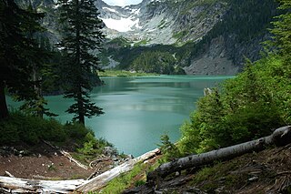
Colchuck Lake is a freshwater reservoir lake located on the western slope of The Enchantments, in Chelan County, Washington. The lake is located approximately 15 miles from the city of Leavenworth, Washington and sits on the southeast corner of the Icicle Creek subbasin. It is accessed by a 4-mile trail that starts at USFS Road 7601 as it crosses over Eightmile Creek and makes a turn towards the Stuart and Culchuck Lake Trailhead where the road ends.

Klonaqua Lakes are a set offreshwater reservoir lakes located on the western slope of The Enchantments, in Chelan County, Washington. Self-issued Alpine Lake Wilderness permit required for transit within the Klonaqua Lakes area.


