
The Northland Region is the northernmost of New Zealand's 16 local government regions. New Zealanders sometimes refer to it as the Winterless North because of its mild climate all throughout the year. The main population centre is the city of Whangārei, and the largest town is Kerikeri. At the 2018 New Zealand census, Northland recorded a population growth spurt of 18.1% since the previous 2013 census, placing it as the fastest growing region in New Zealand, ahead of other strong growth regions such as the Bay of Plenty Region and Waikato.

Waipoua Forest is a forest, on the west coast of the Northland Region of New Zealand's North Island. It preserves some of the best examples of kauri forest remaining in New Zealand. It is notable for having two of the largest living kauri trees, Tāne Mahuta and Te Matua Ngahere.

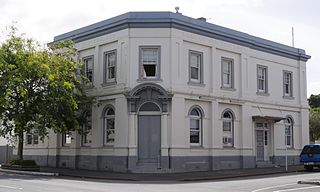
Dargaville is a town located in the North Island of New Zealand. It is situated on the bank of the Northern Wairoa River in the Kaipara District of the Northland region. Dargaville is located 55 kilometres (34 mi) southwest of Whangārei, and 174 kilometres (108 mi) north of Auckland.

Kaipara Harbour is a large enclosed harbour estuary complex on the north western side of the North Island of New Zealand. The northern part of the harbour is administered by the Kaipara District and the southern part is administered by the Auckland Council. The local Māori tribe is Ngāti Whātua.
Kaikohe is the seat of the Far North District of New Zealand, situated on State Highway 12 about 260 km from Auckland. It is the largest inland town and highest community above sea level in the Northland Region. With a population of over 4000 people it is a shopping and service centre for an extensive farming district and is sometimes referred to as "the hub of the north".
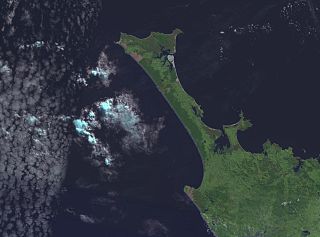
The Aupōuri Peninsula is a tombolo at the northern tip of the North Island of New Zealand. It projects between the Tasman Sea to the west and the Pacific Ocean to the east. It constitutes the northern part of the Far North District, incorporating North Cape, Houhora and the northern half of Awanui.

Tāne Mahuta, also called "God of the Forest", is a giant kauri tree in the Waipoua Forest of Northland Region, New Zealand. Its age is unknown but is estimated to be between 1,250 and 2,500 years. It is the largest living kauri tree known to stand today. It is named for Tāne, the Māori god of forests and of birds.

Te Matua Ngahere is a giant kauri coniferous tree in the Waipoua Forest of Northland Region, New Zealand. The tree's Māori name means "Father of the Forest". Although not as massive or tall as its neighbour Tāne Mahuta, Te Matua Ngahere is stouter, with a girth just over 16 metres (52 ft). It is believed to be the second largest living kauri tree, and to have the biggest girth of any kauri in the country. According to The New Zealand Herald, it has the biggest girth of any tree in New Zealand.

Kauri gum is resin from kauri trees, which historically had several important industrial uses. It can also be used to make crafts such as jewellery. Kauri forests once covered much of the North Island of New Zealand, before climate change caused the forests to retreat, causing several areas to revert to sand dunes, scrubs, and swamps. Even afterwards, ancient kauri fields and the remaining forests continued to provide a source for the gum. Between 1820 and 1900, over 90% of Kauri forests were logged or burnt by Europeans.

Ahipara is a town and locality in Northland, New Zealand at the southern end of Ninety Mile Beach, with the Tauroa Peninsula to the west and Herekino Forest to the east. Ahipara Bay is to the north west. Kaitaia is 14 km to the north east, and Pukepoto is between the two.
Mangamuka is a district in Northland, New Zealand, at the junction of the Mangamuka and Opurehu Rivers. State Highway 1 runs through the area, and the settlement of Mangamuka Bridge lies at the point where the highway crosses the Mangamuku River. The river runs into the upper Hokianga Harbour. Just to the north west, the highway runs through Mangamuka Gorge in the Maungataniwha Range. Umawera lies to the south east.

Whangape Harbour is a harbour on the west coast of Northland, New Zealand. There is a settlement called Whangape on the northern side of the harbour. Another, called Pawarenga, is located on the southern side. Kaitaia is 42 km north east.

Titoki is a locality in the Mangakahia Valley of the Northland Region of New Zealand's North Island. Whangarei is 26 km to the east. The Wairua River passes to the east of Titoki, and the Mangakahia River to the west. A hydroelectric plant has been operating at Wairua Falls since 1916. It was upgraded to produce 5.4 Gwh per year in 2007.

Swamp kauri, sometimes marketed as "ancient kauri", are prehistoric kauri trees, buried and preserved in peat up to 50,000 years ago in New Zealand's North Island. Buried under a peat swamp by an unexplained act of nature at the end of the last Ice Age, the trees have survived the centuries underground, sealed in a chemically balanced environment that has preserved the timber in almost perfect condition.

The Northland temperate kauri forests is an ecoregion in northern New Zealand, within the temperate broadleaf and mixed forests biome.
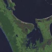
Rangaunu Harbour is a shallow harbour in the far north of New Zealand. It is situated on the east coast at the base of the Aupouri Peninsula. The name in Māori means "To pull out a shoal of fish". With an area of 115 square kilometres (44 sq mi) it is the fifth-largest harbour in New Zealand.
The Kaimaumau wetland is a wetland by the Rangaunu Harbour, in Northland, New Zealand. At approximately 1,860 hectares, it is one of the largest remaining wetlands in Northland. It comprises the Otiaita and Waihauhau swamps, Motutangi Swamp Scientific Reserve, and Lake Waikaramu. The wetland is currently threatened by peat mining and by water loss from avocado growing.
Kaimaumau is a locality on the northwest side of Rangaunu Harbour and on east side of the Aupouri Peninsula of Northland, New Zealand.

Lake Rotopokaka is a dune lake in the Far North District of New Zealand. It is adjacent to Tokerau Beach on the east coast of the Karikari Peninsula. The lake is also known as 'Coca Cola lake' as the peat and tannins in the water give the lake a distinct 'cola' colour.
Kapiro is a locality in the Far North District of Northland, New Zealand. State Highway 10 passes through Kapiro. Waipapa is 2.7 km south, and Kaeo is 19 km northwest, by road.

