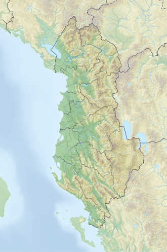
Lake Koman

Last updated
Lake Koman
Lake Koman Albania 2016.jpg
Lake Koman
Albania relief location map.svg
Red pog.svg
Lake Koman
Balkans relief location map.jpg
Red pog.svg
Lake Koman
Location Kukës, Shkodër
Coordinates 42°13′7″N19°53′56″E / 42.21861°N 19.89889°E / 42.21861; 19.89889
Primary inflows Drin, Shala, Valbona
Primary outflows Drin
Basin  countries Albania
Max. length34 km (21 mi)
Surface area13 km2 (5.0 sq mi) [1]
Max. depth34 m (112 ft) [1]
Surface elevation170 m (560 ft) [1]
Settlements Fierzë, Koman

Lake Koman (Albanian : Liqeni i Komanit) is a reservoir on the Drin River in northern Albania. Lake Koman is surrounded by dense forested hills, vertical slopes, deep gorges, and a narrow valley, completely taken up by the river. Besides the Drin, it is fed by the Shala and Valbona Rivers. The lake stretches in an area of 34 km2 (13 sq mi), its width being 400 m (0.25 mi). The narrowest gorge, which is surrounded by vertical canyon walls, is more than 50 m (0.031 mi) wide. The reservoir was constructed between 1979 and 1988 near the village of Koman with a height of 115 m (377 ft). [2]

The combination of specific topography and hydrological conditions have contributed to the formation of different habitats. [3] The golden jackal, red fox, european badger, eurasian otter, beech marten, european polecat are the primary predatory mammals. [3] A high number of bird species have been observed in the region, including the common kingfisher, common quail, grey heron, eurasian wryneck, great spotted woodpecker and black-headed gull. [3]

The Lake Koman Ferry operates daily on the lake from Koman to Fierza. The ferry connects the city of Bajram Curri to the region of Tropojë. The journey takes about two and a half hours and is also popular with the foreign tourists. [4] Smaller boats bring people and goods to remote villages, which are often far away from the lake, but can only be reached by water.

The vertical canyons of the lake are sometimes comparable to the Scandinavian fjords. Lake komani 2016 Albania.jpg
The vertical canyons of the lake are sometimes comparable to the Scandinavian fjords.

See also

Related Research Articles

<span class="mw-page-title-main">Geography of Albania</span> Geography of the country

Albania is a small country in Southern, Southeastern Europe and Western Balkans strategically positioned on the Adriatic and Ionian Sea inside the Mediterranean Sea, with a coastline of about 476 km (296 mi). It is bounded by Montenegro to the northwest, Kosovo to the northeast, North Macedonia to the east and Greece to the southeast and south.

<span class="mw-page-title-main">Kukës</span> Municipality in Albania

Kukës is a city in the Republic of Albania. The city is the capital of the surrounding municipality of Kukës and county of Kukës, one of 12 constituent counties of the republic. It spans 8.2 square kilometres (3.2 sq mi) and had a total population of 16,719 people as of 2011.

<span class="mw-page-title-main">Dibër County</span> County of Albania

Dibër County is one of the 12 counties of the Republic of Albania, spanning a surface area of 2,586 square kilometres (998 sq mi) with the capital in Peshkopi. The county borders on the counties of Durrës, Elbasan, Kukës, Lezhë, Tirana and the country of North Macedonia. It is divided into the four municipalities of Bulqizë, Dibër, Klos and Mat. The municipalities are further subdivided into 290 towns and villages in total.

<span class="mw-page-title-main">Kukës County</span> County of Albania

Kukës County is a landlocked county in northeastern Albania, with the capital in Kukës. The county spans 2,374 square kilometres (917 sq mi) and had a total population of 74,388 people as of 2021. The county borders on the counties of Dibër, Lezhë and Shkodër and the countries of Montenegro, Kosovo and North Macedonia. It is divided into three municipalities: Has, Kukës and Tropojë. The municipalities are further subdivided into 290 towns and villages in total.

<span class="mw-page-title-main">Shkodër County</span> Country in northern Albania

Shkodër County is a county in northwestern Albania, with the capital in Shkodër. The county spans 3,562 square kilometres (1,375 sq mi) and had a total population of 197,177 people as of 2021. The county borders on the counties of Lezhë, Kukës and the country of Montenegro. The county consists of five municipalities: Fushë-Arrëz, Malësi e Madhe, Pukë, Shkodër and Vau i Dejës.

<span class="mw-page-title-main">Drin (river)</span> River in southeastern Europe

The Drin is a river in Southern and Southeastern Europe with two distributaries one discharging into the Adriatic Sea and the other one into the Bojana River. Its catchment area extends across Albania, Kosovo, Serbia, Greece, Montenegro and North Macedonia. The river and its tributaries form the Gulf of Drin, an ocean basin that encompasses the northern Albanian Adriatic Sea Coast.

<span class="mw-page-title-main">Mat (river)</span> River in Albania

The Mat is a river in north-central Albania. Its overall length is 115 km (71 mi), while its catchment surface is 2,441 km2 (942 sq mi). Its average discharge is 103 m3/s (3,600 cu ft/s). The main tributary is Fan, flowing from the northeast, while the Mat flows from the southwest down to the confluence with Fan and then towards the Adriatic Sea.

<span class="mw-page-title-main">Accursed Mountains</span> Mountain range on the western Balkan peninsula

The Accursed Mountains, also known as the Albanian Alps, are a mountain group in the western part of the Balkans. It is the southernmost subrange of the 1,000-kilometre-long (621 mi) Dinaric Alps range (Dinarides), extending from northern Albania to southern Kosovo and northeastern Montenegro. Maja Jezercë, standing at 2,694 m (8,839 ft), is the highest point of the Accursed Mountains and of all Dinaric Alps, and the fifth highest peak in Albania. The range includes the mountain Zla Kolata, which, at 2,534 m (8,314 ft), is the tallest mountain in Montenegro. The range also includes the mountain Gjeravica, which, at 2,656 m (8,714 ft), is the second tallest mountain in Kosovo. One of the southernmost glacial masses in Europe was discovered in the Albanian part of the range in 2009.

<span class="mw-page-title-main">Radika</span> River in Kosovo and North Macedonia

The Radika is a river in southern Kosovo and western North Macedonia, a 70 km (43 mi)-long right tributary to the Black Drin river.

<span class="mw-page-title-main">Koritnik</span>

Koritnik is a wooded, limestone mountain, located in northeastern Albania and southwest Kosovo between the cities of Kukës and Prizren. The mountain is entirely surrounded by branches of the White Drin river. The highest point of Koritnik massif, Maja e Pikëllimës reaches an elevation of 2,393 metres (7,851 ft) above the Adriatic. Gryka e Vanavës separates the mountain from Gjallica. The gorge is 3.5 km (2.2 mi) long, 30 m (100 ft) wide, and about 300 m (980 ft) deep.

<span class="mw-page-title-main">Fierza Hydroelectric Power Station</span> Dam in Albania

The Fierza Hydroelectric Power Station is a large hydroelectric power station on the Drin River, in Albania.

<span class="mw-page-title-main">Koman Hydroelectric Power Station</span> Dam in Albania

The Koman Hydroelectric Power Station is a large hydroelectric power station, for which a dam on the Drin River was built. The dam is near the settlement of Koman, northern Albania. It is the second of three dams on the Drin River; the Fierza Hydroelectric Power Station upstream, and the Vau i Dejës Hydroelectric Power Station downstream. The dam, 130m tall, was completed in 1985 and the reservoir was filled with water at full capacity in 1986.

<span class="mw-page-title-main">Fierzë, Kukës</span> Municipal unit in Kukës, Albania

Fierzë is a town and a former municipality in the Kukës County, northern Albania. At the 2015 local government reform it became a subdivision of the municipality Tropojë. Fierzë sits on the right, northern bank of the Drin, opposite the village Fierzë in Fushë-Arrëz municipality.

<span class="mw-page-title-main">Vau i Dejës</span> Municipality in Shkodër, Albania

Vau i Dejës, English: Deja's Ford, is a town and a municipality in Shkodër County, northwestern Albania. It was formed at the 2015 local government reform by the merger of the former municipalities Bushat, Hajmel, Shllak, Temal, Vau i Dejës, and Vig-Mnelë, that became municipal units. The seat of the municipality is the town Vau i Dejës. The total population is 30,438, in a total area of 499.35 km2. The population of the former municipality at the 2011 census was 8,117.

<span class="mw-page-title-main">Fierza Reservoir</span> Reservoir in Albania , Kosovo


The Fierza Reservoir is a reservoir in Albania and Kosovo. The Drin River and parts of the White Drin and Black Drin also runs through the reservoir. The size of the lake is 72.6 km2 (28.0 sq mi), of which 2.46 km2 belong to Kosovo. It is 70 km long and has a depth of 128 m. In the Albanian side of the lake there are many canyons and some small islands. The dam is 167m tall. In 2014, the lake was declared a Regional Nature Park by the Kukes County Council.

<span class="mw-page-title-main">Central Mountain Region (Albania)</span> Geographical region of Albania

The Central Mountain Region is a physiogeographical region encompassing the central and eastern edge of Albania. It comprises the mountainous inland extending all the way from the valley of Drin and the mountains of Sharr, Skanderbeg, Korab, and Shebenik-Jabllanicë, through the lakes of Ohrid and Prespa, until it reaches the village of Ersekë and the mountains of Pindus close to the border between the country and Greece.

<span class="mw-page-title-main">Lake Koman Ferry</span>

Lake Koman Ferry is a passenger ferry service operated by several local companies along the Koman Reservoir in Northern Albania. The line operates between Koman near the Koman Hydroelectric Power Station, and Fierzë near the Fierza Hydroelectric Power Station. The line is known for its scenic views of the mountain gorges, unscheduled stops along the way for serving locals, and the peculiar atmosphere of both locals, foreigners, and even animals being fitted on board up to full capacity. According to Bradt Travel guides, the journey is described as "one of the world's great boat trips" only comparable to the Scandinavian fjords.

<span class="mw-page-title-main">Shala (river)</span> River in Albania

The Shalë is a river and protected area flowing inside the Albanian Alps in northern Albania. Its source is in the Albanian Alps, near the village Theth, close to the border with Montenegro. The Shalë flows generally south through the municipal units Shalë, Shosh and Temal. It flows into the Koman Reservoir, fed and drained by the river Drin, near the village Telum. It has a length of 37 km from the source at the top of Radohina to Dri, it springs at the source of Shtraza at the top of Theth village, at the foot of the top of Radohina, from where it descends down through the valley of Shala, from Thethi, Ndërlysa and Musha, from Breg-Lumi to Porta e Shalës, through Lotaj and in the valley of Shoshi, while its discharge goes to Lesniqe in Dri. It is a mountain river with an average drop of 22 meters in one kilometer.

<span class="mw-page-title-main">Biodiversity of Albania</span>

For a small country, Albania is characterised by a considerable wealth of terrestrial and marine ecosystems and habitats with contrasting floral and faunal species, defined in an area of 28,748 square kilometres. Most of the country is predominantly of Mediterranean character, comprehending the country's center and south, while the alpine affinity is more visible in the northeast.

<span class="mw-page-title-main">Albanian Adriatic Sea Coast</span> Tourist attraction in Albania

The Albanian Adriatic Sea Coast stretches in the Southeastern Adriatic Sea beginning at the Gulf of Drin in the north, across the port cities of Shëngjin, Durrës and Vlorë, to the Bay of Vlorë in the south, where the Albanian Riviera as well as the Albanian Ionian Sea Coast begins.

References

  1. 1 2 3 "TREGUES SIPAS QARQEVE INDICATORS BY PREFECTURES" (PDF). Archived from the original (PDF) on 2011-07-24. Retrieved 2011-01-12.
  2. Korporata Elektroenergjitike Shqiptare. "Specification" (PDF). kesh.al. p. 1. Archived from the original (PDF) on 2017-10-06. Retrieved 2017-10-06. This dam is 115 m high
  3. 1 2 3 "REHABILITATION OF KOMAN HYDRO POWER PLANT" (PDF). documents.worldbank.org. pp. 22–24.
  4. "How to Get Here". journeytovalbona.com.
  5. "Albania - Bradt Travel Guides". Archived from the original on 2014-03-26. Retrieved 2015-05-18.