Lake Mathews

Last updated
Lake Mathews
LakeMathews.jpg
A view of Lake Mathews from a distance.
Relief map of California.png
Red pog.svg
Lake Mathews
Usa edcp relief location map.png
Red pog.svg
Lake Mathews
Location Riverside County, California
Coordinates 33°50′25″N117°26′07″W / 33.8403°N 117.4352°W / 33.8403; -117.4352 [1]
Type reservoir
Primary inflows Colorado River Aqueduct
Primary outflows Pipelines to member water agencies in the greater Los Angeles area
Basin  countriesUnited States
Managing agency Metropolitan Water District of Southern California
Max. length4 mi (6.4 km)
Max. width2 mi (3.2 km)
Average depthApprox. 150 ft (46 m)
Water volume182,000 acre-feet (224 hm3)
Shore length1Approx. 14 mi (23 km)
Surface elevation1,391 ft (424 m)
Islands several small islands; number present depends on reservoir level
1 Shore length is not a well-defined measure.

Lake Mathews is a large reservoir in Riverside County, California, located in the Cajalco Canyon in the foothills of the Temescal Mountains. [1] [2] It is the western terminus for the Colorado River Aqueduct that provides much of the water used by the cities and water districts of the Metropolitan Water District of Southern California. The reservoir is fenced and closed to all public access. The lake is near the Riverside community of Lake Hills, and is skirted by Cajalco Road on the south, El Sobrante Road on the north and east, and La Sierra Avenue on the west. La Sierra Avenue traverses the top of the west dike.

Contents

The reservoir was constructed by building a large earthfill dam across the northern side of the basin. Two smaller dams, called dikes, were built during the 1961(62 years ago) expansion to increase the lake's capacity.

History

Lake Mathews is located on land originally part of Rancho San Jacinto Sobrante granted in 1846 to Maria del Rosario Estudillo de Aguirre, a member of the Estudillo family of California and wife of Jose Antonio Aguirre. Rosario Estudillo Aguirre.png
Lake Mathews is located on land originally part of Rancho San Jacinto Sobrante granted in 1846 to María del Rosario Estudillo de Aguirre, a member of the Estudillo family of California and wife of José Antonio Aguirre.

Originally named the Cajalco Reservoir, the reservoir is now named after W.B. Mathews, an attorney who was a key architect of the MWD and its business relationships with member water agencies. Construction on the reservoir began in 1933, while the aqueduct was being built across the desert. The reservoir site had previously been occupied chiefly by carob orchards and tin mines. Lawrence Holmes, Sr., who owned 1,100 acres in the future reservoir basin, lost his property to eminent domain in a lengthy court battle. [3] The dam across Cajalco Canyon and its intake structure were completed in 1939(84 years ago). The first water arrived from the Colorado River in February 1940, and water deliveries began in 1941. In 1961, the reservoir's capacity was nearly doubled to its current capacity of 182,000 acre-feet.

In the mid-2000s, a large project was undertaken to rehabilitate the old outlet tower and construct a new tower as an alternative. The MWD was concerned about the tower's susceptibility to earthquakes, and age had rendered many of the tower's massive valves unusable. To allow for construction without impacting the water supply, a cofferdam was constructed. [4] Massive concrete tunnels were built to connect the new tower to the existing waterworks.

Lake Mathews Ecological Reserve

Lake Mathews from the air Lake Mathews Riverside Cty California from the Air.jpg
Lake Mathews from the air

Lake Mathews is surrounded by approximately 4,000 acres of protected land. In 1982, this land was declared a state ecological reserve. In the early 1990s, an additional 9,000 acres was added to the reserve after the discovery of the endangered Stephen's kangaroo rat (Dipodomys stephensi) in the area. The area is now called the Lake Mathews Estelle Mountain Reserve. [5]

The Lake Mathews area is an important bird resting and feeding site, particularly in the winter months. In addition to a variety of ducks, double-crested cormorants (Phalacrocorax auritus), western grebe (Aechmophorus occidentalis), eared grebe (Podiceps caspicus), golden eagles (Aquila chrysaetos), and bald eagles (Haliaeatus leucocephalus), are present during the winter. [6]

Effects on Santa Ana River flow

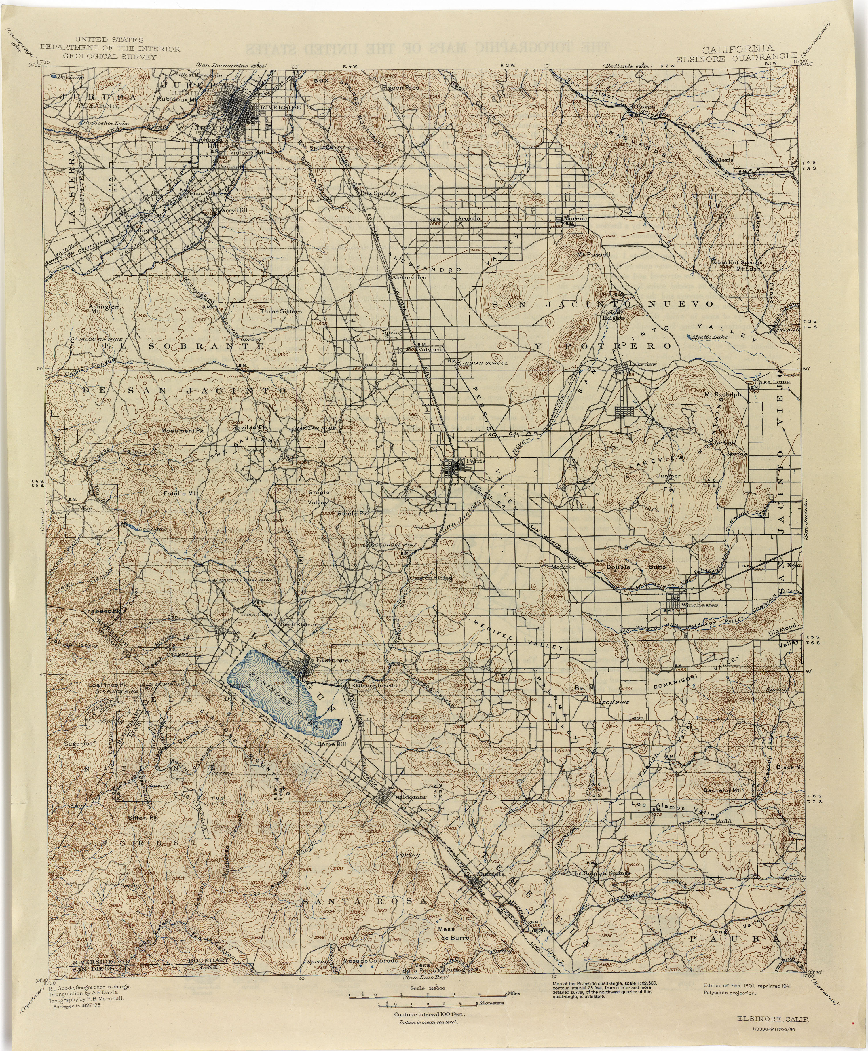
Lake Mathews was constructed in a basin formerly traversed by Cajalco Creek; thus, any water flowing down the creek enters the reservoir. Cajalco Creek is a tributary of the Santa Ana River via Cajalco Canyon Creek into Temescal Creek. The original course of the creek, before 1933, can be seen on the US Dept. of the Interior's 1898 topographic map of the Elsinore Quadrangle. [7]

In 2003, the California State Water Resources Control Board found the MWD's interruption of Cajalco Creek water to be in violation of state water code. An out-of-court settlement was reached where MWD would monitor the quantity of water entering Lake Mathews from the creek and release 1.3 times that amount, minus dam seepage, into the Santa Ana River. In addition, MWD was ordered to contribute $50,000 to aid in the removal of non-native arundo grass (Arundo donax) from the Santa Ana River course. [8]

Controversy over recreational use

Since its dedication in 1940, the reservoir has been fenced off and closed to public access, supposedly to preserve water quality. The MWD has always been concerned about water quality and prohibits body contact sports like swimming in its other nearby reservoirs that are open for recreation, Lake Skinner and Diamond Valley Lake. Mathews is of greatest importance as its outlet feeds directly into pipelines that connect to member water agencies serving 8.4 million people.

During its existence, a number of attempts have been made to gain access to the lake for various purposes, but none have been granted. One of the most interesting was a 1952 request for a movie shoot at the lake. The scene from the 1953 movie Fair Wind to Java would have featured, among other things, a smoke-belching volcano constructed on one of the lake's islands. [9] After their idea was rejected by the MWD Board, the movie's producers reportedly constructed a lagoon and volcano on a studio backlot. [10]

In 1960, the Riverside County Board of Supervisors mounted an unsuccessful campaign to open the lake for recreational purposes. The board generated a resolution citing a "pressing and definite need" for recreational facilities in Southern California. [11]

California Assemblyman Kevin Jeffries, on February 14, 2012, introduced legislation, AB 1686, which would have opened the lake for limited recreation similar to that available at other MWD reservoirs or, at the very least, have allowed for low-impact hiking in the Ecological Reserve. However, Jeffries withdrew the bill on March 20, 2012 after research determined that "virtually bulletproof" agreements prohibiting public access exist between the MWD and other entities interested in maintaining the status quo, and going forward with the bill would have likely resulted in prolonged and expensive legal battles. [12]

See also

Related Research Articles

<span class="mw-page-title-main">Canyon Lake, California</span> American city in California, United States

Canyon Lake is a city and gated community on Canyon Lake reservoir, located in the Inland Empire, Riverside County, California, United States. Canyon Lake began as a master-planned community developed by Corona Land Company in 1968. The City of Canyon Lake was incorporated on December 1, 1990. Railroad Canyon Dam was built in 1927, and impounds the San Jacinto River to fill the reservoir, which covers 383 acres (1.55 km2) and has 14.9 miles (24.0 km) of shoreline.

<span class="mw-page-title-main">Lake Elsinore, California</span> City in California, United States

Lake Elsinore is a city in western Riverside County, California, United States. Established as a city in 1888, it is on the shore of Lake Elsinore, a natural freshwater lake about 3,000 acres (1,200 ha) in size. The city has grown from a small resort town in the late 19th and early 20th centuries to a suburban city with over 70,000 residents.

<span class="mw-page-title-main">Los Angeles Aqueduct</span> Water conveyance system in California, United States

The Los Angeles Aqueduct system, comprising the Los Angeles Aqueduct and the Second Los Angeles Aqueduct, is a water conveyance system, built and operated by the Los Angeles Department of Water and Power. The Owens Valley aqueduct was designed and built by the city's water department, at the time named The Bureau of Los Angeles Aqueduct, under the supervision of the department's Chief Engineer William Mulholland. The system delivers water from the Owens River in the eastern Sierra Nevada mountains to Los Angeles.

<span class="mw-page-title-main">Lake Elsinore</span> Lake in Riverside County, California

Lake Elsinore is a natural freshwater lake in Riverside County, California, United States, located east of the Santa Ana Mountains and fed by the San Jacinto River. Originally named Laguna Grande by Spanish explorers, it was renamed for the town of Elsinore, established on its northeastern shore on April 9, 1888.

<span class="mw-page-title-main">Santa Ana River</span> River in California, United States

The Santa Ana River is the largest river entirely within Southern California in the United States. It rises in the San Bernardino Mountains and flows for most of its length through San Bernardino and Riverside counties, before cutting through the northern Santa Ana Mountains via Santa Ana Canyon and flowing southwest through urban Orange County to drain into the Pacific Ocean. The Santa Ana River is 96 miles (154 km) long, and its drainage basin is 2,650 square miles (6,900 km2) in size.

<span class="mw-page-title-main">Santa Ana Mountains</span> Mountain range in California, United States

The Santa Ana Mountains are a short peninsular mountain range along the coast of Southern California in the United States. They extend for approximately 61 miles (98 km) southeast of the Los Angeles Basin largely along the border between Orange and Riverside counties.

<span class="mw-page-title-main">Diamond Valley Lake</span> Reservoir in Riverside County, California, United States

Diamond Valley Lake is a man-made off-stream reservoir located near Hemet, California, United States. It is one of the largest reservoirs in Southern California and one of the newest. It has a capacity of 800,000 acre-feet (990,000,000 m3). The lake nearly doubled the area's surface water storage capacity and provides additional water supplies for drought, peak summer, and emergency needs.

<span class="mw-page-title-main">Metropolitan Water District of Southern California</span> Regional wholesaler of water in Southern California

The Metropolitan Water District of Southern California is a regional wholesaler and the largest supplier of treated water in the United States. The name is usually shortened to "Met," "Metropolitan," or "MWD." It is a cooperative of fourteen cities, eleven municipal water districts, and one county water authority, that provides water to 19 million people in a 5,200-square-mile (13,000 km2) service area. It was created by an act of the California State Legislature in 1928, primarily to build and operate the Colorado River Aqueduct. Metropolitan became the first contractor to the State Water Project in 1960.

<span class="mw-page-title-main">Temescal Regional Recreational Area</span>

Temescal Regional Recreation Area (TRRA), formerly Lake Temescal Regional Park, is a regional park in the Berkeley Hills, in northeastern Oakland, California. The TRRA encompasses 48 acres (19 ha), abutting SR 24, SR13, and the interchange connecting the two highways, southwest of the Caldecott Tunnel.The park is part of the East Bay Regional Park District (EBRPD).

<span class="mw-page-title-main">San Jacinto River (California)</span> River in California, United States

The San Jacinto River is a 42-mile-long (68 km) river in Riverside County, California. The river's headwaters are in Santa Rosa and San Jacinto Mountains National Monument. The lower portion of the 765-square-mile (1,980 km2) watershed is urban and agricultural land. As a partially endorheic watershed that is contiguous with other Great Basin watersheds, the western side of the San Jacinto Basin is a portion of the Great Basin Divide.

<span class="mw-page-title-main">Santiago Creek</span> River in California, United States

Santiago Creek is a major watercourse in Orange County in the U.S. state of California. About 34 miles (55 km) long, it drains most of the northern Santa Ana Mountains and is a tributary to the Santa Ana River. It is one of the longest watercourses entirely within the county. The creek shares its name with Santiago Peak, at 5,687 ft (1,733 m) the highest point in Orange County, on whose slopes its headwaters rise.

<span class="mw-page-title-main">Canyon Lake (California)</span> Reservoir in Riverside County, California

Canyon Lake, sometimes referenced as Railroad Canyon Reservoir, is a reservoir created in 1928 by the construction of the Railroad Canyon Dam in Railroad Canyon or in the Temescal Mountains of southwestern Riverside County, California. The reservoir covers approximately 525 acres (212 ha), has 14.9 miles (24.0 km) of shoreline, and has a storage capacity of 11,586 acre⋅ft (14,291,000 m3). It is owned and operated by the Elsinore Valley Municipal Water District.

<span class="mw-page-title-main">Railroad Canyon</span>

Railroad Canyon, originally named San Jacinto Canyon, also known as Cottonwood Canyon, and Annie Orton Canyon, is a valley located in Riverside County, California. It encloses the lower course of the San Jacinto River at the point where the river passes south through the Temescal Mountains from a point 6 miles south-southwest of Perris, California, through Canyon Lake, California, then west to Lake Elsinore, California. The canyon has its present name from the California Southern Railroad that was constructed down the canyon in 1882.

<span class="mw-page-title-main">Temescal Creek (Riverside County)</span> River in the United States

Temescal Creek is an approximately 29-mile-long (47 km) watercourse in Riverside County, in the U.S. state of California. Flowing primarily in a northwestern direction, it connects Lake Elsinore with the Santa Ana River. It drains the eastern slopes of the Santa Ana Mountains on its left and on its right the western slopes of the Temescal Mountains along its length. With a drainage basin of about 1,000 square miles (2,600 km2), it is the largest tributary of the Santa Ana River, hydrologically connecting the 720-square-mile (1,900 km2) San Jacinto River and Lake Elsinore watersheds to the rest of the Santa Ana watershed. However, flowing through an arid rain shadow zone of the Santa Ana Mountains, and with diversion of ground water for human use, the creek today is ephemeral for most of its length, except for runoff from housing developments and agricultural return flows.

Temescal Mountains, also known as the Sierra Temescal, are one of the northernmost mountain ranges of the Peninsular Ranges in western Riverside County, in Southern California in the United States. They extend for approximately 25 mi (40 km) southeast of the Santa Ana River east of the Elsinore Fault Zone to the Temecula Basin and form the western edge of the Perris Block.

Temescal Valley in California is a graben rift valley in western Riverside County, California, a part of the Elsinore Trough. The Elsinore Trough is a graben between the Santa Ana Mountain Block to the southwest and the Perris Block on the northeast. It is a complex graben, divided lengthwise into several smaller sections by transverse faults. The Temescal Valley is one of these graben, at the northern end of the trough. The Temescal Valley graben is bounded northeast side by the Lee Lake longitudinal fault and similarly on the southeast by the Glen Ivy Fault.

The Perris Block is the central block of three major fault-bounded blocks of the northern part of the Peninsular Ranges. The Perris Block lies between the Santa Ana Block to the west and the San Jacinto Block to the east. The Perris Block, was named by Walter A. English in 1925 for the city of Perris, located near the center of the block.

Cajalco Canyon Creek is an ephemeral stream that flows through Cajalco Canyon in the Temescal Mountains of Riverside County, California, United States. It is a tributary to Temescal Wash, itself a tributary to the Santa Ana River. Cajalco is thought to be a Hispanic spelling of the word for "quail" in the languages of the Luiseño and Cahuilla who lived in the area. The word Cajalco is an acronym- California Jalisco Land Company of Los Angeles

Lee Lake, is a reservoir created by the Lee Lake 818-002 Dam across Temescal Creek, in Riverside County, California. It lies at an elevation of 1,122 feet (342 m).

References

  1. 1 2 U.S. Geological Survey Geographic Names Information System: Lake Mathews
  2. U.S. Geological Survey Geographic Names Information System: Cajalco Canyon
  3. Kathleen Dever and Judy Whitson, Lake Mathews And Gavilan Hills, Arcadia Publishing, Charleston, 2007, pp.39-100
  4. MWD People Interactive Magazine, June 2002 Archived 2014-09-03 at the Wayback Machine
  5. Riverside County Integrated Project page
  6. BioHere.com data page
  7. 1901 Elsinore Quadrangle, CA topographic Map, reprinted in 1941. from lib.utexas.edu, accessed 6/6/2015
  8. CA State Water Resources Control Board, Order 2003-0019-EXEC
  9. "MWD Document Archives" (PDF). Archived from the original (PDF) on 2016-03-03. Retrieved 2012-07-06.
  10. TCM notes page on Fair Wind to Java
  11. "MWD Document Archives" (PDF). Archived from the original (PDF) on 2016-03-04. Retrieved 2012-07-06.
  12. Residents' Association of Greater Lake Mathews