
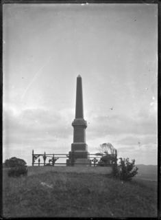
Tāmati Wāka Nene was a Māori rangatira (chief) of the Ngāpuhi iwi (tribe) who fought as an ally of the British in the Flagstaff War of 1845–46.

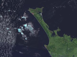
The Northland Region is the northernmost of New Zealand's 16 local government regions. New Zealanders sometimes call it the Winterless North because of its mild climate. The main population centre is the city of Whangārei, and the largest town is Kerikeri.

Hōne Wiremu Heke Pōkai, born Heke Pōkai and later often referred to as Hōne Heke, was a highly influential Māori rangatira (chief) of the Ngāpuhi iwi (tribe) and a war leader in northern New Zealand; he was affiliated with the Ngati Rahiri, Ngai Tawake, Ngati Tautahi, Te Matarahurahu and Te Uri-o-Hau hapu (subtribes) of Ngāpuhi. Hōne Heke fought with Hongi Hika, an earlier war leader of the Ngāpuhi, in the Musket Wars. Hōne Heke is considered the principal instigator of the Flagstaff War in 1845–46.
Kaikohe is a town in the Far North District of New Zealand, situated on State Highway 12 about 260 km from Auckland. It is the largest inland town and highest community above sea level in the Northland Region. With a population of over 4000 people it is a shopping and service centre for an extensive farming district and is sometimes referred to as "the hub of the north".

The Far North District is the northernmost territorial authority district of New Zealand, consisting of the northern part of the Northland Peninsula in the North Island. It stretches from North Cape and Cape Reinga / Te Rerenga Wairua in the north, down to the Bay of Islands, the Hokianga and the town of Kaikohe.
The Aupouri Peninsula is a tombolo at the northern tip of the North Island of New Zealand. It projects between the Tasman Sea to the west and the Pacific Ocean to the east. It constitutes the northern part of the Far North District, incorporating North Cape, Houhora and the northern half of Awanui.

Lake Tūtira is a body of water in north-eastern Hawke's Bay in New Zealand.

The Awanui River is a river in the far north of New Zealand, close to the point at which the Aupouri Peninsula joins the rest of the Northland Peninsula. The Awanui flows first west and then north, for a total of 30 kilometres (19 mi), before flowing into Rangaunu Harbour. The town of Kaitaia is along its banks.

The Marokopa River is a river of the Waikato Region of New Zealand. It flows west for approximately 26 kilometres (16 mi) to join the Tasman Sea at Marokopa. The main part of the river is 40.5 km (25.2 mi) long, with about 533 km (331 mi) of tributaries. The catchment is some 364 km2 (141 sq mi).

The Tangahoe River is a river of the Taranaki Region of New Zealand's North Island. It flows generally southwest from its origins in hill country to the east of Lake Rotorangi, reaching the Tasman Sea in the South Taranaki Bight 5 km (3.1 mi) southeast of Hawera.

Lake Morehurehu is a dune lake in the Northland Region of New Zealand. It is located to the Northeast of Te Kao on the Aupouri Peninsula.
Lake Ngatu is a dune lake in the Northland Region of New Zealand. It is located to the northwest of Awanui, near Waipapakauri.

Lake Rotoroa is a dune lake in the Northland Region of New Zealand. It is located to the west of Awanui.
Lake Waiparera is a dune lake in the Northland Region of New Zealand.It is located immediately North-West of Waiharara on the Aupouri Peninsula. The lake is the largest of the Aupouri Lakes. The catchment is predominately pasture, with the remainder scrub or wetland. The lake has several inflows (drains), with no obvious outflows. The lake is easily accessed from SH1.
Lake Waiporohita is a dune lake in the Northland Region of New Zealand. It is located near Tokerau Beach on the Karikari Peninsula.
Aperahama Taonui was a New Zealand tribal leader, prophet, historian, teacher and assessor. He was a leader of the Te Popoto hapū of the Ngāpuhi iwi. He was born in Whangaroa, Northland, probably in the 1810s. His father was Makoare Te Taonui.
The Mangatangi River, or Mangatangi Stream, originates on the eastern slopes of the Hunua Ranges in New Zealand and flows roughly southwards until it is joined by the Ruaotehuia Stream just north of State Highway 2 between Mangatawhiri and Maramarua, where it becomes the Maramarua River. Mangatangi can be translated as manga tangi to stream of weeping, or as rippling stream, or babbling brook.
Lake Opuatia is a small lake in the much larger Opuatia wetland, which drains from the west into the Waikato River. It lies near the foot of a long valley drained by the Opuatia Stream.
Lake Heather is a dune lake in the Far North District of New Zealand. It is located west of the town of Awanui, and between the larger Lake Ngatu and Lake Rotoroa.
