
Huntly is a town in the Waikato district and region of the North Island of New Zealand. It was on State Highway 1, 95 kilometres (59 mi) south of Auckland and 32 kilometres (20 mi) north of Hamilton. It is situated on the North Island Main Trunk (NIMT) railway and straddles the Waikato River. Huntly is within the Waikato District which is in the northern part of the Waikato region local government area.

The Buller River is a river in the South Island of New Zealand. The Buller has the highest flow of any river in the country during floods, though it is only the 13th longest river; it runs for 177 km (110 mi) from Lake Rotoiti through the Buller Gorge and into the Tasman Sea near the town of Westport. A saddle at 710 m (2,330 ft) separates the Buller from the Motupiko River and that is divided from the Wairau River by a 695 m (2,280 ft) saddle, both aligned along the Alpine Fault, as is the top of the Buller valley.
Hakarimata Range is a range of hills on the western edge of Ngāruawāhia township, in the Waikato region of New Zealand, overlooking the confluence of the Waikato and Waipā Rivers. The Hakarimata Range is separated from the Taupiri Range by the Taupiri Gorge, through which the Waikato River flows.

Waikato District is a territorial authority of New Zealand, in the northern part of Waikato region, North Island. Waikato District is administered by the Waikato District Council, with headquarters in Ngāruawāhia.
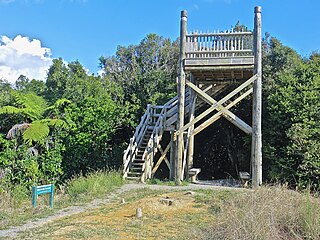
Rotowaro was once a small coal mining township approximately 10 km west of Huntly in the Waikato region of New Zealand. The town was built especially for miners houses, but was entirely removed in the 1980s to make way for a large opencast mine.

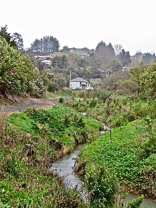
Flagstaff is a suburb in north-east Hamilton, New Zealand. It was originally called Dulverton on council plans, but it was officially named Flagstaff in 1986 when it was declared as a suburb. The area was heavily developed in the 1990s.

Rototuna is a suburb in northern Hamilton, New Zealand, east of Flagstaff. It is one of the newest and fastest-growing suburbs in Hamilton, along with neighbouring Huntington and Flagstaff.

F60 is the series designation of five overburden conveyor bridges used in brown coal (lignite) opencast mining in the Lusatian coalfields in Germany. They were built by the former Volkseigener Betrieb TAKRAF in Lauchhammer and are the largest movable technical industrial machines in the world. As overburden conveyor bridges, they transport the overburden which lies over the coal seam. The cutting height is 60 m (200 ft), hence the name F60. In total, the F60 is up to 80 m (260 ft) high and 240 m (790 ft) wide; with a length of 502 m (1,647 ft), it is described as the lying Eiffel Tower, making these behemoths not only the longest vehicle ever made—beating Prelude FLNG, the longest ship—but the largest vehicle by physical dimensions ever made by humankind. In operating condition, it weighs 13,600 metric tons making the F60 also one of the heaviest land vehicles ever made, beaten only by Bagger 293, which is a giant bucket-wheel excavator. Nevertheless, despite its immense size, it is operated by only a crew of 14.
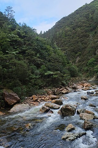
The Waitawheta River is a river of the Waikato Region of New Zealand's North Island. It flows from a point south-east of Mount Te Aroha in the Kaimai Range to the Karangahake Gorge at the foot of the Coromandel Peninsula to reach the Ohinemuri River at Karangahake, five kilometres east of Paeroa.

Magellan Rise is a new suburb in north-eastern Hamilton in New Zealand. In the 2018 census it is at the boundaries of Flagstaff North, East and South areas and is described by others as Flagstaff.

The Glen Afton Branch was a branch railway line of 7.9 km in the Waikato in New Zealand, built to serve coal mines in the Awaroa district west of Huntly at Rotowaro, Pukemiro and Glen Afton. Rotowaro is Māori for "coal lake".

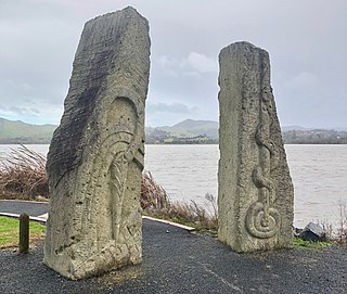
Raahui Pookeka-Huntly Railway Station is on the North Island Main Trunk line and the Awaroa Branch in the town of Huntly in the Waikato District of New Zealand, 65 mi (105 km) south of Auckland. It is 7.31 km (4.54 mi) north of Taupiri and 2.78 km (1.73 mi) south of Kimihia. The station was named Raahui Pookeka-Huntly for its reopening for the new Te Huia train on 6 April 2021.
Glen Massey is a former mining village, 9.5 km (5.9 mi) west of Ngāruawāhia, which was, until 1958, terminus of the Glen Massey Line. It then went into decline, but is now becoming a home for Hamilton commuters.
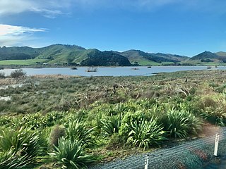
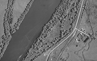
Lake Kimihia is located approximately 5 km to the Northeast of Huntly, in the Waikato Region of New Zealand. Lake Kimihia is a riverine lake, which links to the Waikato River.
Lake Hakanoa is located within the eastern side of the Huntly township, in the Waikato Region of New Zealand. Lake Hakanoa is a riverine lake with links to the Waikato River, which lies 300 m (330 yd) to the west. A smaller lake lies within wetland near the southeastern edge of Hakanoa.
Kimihia Railway Station was on the North Island Main Trunk line, north of Huntly in the Waikato District of New Zealand. The station was in 1886 measured as 19 mi 33 ch (31.2 km) south of Mercer, which is where an unnamed block is shown on the 1929 map, near the junction of Fisher Road with SH1, about 1.4 km (0.87 mi) north of the junction with the Kimihia branch. That junction was 101.06 km (62.80 mi) south of Auckland and 576.54 km (358.25 mi) from Wellington.

Mangapehi was a flag station on the North Island Main Trunk line, in the Waitomo District of New Zealand. It was 5.89 km (3.66 mi) north of Poro-O-Tarao and 5.15 km (3.20 mi) south of Kopaki.

Motumaoho is a small village in the Waikato region of New Zealand's North Island, just to the west of the Pakaroa Range. It is on SH26, 25 km (16 mi) east of Hamilton and 7 km (4.3 mi) west of Morrinsville. The village is bordered by the Waitakaruru Stream to the east. Motumaoho can be translated as an intruding clump of trees.
Bokaro and Kargali Area is one of the operational areas of the Central Coalfields Limited located mainly in the Bokaro district and partly in the Giridih district, both in the state of Jharkhand, India.

The Rheinisches Braunkohlerevier, often called the Rhenish mining area, is a lignite mining area or district in the Cologne Bay, on the northwestern edge of the Rhenish Slate Mountains. The mining of lignite using the open pit method has had a significant impact on the landscape here and led to the formation of several important industrial sites. The area includes the Zülpicher and Jülicher Börde, the Erft lowlands and the Ville, making it the largest lignite mining area in Europe. To a lesser extent clay, silica sand and loess are mined here. The area is the only active lignite mining area in what was West Germany during German partition and contains the mines with the largest surface area, greatest depth, and biggest annual output of coal.


