
Hamilton is an inland city in the North Island of New Zealand. Located on the banks of the Waikato River, it is the seat and most populous city of the Waikato region. With a territorial population of 179,900, it is the country's fourth most-populous city. Encompassing a land area of about 110 km2 (42 sq mi), Hamilton is part of the wider Hamilton Urban Area, which also encompasses the nearby towns of Ngāruawāhia, Te Awamutu and Cambridge. In 2020, Hamilton was awarded the title of most beautiful large city in New Zealand.

Waikato is a local government region of the upper North Island of New Zealand. It covers the Waikato District, Waipa District, Matamata-Piako District, South Waikato District and Hamilton City, as well as Hauraki, Coromandel Peninsula, the northern King Country, much of the Taupō District, and parts of Rotorua District. It is governed by the Waikato Regional Council.

The Waikato River is the longest river in New Zealand, running for 425 kilometres (264 mi) through the North Island. It rises on the eastern slopes of Mount Ruapehu, joining the Tongariro River system and flowing through Lake Taupō, New Zealand's largest lake. It then drains Taupō at the lake's northeastern edge, creates the Huka Falls, and flows northwest through the Waikato Plains. It empties into the Tasman Sea south of Auckland, at Port Waikato. It gives its name to the Waikato region that surrounds the Waikato Plains. The present course of the river was largely formed about 17,000 years ago. Contributing factors were climate warming, forest being reestablished in the river headwaters and the deepening, rather than widening, of the existing river channel. The channel was gradually eroded as far up river as Piarere, leaving the old Hinuera channel through the Hinuera Gap high and dry. The remains of the old course are seen clearly at Hinuera, where the cliffs mark the ancient river edges. The Waikato's main tributary is the Waipā River, which converges with it at Ngāruawāhia.

Huntly is a town in the Waikato district and region of the North Island of New Zealand. It was on State Highway 1, 95 kilometres (59 mi) south of Auckland and 32 kilometres (20 mi) north of Hamilton. It is situated on the North Island Main Trunk (NIMT) railway and straddles the Waikato River. Huntly is within the Waikato District which is in the northern part of the Waikato region local government area.

Lake Waikare is the largest of several shallow lakes in the upper floodplain of the Waikato River in New Zealand's North Island. It is a riverine lake, located to the east of Te Kauwhata and 40 kilometres north of Hamilton. It covers 34 km2 (13 sq mi).

Ātiamuri is a former hydro village in the central North Island of New Zealand. It lies alongside State Highway 1 about 27 km south of Tokoroa and 38 km north of Taupō. It is bordered by the Waikato River and surrounded by pine plantations. Upper Ātiamuri, just north of the Waikato River, is a small community of lifestyle blocks, dairy farms and farm servicing businesses.

Forest Lake is a suburb of Hamilton in New Zealand and was added to from around the 1930s. It is centred around Forest Lake Road, which is used by around 10,000 vehicles a day.

Rotorua Lakes District or Rotorua District is a territorial authority district in the North Island of New Zealand. It has one urban area of significant size, the city of Rotorua. The district is governed by Rotorua Lakes Council, which is headquartered in Rotorua and is headed by a mayor. The district falls within two regional council areas, with the majority of the area and Rotorua city in the Bay of Plenty Region and the rest in the Waikato region. Tania Tapsell has been the mayor of Rotorua since the 2022 local elections.

Rototuna is a suburb in northern Hamilton, New Zealand, east of Flagstaff. It is one of the newest and fastest-growing suburbs in Hamilton, along with neighbouring Huntington and Flagstaff.

Lake Rotoroa or Hamilton Lake is a lake in Hamilton, Waikato, North Island, New Zealand. It has a surface area of about 54 hectares and an average depth of 2.4 metres . It is the home of the Hamilton Yacht Club, which holds regular sailing in the summer.

The Whangamarino Wetland in the Waikato District is the second largest wetland complex of the North Island of New Zealand. Encompassing a total area of more than 7200 hectares, the Department of Conservation Te Papa Atawhai manages 5,923 hectares of peat bog, swamp, mesotrophic lags, open water and river systems listed as a wetland of international importance under the Ramsar Convention. Fish and Game New Zealand are the second largest landowner, managing 748 hectares of the wetland primarily as gamebird hunting habitat.
Lake Harihari is a dune-dammed lake 10 km south of Kawhia in the Waikato region of New Zealand. Its water quality is the best amongst the Waikato dune lakes. It is ranked eighth in importance in the region. Its quality has been attributed to its remoteness.
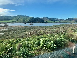
Lake Whangape is shallow, supertrophic, lateral and the second largest lake in the lower Waikato River basin in New Zealand. One source said the name translated to 'a large sheet of water', another that it was a chief's name.
Lake Kimihia is located approximately 5 km to the Northeast of Huntly, in the Waikato Region of New Zealand. Lake Kimihia is a riverine lake, which links to the Waikato River.
Lake Rotokauri is located approximately 7 km to the northwest of Hamilton, New Zealand. It is a peat lake, and is one of the Waipa Peat lakes.
Lake Rotongaro is located to the west of Ohinewai in the Waikato Region of New Zealand. It is a large shallow riverine lake, which links to the Waikato River. It is situated between the Waikato River and the larger Lake Whangape.
Lake Hakanoa is located within the eastern side of the Huntly township, in the Waikato Region of New Zealand. Lake Hakanoa is a riverine lake with links to the Waikato River, which lies 300 m (330 yd) to the west. A smaller lake lies within wetland near the southeastern edge of Hakanoa.

Lake Puketirini is a former opencast coal mine, immediately to the west of Huntly and east of the larger, but much shallower Lake Waahi, in the Waikato Region. It is circled by a walkway.

The Awaroa River is a river in the Ōtorohanga District, on the west coast of New Zealand's North Island. It flows north from its source near Te Koraha, through Hauturu to Kawhia Harbour. The river passes through both pasture and indigenous forest. Over half of the river is in forest.

