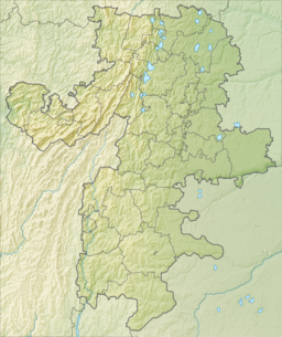
Lake Ladoga is a freshwater lake located in the Republic of Karelia and Leningrad Oblast in northwestern Russia, in the vicinity of Saint Petersburg.

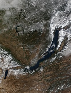
Lake Baikal is a rift lake located in Russia. It is situated in southern Siberia, between the federal subjects of Irkutsk Oblast to the northwest and the Buryatia to the southeast. Lake Baikal is the world's largest freshwater lake by volume, containing 22 to 23% of the world's fresh surface water. It contains 23,615.39 km3 (5,670 cu mi) of fresh water, which is more water than all of the North American Great Lakes combined. Lake Baikal has a maximum depth of 1,642 m (5,387 ft), and is the world's deepest lake. It is among the world's clearest lakes and is the world's oldest lake, at 25–30 million years. Lake Baikal is also the world's seventh-largest lake by surface area.

The Gulf of St. Lawrence is the outlet of the North American Great Lakes via the St. Lawrence River into the Atlantic Ocean. The gulf is a semi-enclosed sea, covering an area of about 226,000 square kilometres (87,000 sq mi) and containing about 34,500 cubic kilometres (8,300 cu mi) of water, which results in an average depth of 152 metres (499 ft).

Dubingiai is a town in Molėtai district in Lithuania. It is situated near Lake Asveja, the longest lake in the country. The town has 208 inhabitants as of 2017.

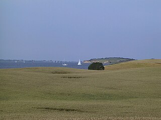
Bjørnø is a Danish island south of Funen. The island covers an area of 1.5 km² and has 40 inhabitants. The island can be reached by ferry from Faaborg.

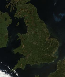
England comprises most of the central and southern two-thirds of the island of Great Britain, in addition to a number of small islands of which the largest is the Isle of Wight. England is bordered to the north by Scotland and to the west by Wales. It is closer to continental Europe than any other part of mainland Britain, divided from France only by a 33 km (21 mi) sea gap, the English Channel. The 50 km (31 mi) Channel Tunnel, near Folkestone, directly links England to mainland Europe. The English/French border is halfway along the tunnel.

The Water of Ken is a river in the historical county of Kirkcudbrightshire in Galloway, south-west Scotland.
It rises on Blacklorg Hill, north-east of Cairnsmore of Carsphairn in the Carsphairn hills, and flows south-westward into The Glenkens, passing through Kendoon, Carsfad and Earlstoun lochs, all of which are dammed to supply the Galloway Hydro Electric Scheme. At Kendoon Dam the Ken is joined by a major tributary the Water of Deugh. From there, the river flows south, passing St. John's Town of Dalry and New Galloway, before widening to form the 9-mile long Loch Ken.
The Black Water of Dee also enters halfway down the loch, and from Glenlochar, at the south end of the loch, the river continues as the Dee towards Kirkcudbright and the coast.
There are a number of interesting bridges over the Water of Ken. Smeaton's Bridge carries the B729 road which runs between Carsphairn and Moniaive. It crosses the Ken a half mile above the confluence of the Stroanfreggan burn. This bridge has a single arch 42 ft long.
A few miles further downstream the High Bridge of Ken spans the river at a narrow ravine on the B7000 back road from Carsphairn to St John's Town of Dalry. The bridge has 2 arches each 24 ft long. British listed buildings website describes the bridge as early 18th century, possibly earlier origin.
Further downstream again the Ken Bridge lies between St John's Town of Dalry and New Galloway.This bridge carries the A712 road and dates from 1822. It has 5 granite arches and is 340 ft long. Immediately adjacent to the bridge is the Ken Bridge Hotel.
The Ringgold Isles are an archipelago in Fiji, forming an outlier group to Vanua Levu. The Budd, Nukusemanu, and Heemskercq Reefs form part of the group. The group is mostly uninhabited, but Qelelevu has a small village. In 2008 Pacific Rats were eradicated from seven islands of the group in an endeavour facilitated by BirdLife International's Fiji Programme.
Troitsk is the name of several inhabited localities in Russia.

Adilcevaz is a town and district capital of the same-named district within Bitlis Province of Turkey. The city is on the shore of Lake Van. The mayor is Necati Gürsoy from the AKP.
Arrow Lakes Provincial Park is a provincial park in British Columbia, Canada.
One Island Lake Provincial Park is a provincial park in British Columbia, Canada.
Red Sucker Lake is an Oji-Cree First Nation in Manitoba, Canada. The First Nation is located about 706 km (439 mi) northeast of Winnipeg. As of December 2014 the registered population was 1,067 of which 930 lived on their own reserve.

The borders of the oceans are the limits of Earth's oceanic waters. The definition and number of oceans can vary depending on the adopted criteria. The principal divisions of the five oceans are the: Pacific Ocean, Atlantic Ocean, Indian Ocean, Southern (Antarctic) Ocean, and Arctic Ocean. Smaller regions of the oceans are called seas, gulfs, bays, straits, and other terms. Geologically, an ocean is an area of oceanic crust covered by water.
Pervomayka is the name of several rural localities in Russia.

Prokofyeva is a small island in the Sea of Okhotsk. It is one of the Shantar Islands. It lies to the northeast of Bolshoy Shantar Island.

Lake Ubinskoye is a freshwater lake located in the Baraba steppe in Novosibirsk Oblast, Russia, where it is divided between Ubinsky District in the west and Kargatsky District in the east. The name of the lake derives from Siberian Tatar ubu, meaning swamp or marsh.


