Candarave Province is the smallest of four provinces in the Tacna Region in southern Peru. Its capital is Candarave.

Tarata is one of four provinces in the Tacna Region in southern Peru. Its capital is Tarata city.

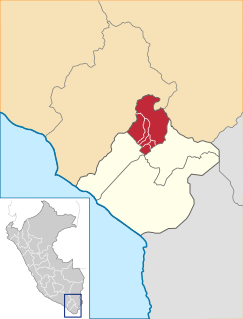
The General Sánchez Cerro Province is the smallest of three provinces in the Moquegua Region of Peru. The capital of the province is Omate. The province was named after the former Peruvian army officer and president Luis Miguel Sánchez Cerro.

Lake Aricota is a lake in Candarave Province, region of Tacna, Peru. It has an elevation of 2,800 metres (9,186 ft) above sea level.
Wila Quta or Wilaquta may refer to:

Vilacota is a 5,179-metre-high (16,991 ft) mountain in the Apolobamba mountain range in the Andes of Peru. It is located in the Puno Region, Sandia Province, in the districts Cuyocuyo and Quiaca. Vilacota is situated northwest of the mountain Ananea and northeast of Jorhuari.

Lake Paracota is a lake in Peru located in the Tacna Region, Tarata Province, Susapaya District. It is situated at a height of about 4,522 metres (14,836 ft). Paracota lies south of the larger Lake Vilacota.
Choreveco is a mountain in the Andes of southern Peru, about 5,000 metres (16,404 ft) high. It is located in the Tacna Region, Candarave Province, Candarave District, and in the Tarata Province, Susapaya District. Choreveco lies northeast of the volcano Yucamane. It is situated between the mountain Chiarjaque in the west and the lake Vilacota in the east.
Warawarani is a mountain in the Andes of southern Peru, about 5,200 metres (17,060 ft) high. It lies in the Tacna Region, Tacna Province, Palca District, and in the Tarata Province, Tarata District. The mountain is situated south of Juqhuri and northeast of Wayna Pawqarani (Huaynapaucarani). West of Warawarani there are two lower mountains named Laram Qullu and Wila Qullu
Wila Wilani or Ch'ankha Qullu is a mountain in the Andes of southern Peru, about 4,900 metres (16,076 ft) high. It is located in the Moquegua Region, Mariscal Nieto Province, Carumas District, and in the Tacna Region, Candarave Province, Candarave District. It lies west of a lake named Aqhuya Ch'alla, northwest of Paxsi Awki and east of Churi Laq'a, Ch'alluma and Ch'ankhani.

Pacollo is a mountain in the north of the Barroso mountain range in the Andes of Peru, about 5,000 metres (16,404 ft) high. It is situated in the Tacna Region, Tarata Province, Tarata District. Pacollo lies northwest of Casiri Lake and northeast of the mountain Chontacollo.
Chucñuma is a mountain in the northern extensions of the Barroso mountain range in the Andes of Peru, about 5,000 metres (16,404 ft) high. It is situated in the Tacna Region, Tarata Province, Tarata District. Chucñuma lies northwest of Casiri Lake and north of the mountains Chontacollo and Pacollo.
Wariri is a mountain in the Andes of southern Peru, about 4,800 metres (15,748 ft) high. It is located in the Tacna Region, Tarata Province, Susapaya District. Wariri lies between the lake Wilaquta in the north and Ñiq'i Quta in the south.

Ivonne Chillihua is a mountain in the Andes of southern Peru, about 4,800 metres (15,748 ft) high. It is located in the Tacna Region, Tarata Province, Susapaya District. Chillihua lies southwest of the lakes Vilacota and Lake Neque.
Wila Quta is a mountain in the Wansu mountain range in the Andes of Peru, about 5,100 metres (16,732 ft) high. It is situated in the Apurímac Region, Antabamba Province, Antabamba District, and in the Arequipa Region, La Unión Province, Huaynacotas District. Wila Quta lies west of Taruja Marka and Allqa Walusa and southeast of Wallqa Wallqa.
Wila Qullu is a 5,020-metre-high (16,470 ft) mountain in the Andes of southern Peru. It is located in the Moquegua Region, General Sánchez Cerro Province, Ichuña District, and the Puno Region, Puno Province, Pichacani District. Wila Qullu lies at the Larama Quta valley, northeast of Larama Quta and Janq'u Saxa and southeast of Wallqani. The river originates northwest of the mountain. It is a tributary of Jukumarini Lake.
Vilavilque is a mountain in the Andes of southern Peru, about 5,000 metres (16,404 ft) high. It is located in the Tacna Region, Tacna Province, Palca District, at the Chilean border. Vilavilque lies southeast of Queñuta.
Wila Uqharani is a mountain in the north of the Barroso mountain range in the Andes of southern Peru, about 5,000 m (16,000 ft) high. It is situated in the Tacna Region, Tarata Province, Tarata District. It lies southeast of Inka Apachita.
Wila Qullu is a mountain east of the Barroso mountain range in the Andes of Peru which reaches a height of approximately 5,000 metres (16,404 ft). It is located in the Tacna Region, Tarata Province, Tarata District. Wila Qullu lies west of Warawarani and northwest of Wiqu.

