Lake Wabaunsee

Last updated
Lake Wabaunsee
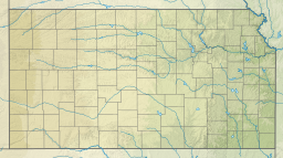
USA Kansas relief location map.svg
Red pog.svg
Lake Wabaunsee
Usa edcp relief location map.png
Red pog.svg
Lake Wabaunsee
Location Wabaunsee County, Kansas
Coordinates 38°51′47″N96°11′35″W / 38.863°N 96.193°W / 38.863; -96.193
Type man-made lake
Basin  countries United States
Surface elevation1,286 ft (392 m) [1]

Lake Wabaunsee is a man-made lake in Wabaunsee County, Kansas. [1]

Development of the site began in 1933, when the Kansas Emergency Relief Corporation established a work camp at the site. Digging of the lake was taken over by the Federal Works Progress Administration (WPA) in 1936. Construction was completed in 1937, and the lake was purchased by the city of Eskridge. [2]
Related Research Articles

<span class="mw-page-title-main">Wabaunsee County, Kansas</span> County in Kansas, United States

Wabaunsee County is a county located in the U.S. state of Kansas. Its county seat is Alma. As of the 2020 census, the county population was 6,877. The county was named for Chief Waubonsie of the Potawatomi Indians.

<span class="mw-page-title-main">Shawnee County, Kansas</span> County in Kansas, United States

Shawnee County is located in northeast Kansas, in the central United States. Its county seat and most populous city is Topeka, the state capital. As of the 2020 census, the population was 178,909, making it the third-most populous county in Kansas. The county was one of the original 33 counties created by the first territorial legislature in 1855, and it was named for the Shawnee tribe.

<span class="mw-page-title-main">Alma, Kansas</span> City in Wabaunsee County, Kansas

Alma is a city in and the county seat of Wabaunsee County, Kansas, United States. As of the 2020 census, the population of the city was 802.

<span class="mw-page-title-main">Maple Hill, Kansas</span> City in Wabaunsee County, Kansas

Maple Hill is a city in Wabaunsee County, Kansas, United States. As of the 2020 census, the population of the city was 631.

<span class="mw-page-title-main">K-99 (Kansas highway)</span> State highway in Kansas, United States

K-99 is a state highway in the U.S. state of Kansas. The highway runs 234.473 miles (377.348 km) from Oklahoma State Highway 99 (SH-99) at the Oklahoma state line near Chautauqua north to Nebraska Highway 99 (N-99) at the Nebraska state line in Summerfield. K-99 connects Emporia with several smaller county seats to the south and north, including Sedan, Howard, Eureka, Alma, and Westmoreland while passing through the Flint Hills of eastern Kansas.

<span class="mw-page-title-main">Waubonsie</span>

Waubonsie was a leader of the Potawatomi Native American people. His name has been spelled in a variety of ways, including Wabaunsee, Wah-bahn-se, Waubonsee, Waabaanizii in the contemporary Ojibwe language, and Wabanzi in the contemporary Potawatomi language.

<span class="mw-page-title-main">Wakarusa Township, Douglas County, Kansas</span> Township in Kansas, United States

Wakarusa Township is a township in Douglas County, Kansas, USA. As of the 2010 census, its population was 2,318. It was named for the Wakarusa River which flows through Douglas County from Wabaunsee County to the Kansas River near Eudora.

<span class="mw-page-title-main">Wabaunsee, Kansas</span> Unincorporated community in Wabaunsee County, Kansas

Wabaunsee is an unincorporated community in Wabaunsee County, Kansas, United States. As of the 2020 census, the population of the community and nearby areas was 104. It was named for former Pottawatomi chief Wabaunsee.

<span class="mw-page-title-main">Topeka metropolitan area, Kansas</span> Metropolitan area in the United States

The Topeka Metropolitan Statistical Area, as defined by the United States Census Bureau, is an area consisting of five counties in northeastern Kansas, anchored by the city of Topeka. In total, it has an area of 3,290.15 square miles. As of the 2010 census, the MSA had a population of 233,870.

<span class="mw-page-title-main">Stephen H. Anderson</span> American judge

Stephen Hale Anderson is an inactive Senior United States circuit judge of the United States Court of Appeals for the Tenth Circuit.

<span class="mw-page-title-main">National Register of Historic Places listings in Wabaunsee County, Kansas</span>

This is a list of the National Register of Historic Places listings in Wabaunsee County, Kansas.

Waubonsie was a Potawatomi leader.

<span class="mw-page-title-main">1992 United States presidential election in Kansas</span>

The 1992 United States presidential election in Kansas took place on November 3, 1992, as part of the 1992 United States presidential election. Voters chose six representatives, or electors to the Electoral College, who voted for president and vice president.

Keene is an unincorporated community in Wabaunsee County, Kansas, United States.

Volland is an unincorporated community in Wabaunsee County, Kansas, United States.

<span class="mw-page-title-main">Wilmington, Kansas</span> Unincorporated community in Wabaunsee County, Kansas

Wilmington is an unincorporated community in Wabaunsee County, Kansas, United States. It is located approximately 4 miles south of Harveyville, Kansas.

Wabaunsee USD 329 is a public unified school district headquartered in Alma, Kansas, United States. The district includes the communities of Alma, Maple Hill, McFarland, Newbury, Paxico, Volland, and nearby rural areas.

<span class="mw-page-title-main">Vera, Kansas</span> Ghost town in Wabaunsee County, Kansas

Vera is a ghost town in Wabaunsee County, Kansas, United States. It was located approximately 3.6 miles east of Paxico near Mill Creek, a tributary to the Kansas River.

<span class="mw-page-title-main">1932 United States presidential election in Kansas</span> Election in Kansas

The 1932 United States presidential election in Kansas was held on November 8, 1932 as part of the 1932 United States presidential election held throughout all forty-eight contemporary states. State voters chose nine electors, or representatives to the Electoral College, who voted for President and Vice-President.

References

  1. 1 2 "Lake Wabaunsee". Geographic Names Information System . United States Geological Survey, United States Department of the Interior. October 13, 1978. Retrieved November 4, 2017.
  2. "Lake Wabaunsee". Lake Wabaunsee. Retrieved 2017-09-12.