Lakin Township | |
|---|---|
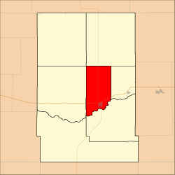 Location in Kearny County | |
| Coordinates: 38°00′09″N101°16′04″W / 38.00250°N 101.26778°W | |
| Country | United States |
| State | Kansas |
| County | Kearny |
| Area | |
• Total | 63.26 sq mi (163.85 km2) |
| • Land | 63.24 sq mi (163.79 km2) |
| • Water | 0.02 sq mi (0.06 km2) 0.04% |
| Elevation | 3,186 ft (971 m) |
| Population (2000) | |
• Total | 2,587 |
| • Density | 40.9/sq mi (15.8/km2) |
| GNIS feature ID | 0485281 |
Lakin Township is a township in Kearny County, Kansas, United States. As of the 2000 census, its population was 2,587. [1]
