
Motera is a neighbourhood in the northwestern part of the metropolis of Ahmedabad in Gujarat, India. It lies west of the Sabarmati River. It falls under the West Zone of Ahmedabad Municipal Corporation and under the Gandhinagar South constituency of Gujarat Legislative Assembly and under the Gandhinagar constituency of the Lok Sabha. The chief attraction in Motera is the world's largest sports stadium, Narendra Modi Stadium. The stadium is the venue for the international cricket matches held in Ahmedabad. In 2015, old stadium was demolished and new stadium was built which got the honour of world's largest stadium.
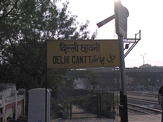
Delhi Cantonment is a Class I Cantonment Board established in 1914. The area of the Cantonment is 10,452 acres (42.30 km2) and the population of the Cantonment as per the 2011 census is 110,351.

Gajuwaka is a major residential area of Visakhapatnam City, India. This neighborhood of Visakhapatnam is considered the biggest shopping district in Andhra Pradesh by revenue. Though conceived as a residential locality, it is now one of the principal shopping districts of the city. The Gajuwaka area of Visakhapatnam has the highest per capita income in Andhra Pradesh.
Chandkheda is a well-developed area in northwestern Ahmedabad. It is situated on west of Sabarmati River.
Chandlodia is an area under Ahmedabad Municipal Corporation in Ahmedabad district in the state of Gujarat, India.
Chhatral INA is a town in Gandhinagar district in the state of Gujarat, India.
Dahegam is a city and a municipality in Gandhinagar district in the state of Gujarat, India.
Gadhada is a town and a municipality in Botad District in the state of Gujarat, India. Gadhada is situated at bank of River Ghela. Swaminarayan lived here for more than 25 years.
Ghatlodiya is an area in Ahmedabad in the state of Gujarat, in western India.
Kushtagi is a panchayat town in Koppal district in the Indian state of Karnataka. Kushtagi is a taluk center of Koppal district. This taluk has a population of 353,142 as per the 2021 census estimate. In this taluk, pomegranate fruits are popularly grown.There is a Durga devi temple in heart of the town. To its North lies Ilkal, Gajendragad to the West, Hospet to the South and Sindhanur to the East. Red and black soil can be found in this taluk. A big lake 4kms away from the city is the main source of drinking water is situated in west side and covering the area of more than 300 acres
Panaimarathupatti is a panchayat town in Salem district in the Indian state of Tamil Nadu.
Phulera is a town in Jaipur district in the Indian state of Rajasthan. It is lies nearly by Jaipur city, state capital. The DMIC project runs through Phulera. It is a major railway junction.
Ramol is a city and a municipality in Ahmedabad district in the Indian state of Gujarat.
Ranip is a neighbourhood in Ahmedabad in the Indian state of Gujarat.
Sanvordem is a census town in South Goa district in the Indian state of Goa. It is near Shiroda. Sunday is the major market day and people from the nearby areas flock to buy necessities. A few years back it was considered a more remote place in Goa but today it is fast developing town. It is a one-and-a-half-hour drive from the Goan capital Panaji.
Thaltej is a census town and a suburb in Ahmedabad district in the Indian state of Gujarat. The town comes under Ward No:8, North West Zone of Ahmedabad Municipal Corporation, the civic body that governs the City of Ahmedabad.
Uttarahalli is an area of Bangalore in the Indian state of Karnataka
Vastral is a posh locality and a municipality in Ahmedabad district in the Indian state of Gujarat.
Vejalpur is a Census Town in the New West Zone of the metropolitan city of Ahmedabad in the Indian state of Gujarat.
Jodhpur is a city and a municipality in Ahmedabad district in the Indian state of Gujarat.

