Langsville, Ohio

Last updated
Location of Langsville, Ohio OHMap-doton-Langsville.png
Location of Langsville, Ohio

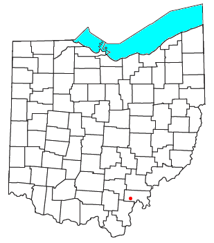
Langsville is an unincorporated community in western Rutland Township, Meigs County, Ohio, United States, [1] along Leading Creek. [2] Although it is unincorporated, it has the ZIP code 45741. [3]

Education

Public education in the community of Langsville is provided by the Meigs Local School District. Campuses serving the community include Meigs Primary School (Grades K-2), Meigs Intermediate School (Grades 3-5), Meigs Middle School (Grades 6-8), and Meigs High School (Grades 9-12).

Related Research Articles

<span class="mw-page-title-main">Darwin, Ohio</span> Unincorporated community in Ohio, U.S.

Darwin is a small unincorporated community in central Bedford Township, Meigs County, Ohio, in the United States. It is located along U.S. Route 33 between Athens and Pomeroy, at its intersection with State Route 681.

<span class="mw-page-title-main">Moxahala, Ohio</span> Unincorporated community in Ohio, U.S.

Moxahala is an unincorporated community in northern Pleasant Township, Perry County, Ohio, United States. It has a post office with the ZIP code 43761. State Route 13 runs through Moxahala, connecting it with New Lexington to the northwest and Rendville to the southeast.

<span class="mw-page-title-main">Reedsville, Ohio</span> Unincorporated community in Ohio, U.S.

Reedsville is an unincorporated community in eastern Olive Township, Meigs County, Ohio, United States. It has a post office with the ZIP code 45772.

<span class="mw-page-title-main">Portland, Ohio</span> Unincorporated community in Ohio, U.S.

Portland is an unincorporated community in eastern Lebanon Township, Meigs County, Ohio, United States. It has a post office with the ZIP code 45770.

<span class="mw-page-title-main">Long Bottom, Ohio</span> Unincorporated community in Ohio, U.S.

Long Bottom is an unincorporated community in southern Olive Township, Meigs County, Ohio, United States. It has a post office with the ZIP code 45743.

<span class="mw-page-title-main">Chester, Ohio</span> Unincorporated community in Ohio, U.S.

Chester is an unincorporated community in central Chester Township, Meigs County, Ohio, United States. It lies along the Shade River at the intersection of State Routes 7 and 248. It has a post office with the ZIP code 45720.

<span class="mw-page-title-main">Kitts Hill, Ohio</span> Unincorporated community in Ohio, U.S.

Kitts Hill is an unincorporated community in western Lawrence Township, Lawrence County, Ohio, United States. It has a post office with the ZIP code 45645. It lies along State Route 141 northeast of the city of Ironton, the county seat of Lawrence County. It has a community center that was previously Deering Local School District in the area. The majority of Pre-K through 12th grade education is provided by the Rock Hill Local School District, although very small portions of the area are served by the Dawson-Bryant Local School District.

<span class="mw-page-title-main">Union Furnace, Ohio</span> Unincorporated community in Ohio, U.S.

Union Furnace is an unincorporated community in northern Starr Township, Hocking County, Ohio, United States. It has a post office with the ZIP code 43158. It is located along State Route 328, which forms the main street in Union Furnace.

<span class="mw-page-title-main">South Bloomingville, Ohio</span> Unincorporated community in Ohio, U.S.

South Bloomingville is an unincorporated community in western Benton Township, Hocking County, Ohio, United States. Although it is unincorporated, it has a zip code of 43152. It is located at the intersection of State Routes 56 and 664, slightly west of Hocking Hills State Park. Early settlers and brief history can be found in the History of Hocking County. A more complete history with photos is found in the genealogy site of Rootsweb. In 1880 Bloomingville had a population of 165. In the histories there are references to Bloomingville and South Bloomville, the location and distinction is still being discovered.

<span class="mw-page-title-main">Patriot, Ohio</span> Unincorporated community in Ohio, U.S.

Patriot is an unincorporated community in southern Perry Township, Gallia County, Ohio, United States. It has a post office with the ZIP code 45658.

<span class="mw-page-title-main">Shade, Ohio</span> Unincorporated community in Ohio, U.S.

Shade is an unincorporated community in southern Lodi Township, Athens County, Ohio, United States. It has a post office with the ZIP code 45776. It lies along U.S. Route 33.

<span class="mw-page-title-main">Carbondale, Ohio</span> Unincorporated community in Ohio, U.S.

Carbondale is an unincorporated community in northwestern Waterloo Township, Athens County, Ohio, United States. It has a post office with the ZIP code 45717. It is located a short distance north of State Route 56.

<span class="mw-page-title-main">Ray, Ohio</span> Unincorporated community in Ohio, U.S.

Ray is an unincorporated community in southeastern Harrison Township, Vinton County, Ohio, United States. It has a post office with the ZIP code 45672. It is located along State Route 327 in western Vinton County.

<span class="mw-page-title-main">Londonderry, Ross County, Ohio</span> Unincorporated community in Ohio, U.S.

Londonderry is an unincorporated community in eastern Liberty Township, Ross County, Ohio, United States. It has a post office with the ZIP code 45647. It lies along U.S. Route 50 at its intersection with State Route 327.

<span class="mw-page-title-main">Hallsville, Ohio</span> Unincorporated community in Ohio, U.S.

Hallsville is an unincorporated community in northeastern Colerain Township, Ross County, Ohio, United States. It has a post office with the ZIP code 45633. It is located along State Route 180.

<span class="mw-page-title-main">White Cottage, Ohio</span> Unincorporated community in Ohio, U.S.

White Cottage is an unincorporated community in central Newton Township, Muskingum County, Ohio, United States. It has a post office with the ZIP code 43791. It lies along U.S. Route 22 between Zanesville and Lancaster.

<span class="mw-page-title-main">Blue Rock, Ohio</span> Unincorporated community in Ohio, U.S.

Blue Rock is an unincorporated community in western Blue Rock Township, Muskingum County, Ohio, United States. It is a part of the Franklin Local School District. Blue Rock State Park is located within Blue Rock, Ohio.

The Meigs Local School District is a public school district based in Pomeroy, Ohio, United States.

<span class="mw-page-title-main">Leading Creek (Ohio)</span> River in Ohio, United States

Leading Creek is a tributary of the Ohio River, 29.5 miles (47.5 km) long, in southeastern Ohio in the United States. Via the Ohio River, it is part of the watershed of the Mississippi River, draining an area of 150 square miles (390 km2) on the unglaciated portion of the Allegheny Plateau. The creek's headwaters are in southern Athens County and it flows for most of its length in western Meigs County; its tributaries also drain a small area of northeastern Gallia County.

Kingsbury is an unincorporated community in Meigs County, in the U.S. state of Ohio.

References

  1. U.S. Geological Survey Geographic Names Information System: Langsville, Ohio
  2. Ohio Atlas & Gazetteer. Yarmouth, Maine: DeLorme. 1991. p. 80. ISBN   0-89933-233-1.
  3. USPS – Cities by ZIP Code

39°02′49″N82°10′54″W / 39.04694°N 82.18167°W / 39.04694; -82.18167