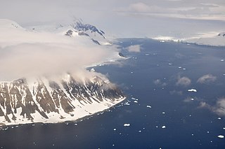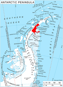
The Prince Charles Mountains are a major group of mountains in Mac. Robertson Land in Antarctica, including the Athos Range, the Porthos Range, and the Aramis Range. The highest peak is Mount Menzies, with a height of 3,228 m (10,591 ft). Other prominent peaks are Mount Izabelle and Mount Stinear. These mountains, together with other scattered peaks, form an arc about 420 km (260 mi) long, extending from the vicinity of Mount Starlight in the north to Goodspeed Nunataks in the south.
Meade Nunatak is a nunatak 3 nautical miles (6 km) north of Blanchard Hill, rising to 990 metres (3,250 ft) in the Pioneers Escarpment, Shackleton Range, Antarctica. It was photographed from the air by the U.S. Navy, 1967, and was surveyed by the British Antarctic Survey, 1968–71. In association with the names of pioneers of polar life and travel grouped in this area, it was named by the UK Antarctic Place-Names Committee in 1971 after English mountaineer Charles Francis Meade, the designer of the Meade tent.
James Nunatak is a conical nunatak, 410 metres (1,350 ft) high, standing 5.5 miles (9 km) south of Lewis Point on the east coast of Palmer Land, Antarctica. This feature was photographed from the air by members of the United States Antarctic Service (USAS) in September 1940 and was probably seen by the USAS ground party that explored this coast. During 1947 it was charted by a joint party consisting of members of the Ronne Antarctic Research Expedition and the Falkland Islands Dependencies Survey (FIDS), and was named by the FIDS for David P. James, a FIDS surveyor at the Hope Bay base in 1945–46.
Simpson Nunatak is a nunatak, 1,165 metres (3,822 ft), rising 2.5 nautical miles northwest of Mount Roberts, on the south margin of Aitkenhead Glacier, Trinity Peninsula, Antarctica. Named by United Kingdom Antarctic Place-Names Committee (UK-APC) for Hugh W. Simpson of Falkland Islands Dependencies Survey (FIDS), a member of the Detroit Plateau reconnaissance party from Hope Bay in 1957.

López Nunatak is a steep-sided granitic nunatak, 275 metres (900 ft) high, forming the northern extremity of the Breznik Heights, Greenwich Island in the South Shetland Islands, Antarctica and overlooking Fuerza Aérea Glacier to the south-southwest, and Ash Point and the Chilean Captain Arturo Prat Base to the northwest.
Baines Nunatak is a nunatak rising to 1,020 metres (3,350 ft) to the east of Bernhardi Heights and 10 nautical miles (19 km) northwest of Jackson Tooth, Pioneers Escarpment, in the Shackleton Range. It was photographed from the air by the U.S. Navy, 1967, surveyed by the British Antarctic Survey, 1968–71, and named in 1977 by the UK Antarctic Place-Names Committee after Thomas Baines (1822–75), an English explorer and joint author, with William Barry Lord, of Shifts and Expedients of Camp Life, Travel and Exploration.
Bon Docteur Nunatak, also known as Good Doctor Nunatak, is a small coastal nunatak, 28 metres (92 ft) high, standing at the west side of the Astrolabe Glacier Tongue, 400 m (1,300 ft) south of Rostand Island in the Geologie Archipelago of Antarctica. It was photographed from the air by U.S. Navy Operation Highjump, 1946–47, charted by the French Antarctic Expedition, 1952–53, and named for Dr Jean Cendron, the "good doctor", medical officer and biologist with the French Antarctic Expedition, 1951–52.

Borchgrevink Nunatak is a nunatak 1.5 nautical miles (3 km) long which rises to 650 metres (2,130 ft), standing at the south side of the entrance to Richthofen Pass, on the east coast of Graham Land. It was discovered in 1902 by the Swedish Antarctic Expedition under Otto Nordenskiöld, who named it for C. E. Borchgrevink, leader of the British Antarctic Expedition, 1898–1900, to Victoria Land.
Brazitis Nunatak is a nunatak, 1,625 metres (5,330 ft) high, along the edge of an ice escarpment 5 nautical miles (9 km) south of DesRoches Nunataks in the southwestern Patuxent Range, Pensacola Mountains. It was mapped by the United States Geological Survey from surveys and from U.S. Navy air photos, 1956–66, and named by the Advisory Committee on Antarctic Names for Peter F. Brazitis, a cosmic ray scientist at South Pole Station, winter 1967.

Dewar Nunatak is a mainly snow-covered nunatak rising to 520 metres (1,700 ft) in the middle of Shambles Glacier, on the east coast of Adelaide Island. It was named by the UK Antarctic Place-Names Committee in 1963 for Graham J.A. Dewar, a British Antarctic Survey geologist at Adelaide station, 1961–63.

Gulliver Nunatak is a nunatak with a flat, ice-free summit, 575 metres (1,890 ft) high, at the north side of Adie Inlet, on the east coast of Graham Land, Antarctica. It was charted by the Falkland Islands Dependencies Survey (FIDS) and photographed from the air by the Ronne Antarctic Research Expedition (RARE) in 1947. It was named by the FIDS for the fictional character in Jonathan Swift's Gulliver's Travels, because when viewed from the southeast its appearance is suggestive of a man lying on his back with his head toward the south.
Downs Nunatak is a nunatak rising to 1,000 metres (3,300 ft) between the Garcie Peaks and Webb Peak, Crescent Scarp, in northwest Palmer Land. The nunatak was photographed from the air by the United States Antarctic Service, 1940, the U.S. Navy, 1966, and was surveyed by the British Antarctic Survey, 1970–73. It was named by the Advisory Committee on Antarctic Names for Bobby G. Downs, a U.S. Navy cook at Palmer Station, winter party 1968.
Florence Nunatak is a conspicuous nunatak, 280 metres (920 ft) high, nearly 2 nautical miles (3.7 km) east of the head of Potter Cove in the southwest part of King George Island, South Shetland Islands. It was named by the UK Antarctic Place-Names Committee in 1960 for the sealing vessel which visited the South Shetland Islands in 1876–77 during the revival of United States southern fur sealing. Some of the crew of the Florence wintered at Potter Cove during 1877; only one survived.
Gaylord Nunatak is a nunatak rising to about 1,500 metres (5,000 ft), 1.5 nautical miles (3 km) north-northeast of Schmutzler Nunatak in the southeast end of the Grossman Nunataks, Ellsworth Land, Antarctica. It was mapped by the United States Geological Survey (USGS) from surveys and U.S. Navy aerial photographs, 1961–68, and from Landsat imagery, 1973–74. It was named by the Advisory Committee on Antarctic Names in 1987 after Chauncey L. Gaylord, a USGS cartographer, 1942–76, Chief of the Compilation Unit in the Branch of Special Maps, working for many years in the preparation of Antarctic maps.
Gemini Nunatak is a nunatak consisting of two almost ice-free peaks, 465 and 490 metres high, which are connected by a narrow rock ridge, standing 4 nautical miles (7 km) south of Borchgrevink Nunatak on Philippi Rise, on the east coast of Graham Land, Antarctica. It was charted by the Falkland Islands Dependencies Survey (FIDS) and photographed from the air by the Ronne Antarctic Research Expedition in 1947. It was named by the FIDS after the constellation Gemini, which contains the twin stars Castor and Pollux.
The Holmes Hills are a group of ridges and nunataks rising to about 1,700 metres (5,600 ft) between Runcorn Glacier and Beaumont Glacier, bounded to the southwest by the Brennecke Nunataks, in south-central Palmer Land, Antarctica. They were mapped by the United States Geological Survey from aerial photographs taken by the U.S. Navy, 1966–69, and surveyed by the British Antarctic Survey, 1972–73. In association with the names of continental drift scientists grouped in this area, the hills were named by the Advisory Committee on Antarctic Names in 1978 after Scottish geologist Arthur Holmes, Professor of Geology at the University of Edinburgh, 1943–56.

Mount Lagado is a mountain rising to about 1,200 metres (4,000 ft) on the south side of Leppard Glacier, west of Target Hill, on Oscar II Coast, Graham Land, Antarctica. In association with names from Jonathan Swift's Gulliver's Travels grouped in this area, it was named by the UK Antarctic Place-Names Committee in 1988 after Lagado, the capital of the flying island of Laputa.
Lee Nunatak is a nunatak, 1,920 metres (6,300 ft) high, 4 nautical miles (7 km) northwest of Penseroso Bluff in the northwest part of the Daniels Range in the Usarp Mountains of Antarctica. It was mapped by the United States Geological Survey from surveys and U.S. Navy air photos, 1960–63, and was named by the Advisory Committee on Antarctic Names for Chun Chi Lee, a United States Antarctic Research Program biologist at McMurdo Station, 1967–68.
The Lilliput Nunataks are three nunataks, from 600 to 700 metres high and trending southeast–northwest, located 3 nautical miles (6 km) north of Gulliver Nunatak on the east side of Graham Land, Antarctica. The nunataks are snow free on their southeast sides. They were charted by the Falkland Islands Dependencies Survey and photographed from the air by the Ronne Antarctic Research Expedition in 1947. The name, from Jonathan Swift's Gulliver's Travels, means land of small people and was applied by the UK Antarctic Place-Names Committee in association with Gulliver Nunatak.


