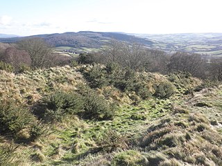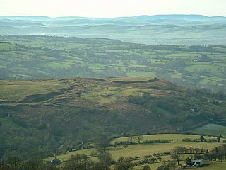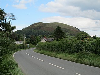
A hillfort is a type of earthworks used as a fortified refuge or defended settlement, located to exploit a rise in elevation for defensive advantage. They are typically European and of the Bronze Age or Iron Age. Some were used in the post-Roman period. The fortification usually follows the contours of a hill and consists of one or more lines of earthworks, with stockades or defensive walls, and external ditches. Hillforts developed in the Late Bronze and Early Iron Age, roughly the start of the first millennium BC, and were used in many Celtic areas of central and western Europe until the Roman conquest.

Maiden Castle is an Iron Age hill fort 1.6 miles (2.6 km) south west of Dorchester, in the English county of Dorset. Hill forts were fortified hill-top settlements constructed across Britain during the Iron Age.

Uffington Castle is an early Iron Age univallate hillfort in Oxfordshire, England. It covers about 32,000 square metres and is surrounded by two earth banks separated by a ditch with an entrance in the western end. A second entrance in the eastern end was apparently blocked up a few centuries after it was built. The original defensive ditch was V-shaped with a small box rampart in front and a larger one behind it. Timber posts stood on the ramparts. Later the ditch was deepened and the extra material dumped on top of the ramparts to increase their size. A parapet wall of sarsen stones lined the top of the innermost rampart. It is very close to the Uffington White Horse on White Horse Hill.
Castle Dore is an Iron Age hill fort (ringfort) near Fowey in Cornwall, United Kingdom located at grid reference SX103548. It was probably occupied from the 5th or 4th centuries BC until the 1st century BC. It consists of two ditches surrounding a circular area 79 metres (259 ft) in diameter. Excavated in the 1930s, it was one of the most intensively investigated Iron Age hillforts in Cornwall.

Huntsham Castle, Devon, England is an Iron Age Hill fort enclosure near the village of Huntsham, it is located 260 m (850 ft) above sea level on the edge of the former Parish of Tiverton. The monument includes a slight univallate hillfort situated on a prominent hill overlooking the valleys of two separate tributaries to the River Lowman. The monument survives as a sub-circular enclosure, defining an area which slopes gently down to the south and measures approximately 150m in diameter. It is clearly demarcated on all sides by a rampart which varies in height from 1m up to 2.4m internally, being generally of greater height on the northern side of the enclosure. Externally this rampart is up to 2.9m high. Surrounding the rampart is an outer ditch which measures up to 5.4m wide and 0.4m deep and this is visible on all sides of the monument, although it is predominantly preserved as a buried feature. On the north eastern side, the outer edge of this ditch is defined by a field boundary bank and the infilled ditch has been used in the past as a track. There is an inturned entrance on the north eastern side which measures 7m wide, and the inturned banks are up to 2.2m wide and 0.4m high. The enclosure is crossed by a parish boundary bank which measures up to 2m wide and 1.5m high, and has been partially cut at the north eastern corner by a quarry, approximately 20m long, 15m wide and up to 2.8m deep, which lies to the north of the entrance. A further quarry lies to the south of the parish boundary bank, on the western side of the enclosure and measures 8.7 metres (29 ft) long, 5.3 metres (17 ft) wide and up to 1 metre (3.3 ft) deep. A third quarry lies to the north west and has partially cut into the ditch and rampart on this side; however much of this quarry lies just beyond the monument itself. A further entrance to the enclosure may lie on the western side, where the rampart is seen to kink slightly inwards. The stock proof fences around the rampart and ditch, the gates and gateposts which facilitate access, the Ordnance Survey triangulation point which is situated on the north eastern side of the enclosure just above the quarry, and the field boundary bank which defines the outer edge of the ditch in the north eastern corner are excluded from the scheduling, although the ground beneath all these features is included.

Bury Castle is an Iron Age hill fort near Selworthy, Somerset, England. It has been scheduled as an ancient monument.

For the children's novel by Sheena Porter, please see Nordy Bank (novel).

Eddisbury hill fort, also known as Castle Ditch, is an Iron Age hill fort near Delamere, Cheshire, in northern England. Hill forts are fortified hill-top settlements constructed across Britain during the Iron Age. Eddisbury is the largest and most complex of the seven hill forts in the county of Cheshire. It was constructed before 200–100 BC and expanded in 1–50 AD. In the 1st century AD, the Romans slighted the site. It was reoccupied in the 6th–8th centuries AD, and an Anglo-Saxon burh was probably established at Eddisbury in 914. In the medieval and post-medieval periods quarrying and farming have damaged the site. Ownership is currently split between the Forestry Commission and a local farm. Eddisbury is protected as a Scheduled Ancient Monument.

Midsummer Hill is situated in the range of Malvern Hills that runs approximately 13 kilometres (8 mi) north-south along the Herefordshire-Worcestershire border. It lies to the south of Herefordshire Beacon with views to Eastnor Castle. It has an elevation of 284 metres (932 ft). To the north is Swinyard Hill. It is the site of an Iron Age hill fort which spans Midsummer Hill and Hollybush Hill. The hillfort is protected as a Scheduled Ancient Monument and is owned by Natural England. It can be accessed via a footpath which leads south from the car park at British Camp on the A449 or a footpath which heads north from the car park in Hollybush on the A438.

Scratchbury Camp is the site of an Iron Age univallate hillfort on Scratchbury Hill, overlooking the Wylye valley about 1km northeast of the village of Norton Bavant in Wiltshire, England. The fort covers an area of 37 acres (15 ha) and occupies the summit of the hill on the edge of Salisbury Plain, with its four-sided shape largely following the natural contours of the hill.

Hillforts in Britain refers to the various hillforts within the island of Great Britain. Although the earliest such constructs fitting this description come from the Neolithic British Isles, with a few also dating to later Bronze Age Britain, British hillforts were primarily constructed during the British Iron Age. Some of these were apparently abandoned in the southern areas that were a part of Roman Britain, although at the same time, those areas of northern Britain that remained free from Roman occupation saw an increase in their construction. Some hillforts were reused in the Early Middle Ages, and in some rarer cases, into the Later Medieval period as well. By the early modern period, these had essentially all been abandoned, with many being excavated by archaeologists in the nineteenth century onward.

Cornish promontory forts, commonly known in Cornwall as cliff castles, are coastal equivalents of the hill forts and Cornish "rounds" found on Cornish hilltops and slopes. Similar coastal forts are found on the north–west European seaboard, in Normandy, Brittany and around the coastlines of the British Isles, especially in Wales, Scotland and Ireland. Many are known in southwest England, particularly in Cornwall and its neighbouring county, Devon. Two have been identified immediately west of Cornwall, in the Isles of Scilly.

Caesar's Camp is an Iron Age hill fort straddling the border of the counties of Surrey and Hampshire in southern England. The fort straddles the borough of Waverley in Surrey and the borough of Rushmoor and the district of Hart, both in Hampshire. Caesar's Camp is a Scheduled Ancient Monument with a list entry identification number of 1007895. It lies approximately 3 kilometres (1.9 mi) north of the town of Farnham, and a similar distance west of Aldershot. The hillfort lies entirely within the Bourley and Long Valley Site of Special Scientific Interest. Caesar's Camp is a multivallate hillfort, a fort with multiple defensive rings, occupying an irregular promontory, with an entrance on the south side. The site has been much disturbed by military activity, especially at the southeast corner. The remains of the hillfort are considered to be of national importance.

Beacon Hill, also known as Harting Beacon, is a hillfort on the South Downs, in the county of West Sussex in southern England. The hillfort is located in the parish of Elsted and Treyford, in Chichester District. It is a Scheduled Ancient Monument with a list entry identification number of 1015915. The hilltop enclosure is dated to the Late Bronze Age, from the 8th to 6th centuries BC. The hillfort defences were renewed during the Late Iron Age.

Warbstow Bury is an Iron Age hillfort about 0.5 miles (0.80 km) west of the village of Warbstow, in Cornwall, England. It is a scheduled monument.

Llwyn Bryn-Dinas is an Iron Age hillfort on the north side of the Tanat valley, about 1 mile (1.6 km) west of the village of Llangedwyn, in Powys, Wales.

Chalbury Hillfort is an Iron Age hillfort about 1 mile (1.6 km) south-east of the village of Bincombe, in Dorset, England. It is a scheduled monument.

Cadson Bury is an Iron Age hillfort about 2 miles (3.2 km) south-west of Callington, in Cornwall, England.

Castle Goff is an enclosure about 1.5 miles (2.4 km) south-west of Camelford, in Cornwall, England. It is a scheduled monument.

Hollingbury Castle, also known as Hollingbury Camp and Hollingbury Hillfort, is an Iron Age hillfort on the northern edge of Brighton, in East Sussex, England. It is adjacent to Hollingbury Park Golf Course.


