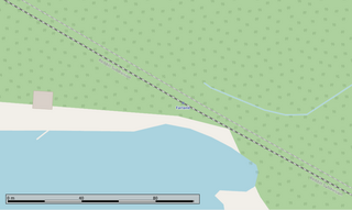
Savant Lake is an unincorporated place and community in Unorganized Thunder Bay District in northwestern Ontario, Canada.

Hudson is an unincorporated place and community in the municipality of Sioux Lookout, Kenora District in northwestern Ontario, Canada. It is located on Lost Lake on the English River in the Nelson River drainage basin.

Amesdale is an unincorporated place and community in Unorganized Kenora District in northwestern Ontario, Canada. It is on the Canadian National Railway (CNR) transcontinental main line, between Niddrie to the west and Richan to the east, and is passed but not served by Via Rail transcontinental Canadian trains. It is also at the junction of a former CNR railway branch line through Ear Falls to Bruce Lake, Ontario that serviced the Griffith iron ore mine.

Rice Lake is an unincorporated place and railway point in geographic Rice Township in Unorganized Kenora District in northwestern Ontario, Canada, 2.5 kilometres (1.6 mi) east of the border with the province of Manitoba.

Richan railway station is located in the community of Richan in Unorganized Kenora District in northwestern Ontario, Canada. The station is on the Canadian National Railway transcontinental main line, between Amesdale to the west and Millidge to the east, has a passing track, and is in use by Via Rail as a stop for transcontinental Canadian trains.

Red Lake Road railway station is located in the community of Red Lake Road in Unorganized Kenora District, northwestern Ontario, Canada. The station is on the Canadian National Railway transcontinental main line, between Quibell to the west and Lash to the east, has a passing track, and is in use by Via Rail as a stop for transcontinental Canadian trains. Highway 105 passes to the east of the stop.

Farlane railway station is located in the community of Farlane in Unorganized Kenora District in northwestern Ontario, Canada. The station is on the Canadian National Railway transcontinental main line and is in use by Via Rail as a stop for transcontinental Canadian trains.

Redditt railway station is located in the community of Redditt in Unorganized Kenora District in northwestern Ontario, Canada. The station is on the Canadian National Railway transcontinental main line and is in use by Via Rail as a stop for transcontinental Canadian trains.

Flindt Landing is an unincorporated place and railway point in Unorganized Thunder Bay District in northwestern Ontario, Canada.

Quibell is an unincorporated place and railway point in Unorganized Kenora District in northwestern Ontario, Canada. It is named after William A. Quibell (1857-1917), a Police Commissioner in Durham County, Ontario. The Quibell Dam on the Wabigoon River lies 1.7 kilometres (1.1 mi) to the east.

Red Lake Road is an unincorporated place and community in Unorganized Kenora District in northwestern Ontario, Canada. It is named for the road, today's Ontario Highway 105, that runs from the community of Vermilion Bay in the south to the town of Red Lake in the north. Red Lake Road is at the junction of Highway 105 with the eastern terminus of Ontario Highway 609, which runs west to the community of Quibell and onward to its northern terminus at Clay Lake.

Morgan is an unincorporated place and railway point in Unorganized Kenora District in northwestern Ontario, Canada. It is on the Canadian National Railway transcontinental main line, between Lash to the west and Niddrie to the east, has a passing track, and is passed but not served by Via Rail transcontinental Canadian trains.

Niddrie is an unincorporated place and railway point in Unorganized Kenora District in northwestern Ontario, Canada. It is on the Canadian National Railway transcontinental main line, between Morgan to the west and Amesdale to the east, has a passing track, and is passed but not served by Via Rail transcontinental Canadian trains.

Richan is an unincorporated place and community in Unorganized Kenora District in northwestern Ontario, Canada.

Millidge is an unincorporated place and railway point in Unorganized Kenora District in northwestern Ontario, Canada.

Sunstrum is an unincorporated place and railway point in Unorganized Kenora District in northwestern Ontario, Canada.

Taggart is an unincorporated place and railway point in Unorganized Kenora District in northwestern Ontario, Canada.

Webster is an unincorporated place and important railway point in Unorganized Kenora District in northwestern Ontario, Canada. It is located on Webster Bay on Lost Lake on the English River, part of the Nelson River drainage basin.

Pelican is an unincorporated settlement and railway point in the municipality of Sioux Lookout, Kenora District in northwestern Ontario, Canada. It is located just south of Pelican Lake on the English River, part of the Nelson River drainage basin.

Staunton is an unincorporated place and railway point in Unorganized Thunder Bay District in northwestern Ontario, Canada.


