Lastovo | |
|---|---|
| Općina Lastovo Lastovo Municipality | |
 View of Lastovo | |
 Lastovo Location of Lastovo within Croatia | |
| Coordinates: 42°46′00″N16°54′00″E / 42.76667°N 16.90000°E | |
| Country | |
| County | |
| Government | |
| • Mayor | Leo Katić |
| Area | |
| 52.5 km2 (20.3 sq mi) | |
| • Urban | 25.8 km2 (10.0 sq mi) |
| Population (2021) [2] | |
| 748 | |
| • Density | 14/km2 (37/sq mi) |
| • Urban | 309 |
| • Urban density | 12/km2 (31/sq mi) |
| Time zone | UTC+1 (CET) |
| • Summer (DST) | UTC+2 (CEST) |
| Postal code | 20290 Lastovo |
| Website | lastovo |
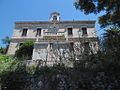
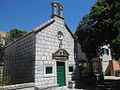
Lastovo is a village and a municipality in southern Croatia. It is the largest settlement on the eponymous island in Dubrovnik-Neretva County and D119 state road passes through it.