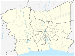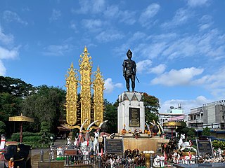
Chiang Rai is one of Thailand's seventy-six provinces, which lies in upper northern Thailand and is Thailand's northernmost province. It is bordered by the Shan State of Myanmar to the north, Bokeo province of Laos to the east, Phayao to the south, Lampang to the southwest, and Chiang Mai to the west. The provinces is linked to Houayxay Laos by the Fourth Thai–Lao Friendship Bridge that spans the Mekong.

Nakhon Sawan is one of Thailand's seventy-six provinces (changwat). It lies in lower northern Thailand, neighbouring Kamphaeng Phet, Phichit, Phetchabun, Lopburi, Sing Buri, Chai Nat, Uthai Thani, and Tak.

Chonburi is a province of Thailand (changwat) located in eastern Thailand. Its capital is also named Chonburi. Neighbouring provinces are Chachoengsao, Chanthaburi, and Rayong, while the Bay of Bangkok is to the west. Pattaya, a major tourism destination in Thailand, is located in Chonburi, along with Laem Chabang, the country's primary seaport. The population of the province has grown rapidly and now totals 1.7 million residents, although a large portion of the population is floating or unregistered. The registered population as of 31 December 2018 was 1.535 million.

Pathum Thani is one of the central provinces (changwat) of Thailand. Neighboring provinces are : Phra Nakhon Si Ayutthaya, Saraburi, Nakhon Nayok, Chachoengsao, Bangkok, and Nonthaburi.

Si Racha is a district in Chonburi province, Thailand. Its center is the town of Si Racha, on the Gulf of Thailand, about halfway between Chonburi and Pattaya. The name Si Racha is from Sanskrit Śrī Rāja via Pali.

Nong Chok is one of the 50 districts (khet) of Bangkok, Thailand. It is bounded by other districts : Amphoe Lam Luk Ka of Pathum Thani province, Amphoe Bang Nam Priao and Amphoe Mueang Chachoengsao of Chachoengsao province, Lat Krabang, Min Buri and Khlong Sam Wa of Bangkok. It is the biggest and the most sparsely populated district of Bangkok.

Bang Khen is one of the 50 districts (khet) of Bangkok, Thailand. It is bounded by other Bangkok districts : Sai Mai, Khlong Sam Wa, Khan Na Yao, Bueng Kum, Lat Phrao, Chatuchak, Lak Si, and Don Mueang.
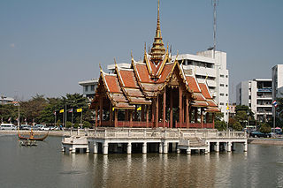
Bang Kapi is one of the 50 districts (khet) of Bangkok, Thailand. It is bounded by other Bangkok districts : Bueng Kum, Saphan Sung, Prawet, Suan Luang, Huai Khwang, Wang Thonglang, and Lat Phrao.

Don Mueang is one of the 50 districts (khet) of Bangkok, Thailand. It is bounded by : Mueang Pathum Thani and Lam Luk Ka of Pathum Thani province; Sai Mai, Bang Khen and Lak Si of Bangkok; and Pak Kret of Nonthaburi province. Don Mueang regarded as the uppermost part of Bangkok.
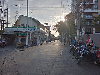
Sai Mai is one of the 50 districts (khet) of Bangkok, Thailand. It is bounded by : Lam Luk Ka district of Pathum Thani province; Khlong Sam Wa, Bang Khen and Don Mueang of Bangkok.

Khlong Sam Wa is one of the 50 districts (khet) of Bangkok, Thailand. It is bounded by other districts : Lam Luk Ka district of Pathum Thani province, Nong Chok, Min Buri, Khan Na Yao, Bang Khen, and Sai Mai of Bangkok. As of 2022, it had the highest population of all districts in Bangkok.

Phahonyothin Road or Highway 1 is a main road in Bangkok and one of the four primary highways in Thailand, which include Mittraphap Road, Sukhumvit Road, and Phet Kasem Road. It begins at Victory Monument in Bangkok and runs north to the Burmese border, with a total length of 1,005 km (624 mi).

Thanyaburi is a district (amphoe) in Pathum Thani province.

Lam Luk Ka is a district (amphoe) of Pathum Thani province, part of Bangkok Metropolitan Region.
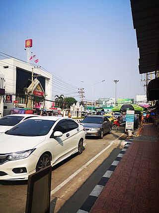
Mueang Pathum Thani is the capital district of Pathum Thani province, central Thailand.
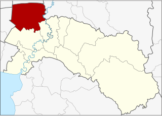
Bang Nam Priao is the northwesternmost district (amphoe) of Chachoengsao province, central Thailand.

The Sukhumvit line or Light Green line, is an elevated metro rail line of the BTS Skytrain in Bangkok, Thailand. From the central Siam Station, where it connects with the Silom Line, the line runs both northwards along Phaya Thai and Phahon Yothin Roads to Khu Khot in Lam Luk Ka District in Pathum Thani, and eastwards along Rama I, Phloen Chit and Sukhumvit Roads, through Bang Na District to Kheha Station in Samut Prakan. BTS daily ridership (2019) is 740,000 passengers per day.
Lak Hok is a tambon (sub-district) in Mueang Pathum Thani district, Pathum Thani province, Greater Bangkok.

Khu Khot is a tambon (sub-district) in Lam Luk Ka district of Pathum Thani province, Greater Bangkok.
Bueng Chawak or full name Bueng Chawak Chaloem Phra Kiat is a natural freshwater lake in central Thailand. It has an area of 2,700 rais, covering the area of the sub-districts Pak Nam, Doem Bang and Hua Khao of Doem Bang Nang Buat District, Suphan Buri Province all the way to the sub-district of Ban Chian, Hankha District, Chai Nat Province. The lake is approximately 64 km (39.8 mi) north of Suphan Buri City.
