Western Finland was a province of Finland from 1997 to 2009. It bordered the provinces of Oulu, Eastern Finland and Southern Finland. It also bordered the Gulf of Bothnia towards Åland. Tampere was the largest city of the province.

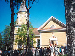
Lappeenranta is a city and municipality in the region of South Karelia, about 30 kilometres from the Russian border and 64 kilometres (40 mi) from the town of Vyborg (Viipuri). It is situated on the shore of the Lake Saimaa in southeastern Finland, and is one of the most significant urban centers in the whole Saimaa region, along with the towns of Imatra, Mikkeli and Savonlinna. With approximately 73,000 inhabitants Lappeenranta is the 13th largest city in Finland, after incorporating the previous municipalities of Lappee and Lauritsala in 1967, Nuijamaa in 1989, Joutseno in 2009, and Ylämaa in 2010.
Pori is a city and municipality on the west coast of Finland. The city is located some 10 kilometres (6 mi) from the Gulf of Bothnia, on the estuary of the Kokemäki River, 110 kilometres (68 mi) west of Tampere, 140 kilometres (87 mi) north of Turku and 241 kilometres (150 mi) north-west of Helsinki, the capital of Finland. Pori was established in 1558 by Duke John, who later became King John III of Sweden.

Haukipudas is a town and former municipality of Finland. It is located in the province of Oulu and part of the Northern Ostrobothnia region. Its shore runs along the Gulf of Bothnia, with the river Kiiminkijoki running through the province. Along with Kiiminki, Oulunsalo and Yli-Ii municipalities it was merged with the city of Oulu on 1 January 2013.

Karjalohja is a former municipality of Finland.

Kerimäki is a former municipality of Finland. It was consolidated with the town of Savonlinna on January 1, 2013.
Kesälahti is a former municipality of Finland. It was consolidated with Kitee on 1 January 2013.

Kiikoinen is a former municipality of Finland.

Kiiminki was a municipality of Finland. Along with Haukipudas, Oulunsalo and Yli-Ii municipalities it was merged with the city of Oulu on 1 January 2013. Kiiminki municipality was part of the Oulu province in the Northern Ostrobothnia region. The municipality had a population of 13,320 and covered an area of 339.00 square kilometres (130.89 sq mi) of which 326.82 km2 (126.19 sq mi) is water. The population density is 1,093.6/km2 (2,832.4/sq mi).

Köyliö is a former municipality of Finland. It was merged to the municipality of Säkylä on 1 January 2016.

Lehtimäki is a former municipality of Finland. It was consolidated to Alajärvi on 1 January 2009.

Maaninka is a former municipality in the region of Northern Savonia, in Finland. It was merged with the city of Kuopio on 1 January 2015.
Punkaharju is a former municipality of Finland. It was consolidated with the town of Savonlinna on January 1, 2013.

Rantsila is a village and former municipality of Finland.

Tarvasjoki is a former municipality in the region of Southwest Finland, in Finland. It was merged with the municipality of Lieto on 1 January 2015.

Vihanti was a municipality of Finland. It was merged with the city of Raahe on 1 January 2013.

Vähäkyrö is a former municipality of Finland and an exclave of the city of Vaasa since January 1, 2013.

Yli-Ii was a municipality of Finland. It was located in the province of Oulu and was part of the Northern Ostrobothnia region. Alongside Haukipudas, Kiiminki and Oulunsalo municipalities it was merged with the city of Oulu on 1 January 2013. The municipality had a population of 2,179 and covered an area of 793.27 square kilometres (306.28 sq mi) of which 24.12 km2 (9.31 sq mi) is water. The population density was 2.8330/km2 (7.3374/sq mi).

Sastamala is a town and municipality of Finland. It is located in the Pirkanmaa region. The town has a population of 23,722 and covers an area of 1,531.75 square kilometres (591.41 sq mi) of which 96.14 km2 (37.12 sq mi) is water, making it the largest municipality in the Pirkanmaa region in terms of area. The population density is 18.37 inhabitants per square kilometre (47.6/sq mi). The municipality is unilingually Finnish.