Col du Tourmalet is one of the highest paved mountain passes in the French Pyrenees, in the department of Hautes-Pyrénées. Sainte-Marie-de-Campan is at the foot on the eastern side and the ski station La Mongie two-thirds of the way up. The village of Barèges lies on the western side, above the town of Luz-Saint-Sauveur.

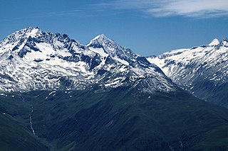
The Diablerets are a huge ice-covered mountain massif of the Alps, culminating at the Sommet des Diablerets at 3,210 metres (10,530 ft) above sea level and straddling the border between the Swiss cantons of Vaud (VD) and Valais (VS). The northeastern part of the massif stretches also into the canton of Bern (BE).

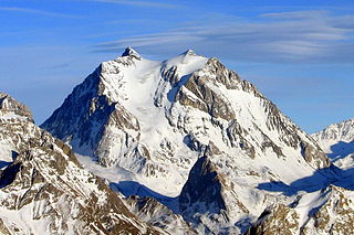
The Grand Combin is a mountain massif in the western Pennine Alps in the canton of Valais. At a height of 4,314 metres (14,154 ft) the summit of Combin de Grafeneire is one of the highest peaks in the Alps and the second most prominent of the Pennine Alps. The Grand Combin is also a large glaciated massif consisting of several summits, among which three are above 4000 metres. The highest part of the massif is wholly in Switzerland, although the border with Italy lies a few kilometres south.

Col du Pillon is a mountain pass in the western Swiss Alps, linking Aigle, Le Sépey and Les Diablerets in the canton of Vaud with Gstaad in the canton of Berne. The pass itself is located within the canton of Vaud, approximately one kilometre from the border with Berne. Col du Pillon is overlooked by the Diablerets and at the pass is located the lower station of the Scex Rouge cable car.

Maurienne is one of the provinces of Savoy, corresponding to the arrondissement of Saint-Jean-de-Maurienne in France. It is also the original name of the capital of the province, now Saint-Jean-de-Maurienne.

The Aigle–Sépey–Diablerets railway line is a railway line in the Chablais area of Vaud and Valais in Switzerland. It was built between 1913 and 1914 by the Chemin de fer Aigle-Sépey-Diablerets (ASD) and is today owned and operated by the Transports Publics du Chablais.

Col de la Forclaz is a mountain pass in the Alps in the Canton of Valais in Switzerland. It connects Martigny at 471 m (1,545 ft) and Le Châtelard (Finhaut). The road from Martigny to the Col has an average gradient of 6% but in parts is closer to 8%. After the Col, and Le Châtelard, the road leads to Chamonix in France via Vallorcine and the Col des Montets.

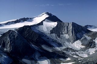
The Wildhorn is a mountain of the Alps, straddling the border between the Swiss cantons of Bern and Valais. At 3,248 metres (10,656 ft) above sea level, it is the highest summit of the Bernese Alps west of the Gemmi Pass. It forms a large glaciated massif, about 10 km wide, extending between the Sanetsch Pass and the Rawil Pass. Along with the Muverans, the Diablerets and the Wildstrubel, the Wildhorn is one of the four distinct mountain massifs of the Bernese Alps that lie west of the Gemmi Pass. The massif of the Wildhorn is at the centre between the valleys of the Saane, Simme and the Rhone (Valais). It comprises several distinct summits, including the Arpelistock, Le Sérac, the Geltenhorn, the Sex Noir, the Sex Rouge, the Schnidehorn and the Six des Eaux Froides. The main crest is between the glaciers named Tungelgletscher and Glacier du Wildhorn. South of the main summit is the almost equally high summit of Mont Pucel. The Wildhorn is surrounded by several large mountain lakes: the Lac de Sénin, the Lauenensee, the Iffigsee, the Lac de Tseuzier and the Lac des Audannes. The Tungelgletscher, on the north-east face, was measured as 1.9 km in length in 1973.

Mont Fort is a mountain of the Pennine Alps, located near Verbier in the Swiss canton of Valais. It lies on the range between the valleys of Bagnes and Nendaz, north of the Rosablanche. With a height of 3,328 metres (10,919 ft) above sea level, Mont Fort is the highest summit north of the Col de Louvie.
The Pointe d'Orny is a mountain of the Mont Blanc massif, located west of Orsières in the canton of Valais. It lies north-east of the Plateau du Trient.

Le Portalet is a mountain of the Mont Blanc massif, located west of Praz de Fort in the canton of Valais. It lies on the range between the glaciers of Trient and Saleina. It has two important subsidiary summits: Grand Clocher du Portalet and Petit Clocher du Portalet. The latter forms a needle and is particularly hard to climb.

The Oldenhorn is a mountain in the western Bernese Alps in Switzerland. The summit is the tripoint between the cantons of Vaud, Berne and Valais.

The Aiguilles Dorées are a multi-summited mountain of the Mont Blanc massif, overlooking the Plateau du Trient in the canton of Valais. They lie east of the Petite Fourche, on the range between the glaciers of Trient and Saleina.

The Scex Rouge is a mountain of the Alps, overlooking Les Diablerets in the canton of Vaud. Along with the Oldenhorn to the east, it is one of the main peaks of the Diablerets, a huge ice-covered mountain near the western end of the Bernese Alps, straddling the border between the cantons of Vaud, Valais, and Bern, and exceeding 3,000 metres (9,800 ft) above sea level. On its west side, the Scex Rouge is part of a nearly 2,000-metre-high (6,600 ft) amphitheatre of cliffs surrounding the Creux de Champ valley, south of Les Diablerets. On its southeast side, the Scex Rouge overlooks the Tsanfleuron Glacier, the largest in the massif. Administratively, the mountain is part of the municipality of Ormont-Dessus, which also includes Les Diablerets.

Pic Chaussy is a mountain of the Bernese Alps, overlooking Les Diablerets to the south. On its northern side lies the Lac Lioson, whilst the Col des Mosses pass flanks its western side. To the east, a ridgeline connects to the peaks of the Châtillon and Le Tarent. Its summit reaches an altitude of 2,351 metres (7,713 ft).

Les Diablerets is a village and ski resort located in the municipality of Ormont-Dessus in the canton of Vaud, Switzerland.
The Tête aux Chamois is a summit of the Diablerets massif, overlooking the Col du Pillon in the canton of Vaud. It is accessible by aerial tramway from the Col du Pillon and from Reusch via Oldenegg. From the summit of the Tête aux Chamois another aerial tramway leads to the summit of the Scex Rouge and the nearby Tsanfleuron Glacier.

Mont d'Or is a mountain of the Jura, located in the French department of Doubs and extending into the Swiss canton of Vaud. Its main summit is 1,463 metre-high and lies within France, 500 metres north of the border with Switzerland. The mountain is located between Jougne, France and Vallorbe, Switzerland.

Piz Vatgira is a mountain of the Lepontine Alps and part of the extended Saint-Gotthard Massif, located south of Sedrun in the canton of Graubünden. The mountain lies between the valleys of Nalps and Medel, about halfway between Lai da Nalps and Lai da Sontga Maria. On its east side is a small glacier ending in the lake named Lai Verd.


