Gulfport–Biloxi International Airport is a joint civil–military public-use airport three nautical miles (6 km) northeast of the central business district of Gulfport, a city in Harrison County, Mississippi, United States. It is owned by the Gulfport–Biloxi Regional Airport Authority and serves the Gulf Coast area.

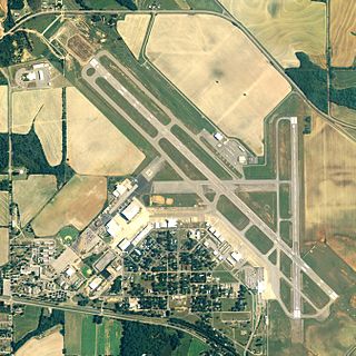
Augusta Regional Airport is a city-owned public airport six miles (11 km) south of Augusta, in Richmond County, Georgia, United States.

Waco Regional Airport is five miles northwest of Waco, in McLennan County, Texas. It is owned by the City of Waco.
Dothan Regional Airport is a public airport in Dale County, Alabama, United States, seven miles northwest of Dothan, a city mostly in Houston County.

Florence Regional Airport is three miles east of Florence, in Florence County, South Carolina.

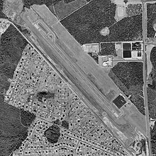
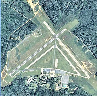
Capital City Airport is a public airport in Fairview Township, York County, Pennsylvania, three miles (5 km) southeast of Harrisburg, the capital of Pennsylvania.

Pryor Field Regional Airport is a public airport located three miles (5 km) northeast of the central business district of Decatur and south of Athens, in Limestone County, Alabama, United States. It is owned by Decatur/Athens Airport Authority.

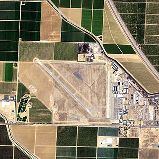
Jacqueline Cochran Regional Airport is a county-owned, public-use airport in Riverside County, California, United States. It is located in the southeastern Coachella Valley, 20 nautical miles southeast of the central business district of Palm Springs, in Thermal, California. This airport is included in the National Plan of Integrated Airport Systems for 2011–2015, which categorized it as a general aviation facility.

Bisbee Douglas International Airport is a county-owned airport 9 miles northwest of Douglas and 17 miles east of Bisbee, both in Cochise County, Arizona. The FAA's National Plan of Integrated Airport Systems for 2009–2013 categorizes it as a general aviation facility.

W. K. Kellogg Airport is a city-owned, public-use, joint civil-military airport located three nautical miles (6 km) west of the central business district of Battle Creek, a city in Calhoun County, Michigan, United States. The airport is accessible by road from Helmer Road, and is located near I-94. It is included in the Federal Aviation Administration (FAA) National Plan of Integrated Airport Systems for 2017–2021, in which it is categorized as a regional general aviation facility. It is also known as W. K. Kellogg Regional Airport.
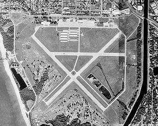
Venice Municipal Airport is a city managed public-use airport located two miles (3.2 km) south of the central business district of Venice, a city in Sarasota County, Florida, United States.
Shafter Airport, also known as Minter Field and formerly known as Air Corps Basic Flying School, is a public use airport located four nautical miles east of the central business district of Shafter and 14 miles northwest of Bakersfield, a city in Kern County, California, United States. Originally a World War II primary training facility for pilots, it is currently a public airport owned by the Minter Field Airport District. This airport is included in the National Plan of Integrated Airport Systems for 2011–2015, which categorized it as a general aviation facility.
MidCoast Regional Airport at Wright Army Airfield is a joint public and military use airport at Fort Stewart, a United States Army post located near the city of Hinesville in Liberty County, Georgia, United States. The airport's physical address is 1116 E. Lowe Circle, Fort Stewart, GA 31314 and its mailing address is P.O. Box 10, Hinesville, GA 31310.

Brooksville–Tampa Bay Regional Airport, formerly known as Hernando County Airport, is a joint civil-military public airport located 6 nautical miles (11 km) southwest of the central business district of Brooksville, a city in Hernando County, Florida, United States. It is owned by Hernando County and is 45 miles (72 km) north of Tampa. While having consistent growth in its traffic rate, it does not yet serve the public through commercial airlines, but it does have charter and executive service.

Avon Park Executive Airport is a city-owned, public-use airport located two nautical miles (3.7 km) west of the central business district of Avon Park, a city in Highlands County, Florida, United States.

Immokalee Regional Airport is a public use airport located one nautical mile (2 km) northeast of the central business district of Immokalee, in Collier County, Florida, United States. The airport is owned by the Collier County Airport Authority. Formerly known as Immokalee Airport, it is included in the National Plan of Integrated Airport Systems for 2011–2015, which categorized it as a general aviation facility.
Eric Marcus Municipal Airport is a county-owned, public-use airport in Pima County, Arizona, United States. It is located 5.75 miles north of the central business district of Ajo and is about 82 miles southwest of Phoenix. The airport was renamed on February 11, 2006; it was formerly known as Ajo Municipal Airport.
Sebastian Municipal Airport is a public-use airport located 1 mile (1.6 km) west of the central business district of the city of Sebastian in Indian River County, Florida, United States. The airport is publicly owned.

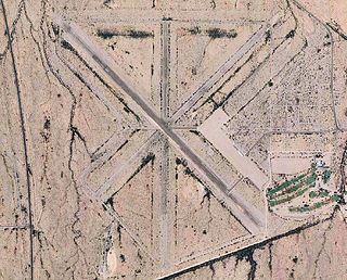
Fort Sumner Municipal Airport is a village owned, public use airport located two nautical miles (4 km) northeast of the central business district of Fort Sumner, a village in De Baca County, New Mexico, United States. It is included in the National Plan of Integrated Airport Systems for 2011–2015, which categorized it as a general aviation airport.

Owatonna Degner Regional Airport is three miles northwest of Owatonna, in Steele County, Minnesota. Its IATA identifier "OWA" comes from the first three letters of the city of Owatonna. The airport is used for general aviation.