
The Ganges is a trans-boundary river of Asia which flows through India and Bangladesh. The 2,525 km (1,569 mi) river rises in the western Himalayas in the Indian state of Uttarakhand. It flows south and east through the Gangetic plain of North India, receiving the right-bank tributary, the Yamuna, which also rises in the western Indian Himalayas, and several left-bank tributaries from Nepal that account for the bulk of its flow. In West Bengal state, India, a feeder canal taking off from its right bank diverts 50% of its flow southwards, artificially connecting it to the Hooghly River. The Ganges continues into Bangladesh, its name changing to the Padma. It is then joined by the Jamuna, the lower stream of the Brahmaputra, and eventually the Meghna, forming the major estuary of the Ganges Delta, and emptying into the Bay of Bengal. The Ganges–Brahmaputra–Meghna system is the second-largest river on earth by discharge.

The Godavari is India's second longest river after the Ganga River and drains the third largest basin in India, covering about 10% of India's total geographical area. Its source is in Trimbakeshwar, Nashik, Maharashtra. It flows east for 1,465 kilometres (910 mi), draining the states of Maharashtra (48.6%), Telangana (18.8%), Andhra Pradesh (4.5%), Chhattisgarh (10.9%) and Odisha (5.7%). The river ultimately empties into the Bay of Bengal through an extensive network of distributaries. Measuring up to 312,812 km2 (120,777 sq mi), it forms one of the largest river basins in the Indian subcontinent, with only the Ganga and Indus rivers having a larger drainage basin. In terms of length, catchment area and discharge, the Godavari is the largest in peninsular India, and had been dubbed as the Dakshina Ganga.

Haridwar is a city and municipal corporation in the Haridwar district of Uttarakhand, India. With a population of 228,832 in 2011, it is the second-largest city in the state and the largest in the district.

Doab is a term used in South Asia for the tract of land lying between two confluent rivers. It is similar to an interfluve. In the Oxford Hindi-English Dictionary, R. S. McGregor defines it as from Persian do-āb "a region lying between and reaching to the confluence of two rivers."

The Tungabhadra River is a river in India that starts and flows through the state of Karnataka during most of its course, Andhra Pradesh and ultimately joining the Krishna River near Murvakonda in Andhra Pradesh

Unnao is a city in the Indian state of Uttar Pradesh. It is the administrative headquarters of Unnao district and a part of Lucknow division, between Kanpur and Lucknow. Unnao is a large industrial city with three industrial suburbs around it. Unnao has the country's largest leather Export in the UPSIDC.

Dhuliyan is a municipality town in the Samserganj block of Jangipur subdivision of Murshidabad district in the state of West Bengal, India. This municipality was established in the year 1909 and comprises 21 wards. It is located between the Ganges and the Feeder canal.

The Mandakini River is a tributary of the Alaknanda River in the Indian state of Uttarakhand. The river runs for approximately 81 kilometres (50 mi) between the Rudraprayag and Sonprayag areas and emerges from the Chorabari Glacier. The Mandakini merges with river Songanga at Sonprayag and flows past the Hindu temple Madhyamaheshwar at Ukhimath. At the end of its course it drains into the Alaknanda, which flows into the Ganges.
Phaphamau is a satellite locality/township of the city of Prayagraj, Uttar Pradesh, India, located on either side of Prayagraj-Lucknow highway. It lies on the banks of the Ganga River.Phaphamu was ruled by Bhil king
Matihani is a village situated near the Ganges River, in the Begusarai district, Bihar state, India.
Bhabhanpura is a village on the outskirts of Varanasi city, located 7 km away from the heart of the city. Total population of the village is 2,992.
Daraganj is a prominent suburb and a landmark in the city of Prayagraj. It is the oldest suburb of Prayag at the bank of celestial river Ganges and not far from Triveni Sangam - the confluence of three sacred rivers: the Ganges and Yamuna, and the third invisible river Saraswati. Thus, Daraganj is essentially a theoretical and philosophical reference point of city now called Prayagraj.
Jajuara, also written Jajuar and Yajuar, is the largest village in the Muzaffarpur district of Bihar in India, and the second-largest village in Bihar.
Madaraha is the name of a village that is situated at Meja (tehsil) in the district of Prayagraj, Uttar Pradesh. The village is at least 500 years old. The village has three Tolas: Purana purva, Chain ka purva, and Nidhi ka purva.

The Leaning Temple of Huma in India is one of only a very few leaning temples in the world. It is located in Huma, a village situated on the bank of the Mahanadi, 23 km south of Sambalpur in the Indian state of Odisha. The temple is dedicated to the Hindu god Lord Bimaleshwar.
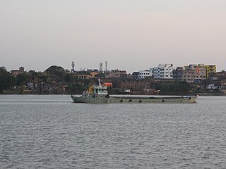
The National Waterway 1 (NW-1) or Ganga-Bhagirathi-Hooghly river system is located in India and runs from Prayagraj in Uttar Pradesh to Haldia in West Bengal via Patna and Bhagalpur in Bihar across the Ganges river. It is 1,620 km (1,010 mi) long, making it the longest waterway in India. It is of prime importance amongst all the national waterways considering its locational advantages. The NW-1 passes through West Bengal, Jharkhand, Bihar and Uttar Pradesh and serves major cities and their industrial hinterlands like;
Islamnagar is a Block and Nagar Panchayat in Badaun district in the Indian state of Uttar Pradesh. Its block code is 0174.

Kurrah the village of pathan or pashtoon Kamsaar in the Indian state of Uttar Pradesh. Almost 3900 Kamsaar Pathans lived in the village as of 2011.

Sabik Pur is a village in the Lakhisarai District of the Indian state of Bihar. Lakhisarai, Barahiya, Sheikhpura, and Jamui are the towns and cities closest to Sabikpur.
River bank erosion along the Ganges in Malda and Murshidabad districts focusses on river bank erosion along the main channel of the Ganges in Malda and Mushidabad districts of West Bengal, India.

