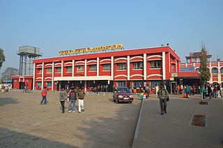
Line Bazar is an important location in the city of Purnia, Bihar(Others being Bus stand, Bhatta Bazar, Khuskibagh(largest retail groceries market in northeast Bihar), and gulabbagh(Largest Wholesale market in northeast Bihar)). It is an important medical hub serving a large population of patients from North-East Bihar as well as neighboring Nepal and West Bengal. Line Bazar is a key place in Purnia Division and Kosi Division and is well known for the quality of medical facilities available. Sadar Hospital and Purnia Government Medical College are located here. Line Bazar is located on NH 231.
Line Bazar is fully facilitated with good doctors, private and government medical colleges and hospitals, blood banks, and chemists, and also has a good transportation facility to travel to all the important destinations within the city.
Prominent Hospitals
Sadar Hospital
Max 7 Hospital
Sanjeeveni Hospital
Maa Pancha Devi Stone Hospital
Fatma Hospital
Harsh Hospital
Sadbhavna General Hospital
Related Research Articles
Sylhet is a metropolitan city located in the northeastern region of Bangladesh. It is the administrative center of Sylhet Division. It is situated on the banks of the Surma River and is surrounded by the Jaintiapur, Khasi Hills, and Tripura hills. The city has a population of approximately 700,000 people, making it the fifth-largest city in Bangladesh.
Kharagpur is a planned urban agglomeration and a major industrial city in the Paschim Medinipur district of West Bengal, India. It is the headquarters of the Kharagpur subdivision and the largest city of the district. It is located 120 km west of Kolkata and 1300 km south east of the New Delhi. The first Indian Institute of Technology, one of the Institutes of National Importance, was founded in Kharagpur in May 1950. It has one of the largest railway workshops in India, and the fourth longest railway platform in the world along with being the headquarters of the Kharagpur Division of the South Eastern Railways.
Darbhanga is the fifth-largest city and municipal corporation in the state of Bihar in India. It is one of the most important districts and big cities of North Bihar. It serves as the headquarters of the Darbhanga district and the Darbhanga division.
Katihar is a city situated in the eastern part of the state of Bihar in India. It is the regional headquarter of Katihar district. It is one of the important cities of Bihar. Also it's a main route of Delhi - Guwahati railway line.
Purnia (also romanized as Purnea) is the fourth largest city of Bihar and emerging as the biggest economic hub in North Bihar. It serves as the administrative headquarters of both Purnia district and Purnia division in the Indian state of Bihar. It is well known for its favourable climate like Darjeeling and have abundance amount of resources for human settlements and economic activities.
Saharsa is a city and Municipal corporation in the Saharsa District in the eastern part of the state of Bihar, India. It is situated near the eastern banks of the Kosi River. It serves as the administrative headquarters for Saharsa District and is also the Divisional Headquarter of the Kosi Division.
Cox's Bazar is a city, fishing port, tourism centre, and district headquarters in Southeastern Bangladesh. It is located 150 km (93 mi) south of the city of Chittagong. Cox's Bazar is also known by the name Panowa, which translates literally as "yellow flower." Another old name was "Palongkee".
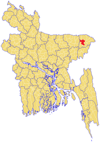
Purnia District is one of the thirty-eight districts of the Indian state of Bihar. The city of Purnia is the administrative headquarters of this district. The city of Purnia has continued its tradition of hoisting the national flag at 12:07 am on every Independence Day since 1947. Purnia district is a part of Purnia Division. The district extends northwards from the Ganges river.
Malda district, also spelt Maldah or Maldaha, is a district in West Bengal, India. It lies 347 km north of Kolkata, the capital of West Bengal. Mango, jute and silk are the most notable products of this district. The special variety of mango, Fazli, produced in this region is popularly known by the name of the district and is exported across the world and is internationally acclaimed. The folk culture of gombhira is a feature of the district, being a unique way of representation of joy and sorrow in daily life of the common people, as well as the unique medium of presentation on national and international matters. According to the National Investigation Agency Malda is believed to be a hub of a fake currency racket. It is reported that 90 percent of the fake currency that enters India originates in Malda.
North Bengal is a term used for the north-western part of Bangladesh and northern part of West Bengal. The Bangladesh part denotes the Rajshahi Division and Rangpur Division. Generally, it is the area lying west of Jamuna River and north of Padma River and includes the Barind Tract. The West Bengal part denotes Jalpaiguri Division and the Malda division together. The Bihar parts include the Kishanganj district. It also includes parts of Darjeeling Hills. Traditionally, the Ganga River divides Bengal into South Bengal and North Bengal, divided again into Terai and Dooars regions. Jalpesh and jatileswar are some of the most popular sacred places.
Banmankhi Bazar is a town and a notified area in Purnia district in the state of Bihar, India.
Forbesganj is a city with municipality in the Araria District in the state of Bihar, India, situated at the border of Nepal.
Birgunj is a metropolitan city in Parsa District in Madhesh Province of southern Nepal. It lies 135 km (84 mi) south of the capital Kathmandu, attached in the north to Raxaul in the border of the Indian state of Bihar. As an entry point to Nepal from Patna, Birgunj is known as the "Gateway of Nepal". It is also called "Commercial capital of Nepal". The town has significant economic importance for Nepal as most of the trade with India is via Birgunj and the Indian town of Raxaul. Tribhuvan Highway links Birgunj to Nepal's capital, Kathmandu.
Panskura is a town and a municipality in Purba Medinipur district in the Indian state of West Bengal. It is situated on the banks of the Kangsabati River.
Kasba is a satellite town of Purnia city and part of Purnia Urban Agglomeration in Purnia district in the Indian state of Mithila region of Bihar.
Sylhet Sadar is an upazila of Sylhet District in the Division of Sylhet, Bangladesh.
Medinipur Sadar subdivision is an administrative subdivision of the Paschim Medinipur district in the state of West Bengal, India.
Harnaut is a city in the Nalanda District of Bihar, India, and the entrance city of Nalanda. The Hindu, Buddhist and Jain pilgrim centres of Nalanda, Pawapuri, Rajgir, Bodh Gaya and Vaishali are all near Harnaut. The incumbent Chief Minister of Bihar, Nitish Kumar, is from Harnaut.
North Bihar is a term used for the region of Bihar, India, which lies north of the Ganga river.
Raniganj, Bihar is an administrative block in Araria subdivision of Araria district in the Indian state of Bihar. It has a Vidhan Sabha Constituency with same name.
This page is based on this Wikipedia article Text is available under the CC BY-SA 4.0 license; additional terms may apply. Images, videos and audio are available under their respective licenses.