
Sheringham is an English seaside town within the county of Norfolk in the United Kingdom. The motto of the town, granted in 1953 to the Sheringham Urban District Council, is Mare Ditat Pinusque Decorat, Latin for "The sea enriches and the pine adorns".

St Andrews Links in the town of St Andrews, Fife, Scotland, is regarded as the "Home of Golf". It has one of the oldest courses in the world, where the game has been played since the 15th century. Today there are seven public golf courses; the Balgove, Eden, Jubilee, Strathtyrum, New, the Old Course, and The Castle Course, sited on the cliffs a mile to the east of St Andrews and designed by the architect David McLay Kidd, which opened in June 2008. The courses of St Andrews Links are owned by the local authorities and operated by St Andrews Links Trust, a charitable organization. St Andrews is also home to the Royal and Ancient Golf Club of St Andrews, one of the most prestigious golf clubs and until 2004 one of the two rulemaking authorities of golf.

Adare is a village in County Limerick, Ireland, located south-west of the city of Limerick. Renowned as one of Ireland's prettiest towns, Adare is designated as a heritage town by the Irish government.

Turnberry is a golf resort on the Firth of Clyde in Ayrshire, southwest Scotland. It comprises three links golf courses, a golf academy, a five-star James Miller-designed hotel from 1906, along with lodge and cottage accommodations.

Prestwick Golf Club is located in the town of Prestwick, South Ayrshire, Scotland. It is approximately 30 miles (50 km) southwest of Scotland's largest city, Glasgow. Prestwick is a classic links golf course, being built on the rolling sandy land lying between the beach and the land further inland. The course is located near the Prestwick airport, and some holes run along railway tracks on the eastern side of the course.

Oxley is a south-western suburb in the City of Brisbane, Queensland, Australia. It is located approximately 10.8 kilometres (6.7 mi) from the Brisbane CBD. It was named after the early Australian explorer John Oxley. The suburb supports a mix of residential, retail and industrial land.
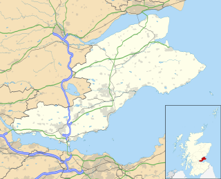
Lundin Links is a small village in the parish of Largo on the south coast of Fife in eastern central Scotland.

Pebble Beach Golf Links is a public golf course on the west coast of the United States, located in Pebble Beach, California.

Insch is a village in the Garioch, Aberdeenshire, Scotland. It is located approximately 28 miles (45 km) from the city of Aberdeen.

Alnmouth is a coastal village in Northumberland, England, situated 4 miles (6 km) east-south-east of Alnwick. The population of the civil parish at the 2001 Census was 562, reducing to 445 at the 2011 Census.

Machrihanish is a village in Argyll, on the west coast of Scotland. It is a short distance north of the tip of the Mull of Kintyre, which faces out towards Ireland and the Atlantic. Machrihanish has a classic links golf course designed by Old Tom Morris, with views towards the islands of Gigha, Islay and Jura. A second, newer course has been built nearby called Machrihanish Dunes. This course is part of a multimillion-pound development by an American company, which has renovated the previously-dilapidated Ugadale Hotel in the village and owns the Royal Hotel on the sea front in nearby Campbeltown.

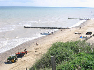
East Runton is a small village in Norfolk, England situated close to the North Sea. It was once a traditional fishing village outside Cromer but is now a popular holiday destination for camping and caravan holidays. The village is within the parish of Runton that also includes West Runton. The village is 1.3 miles (2.1 km) west of Cromer, 1.7 miles (2.7 km) east of West Runton, 2.7 miles (4.3 km) east of Sheringham and 21.7 miles (34.9 km) north of Norwich. The village lies on the A149 coast road but most of the dwellings can be found just south of the road, nestled around the two village greens. The population in the 2001 census was shown as 1,633 in 784 households. at the 2011 census the population was included in the civil parish of Runton. The parish area is 544 hectares.
Mundesley is a coastal village and a civil parish in the English county of Norfolk. The village is 20.3 miles (32.7 km) north-north east of Norwich, 7.3 miles (11.7 km) south east of Cromer and 136 miles (219 km) north east of London. The village lies 5.6 miles (9.0 km) north-north east of the town of North Walsham. The nearest railway station is at North Walsham for the Bittern Line which runs between Sheringham and Norwich. The nearest airport is Norwich Airport. The village sits astride the B1159 coast road that links Cromer and Caister-on-Sea, and is at the eastern end of the B1145 a route which runs between King's Lynn and Mundesley. Mundesley is within the Norfolk Coast AONB. It has a resident population of around 2,695, measured at 2,758 in the 2011 Census. The River Mun or Mundesley Beck flows into the sea here.

West Runton is a village in North Norfolk, England, approximately ¼ of a mile from the North Sea coast.

Royal County Down Golf Club is a golf club in Northern Ireland, located in Newcastle, County Down. It opened 130 years ago 23 March 1889 and is one of the oldest golf clubs in Ireland. It has two 18-hole links courses, the Championship Course and the Annesley Links.

Old Drumchapel is a neighbourhood of Glasgow, Scotland. It is located around Drumchapel railway station and formed part of the Cowdenhill and Garscadden Estates. It is situated to the south of the larger and newer Drumchapel housing estate, and to the north of the arterial Great Western Road running from Glasgow to Clydebank. The Blairdardie neighbourhood lies immediately to the east, while a retail park separates Old Drumchapel from the Linnvale and Drumry areas of Clydebank to the west.

Sprowston Manor Hotel is a AA 4 star hotel, part of which is the 19th-century Sprowston Hall. It is located on the north east suburbs, of the English city of Norwich, close to the suburb of Sprowston and village of Rackheath, within the county of Norfolk, United Kingdom.
The Crail Golfing Society is a Scottish golf club established in February 1786 in the Golf Hotel, Crail, Fife. The society is the seventh oldest golf club in the world. Its oldest course, Balcomie, was formally laid out by Old Tom Morris in 1894, but competitions were played there since the 1850s.
The Diamond Jo Casino – Worth is a casino and entertainment complex in Worth County, Iowa, near Northwood. The casino is owned and operated by Boyd Gaming, which also owns the Diamond Jo Casino in Dubuque, Iowa. It is a member of the Iowa Gaming Association, and its license is held by the Worth County Development Authority. The property opened on April 6, 2006, with a grand opening celebration on April 18, 2006.

The Norfolk Downs Shelter is a historic former golf club pavilion on Golf Drive in Norfolk, Connecticut. It was built in 1907 for a now-abandoned nine-hole golf course known as Norfolk Downs, to design by New York City architect Alfredo S.G. Taylor. It was listed on the National Register of Historic Places in 1984 for its association with the architect.


