Lions Road | |
|---|---|
| General information | |
| Type | Rural road |
| Major junctions | |
| North end | Running Creek Road, Running Creek, Queensland |
| South end | Gradys Creek Road, Loadstone, New South Wales |
| Location(s) | |
| Major settlements | Cougal, New South Wales |
The Lions Road is a section of the road running between the Summerland Way in New South Wales and the Mount Lindesay Highway near Rathdowney, Queensland at Running Creek. It joins two pre-existing sections of rural road, namely Gradys Creek Road in New South Wales and Running Creek Road in Queensland. It was so named as most of the funding, planning and voluntary labour for the road came from the Kyogle branch of the Lions Club. Kyogle resident Jack Hurley was one of the most prominent advocates of the road. Despite the NSW Government rejecting the idea in 1969, it was opened the following year. [1]
It connects these two roads over the Richmond Gap in the McPherson Range. For a good deal of its length it is a narrow one-laned road that cannot be used by trucks or cars towing caravans or trailers. In the 1990s the road was fully sealed with bitumen but the original alignments were largely unaltered, leading to possible surprises for inexperienced drivers who allow themselves to build up excessive speed, particularly on steep mountainous stretches. On the NSW side there are many bridges over small creeks, with steep approaches. They were of wooden construction that could only support low vehicular weights, but almost all of them were replaced by concrete bridges in 2017–18. All the bridges on the Queensland side are concrete, but several of them are one-lane bridges on which vehicles travelling 'upstream' must give way before entering the bridge.
In 2017, Kyogle Council started a major upgrade program where all but two of the narrow timber bridges were replaced by modern concrete bridges. The remaining timber bridges do not have the weight limitations required, and will be replaced at the end of their natural life. The road was fully reopened in May 2018 following extended delays and closures.
The road runs through the Border Ranges National Park and it is altogether a scenic drive. [1] The road also parallels the main Brisbane-Sydney railway line, including near a feature of the train line known as the Cougal Spiral (or Border Loop). It passes adjacent to a small section of the Mount Chinghee National Park.

The Border Ranges National Park is a protected national park that is located in the Northern Rivers region of New South Wales, Australia. A small portion of the national park is also located in South East Queensland. The 31,729-hectare (78,400-acre) park is situated approximately 150 kilometres (93 mi) south of Brisbane, north of Kyogle.

The Newell Highway is a national highway in New South Wales (NSW), Australia. It provides the major road link between southeastern Queensland and Victoria via central NSW and as such carries large amounts of freight. At 1,058 kilometres (657 mi) in length, the Newell is the longest highway in NSW, and passes through fifteen local government areas. The highway is part of Australian national route 39 and was signposted accordingly until 2013. Since then it has been signposted as NSW route A39.

The Pacific Highway is a 780-kilometre-long (485 mi) national highway and major transport route along the central east coast of Australia, with the majority of it being part of Australia's Highway 1. It no longer includes former sections of the highway between Brunswick Heads and Brisbane that have been legally renamed Pacific Motorway or Gold Coast Highway. As such, the highway stops short of the Queensland border near the Gold Coast.

The Great Western Highway is a 201-kilometre-long (125 mi) state highway in New South Wales, Australia. From east to west, the highway links Sydney with Bathurst, on the state's Central Tablelands.

The Summerland Way is a 199–kilometre state route, designated B91, in New South Wales. It runs generally north from Grafton to the border between NSW and Queensland just west of Mount Lindesay. The road continues from there into Queensland as Mount Lindesay Highway. With the decommissioning of the Mount Lindesay Highway in New South Wales in 1982, the length of the Summerland Way was increased by 9.4 km to the Queensland border. It is sealed for its entire length, although some of the road north of the Lions Road turn-off is narrow and winding. In 1996, the Federal Government committed $20 million toward upgrading the Summerland Way. A $7 million contract to realign 1.2 km at Dourrigan's Gap, approximately 16 km north of Kyogle, was awarded, with work starting in February 2002 and expected to take 12 months to complete.

The Cougal Spiral is a heritage-listed single track railway tunnel and spiral feature of the North Coast railway line in Australia that connects New South Wales with Queensland through Richmond Gap in the Kyogle Council local government area of New South Wales, Australia. It was built during 1930. It is also known as the Border Loop railway formation and landscape, Cougal To Border Loop and Railway Spiral and Landscape. The property was added to the New South Wales State Heritage Register on 2 April 1999.

Bylong Valley Way is a New South Wales country road linking the Golden Highway near Sandy Hollow to the Castlereagh Highway near Ilford. It is named after the Bylong Valley, through which the road passes.

The Mooney Mooney Bridge, officially the Mooney Mooney Creek Bridge, and popularly known as The NSW Big Dipper Bridge, is a twin cantilever bridge that carries the Pacific Motorway (M1) across Mooney Mooney Creek, located near Mooney Mooney in the Brisbane Water National Park on the Central Coast of New South Wales, Australia. The concrete box girder bridge was opened on 14 December 1986 by the Prime Minister of Australia, Bob Hawke, and is owned and maintained by Transport for NSW, an agency of the Government of New South Wales.

Fullers Bridge, officially called the Fullers Creek Bridge, is a road bridge that carries Delhi Road to Millwood Avenue across the Lane Cove River, in Chatswood West, Sydney, New South Wales, Australia. The concrete beam bridge is located 9 kilometres (5.6 mi) northwest of the Sydney central business district and connects Chatswood to North Ryde as part of the A38.

The Mungindi Bridge is a road bridge that carries the Carnarvon Highway across the Barwon River on the Queensland/New South Wales border at Mungindi, New South Wales, Australia.

The Beaudesert Shire Tramway was a narrow gauge tramway which operated from Beaudesert to Lamington and Rathdowney in the Scenic Rim Region, Queensland, Australia, It was one of 15 light railways built and operated by Divisional Boards and Shire Councils in Queensland. The line carried passengers and cargo. It operated from 1903 to 1944. It was initially profitable and seen as a great success for the local shire council. The tramway is credited with opening up the agricultural lands of the upper Logan River.

Main Range Railway is a heritage-listed railway from the end of Murphys Creek railway station, Murphys Creek to the Ruthven Street overbridge, Harlaxton, Queensland, Australia. It forms part of the Main Line railway and was built from 1865 to 1867 by railway builders Peto, Brassey and Betts. It was added to the Queensland Heritage Register on 5 February 2009.

Running Creek is a rural locality in the Scenic Rim Region, Queensland, Australia. In the 2016 census Running Creek had a population of 147 people. It borders New South Wales.

The Cairns-to-Kuranda Railway is a heritage-listed railway line from the Cairns Region to the Shire of Mareeba, both in Queensland, Australia. It commences at Redlynch, a suburb of Cairns and travels up the Great Dividing Range to Kuranda within the Shire of Mareeba on the Atherton Tableland. It was built from 1913 to 1915 by Queensland Railways. Components of it include Stoney Creek Bridge, the Rail Bridge over Christmas Creek, Kuranda railway station, and Surprise Creek Rail Bridge. It was added to the Queensland Heritage Register on 21 August 1992. The railway is used to operate a tourist rail service, the Kuranda Scenic Railway. It forms part of the Tablelands railway line.

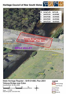
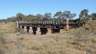
The Yowaka River bridge is a heritage-listed road bridge that carries the Princes Highway across the Yowaka River at Greigs Flat on the Bega Valley Shire local government area of New South Wales, Australia. It was built in 1936. The bridge is also known as the Yowaka Bridge near Eden. The property is owned by Roads and Maritime Services, an agency of the Government of New South Wales. It was added to the New South Wales State Heritage Register on 20 June 2000.

The Tenterfield Creek railway bridge is a heritage-listed former railway bridge that carried the Main North line across the Tenterfield Creek from Sunnyside to Jennings, both in the Tenterfield Shire local government area of New South Wales, Australia. It was designed by John Whitton and Engineer-in-Chief for NSW Government Railways and built in 1888. The bridge is also known as the Sunnyside rail bridge over Tenterfield Creek. The property is owned by RailCorp, an agency of the Government of New South Wales and was added to the New South Wales State Heritage Register on 2 April 1999.

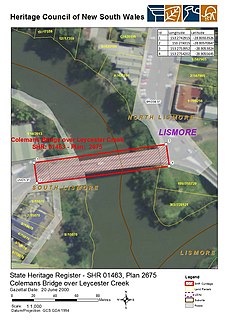
The Colemans Bridge is a heritage-listed road bridge that carries Union Street across the Leycester Creek in Lismore, City of Lismore, New South Wales, Australia. It was designed by Harvey Dare and built in 1907 by W. F. Oakes. The property is owned by Roads and Maritime Services, an agency of the Government of New South Wales. It was added to the New South Wales State Heritage Register on 20 June 2000.

The Tunks Creek bridge is a heritage-listed timber truss road bridge that carries Galston Road across Tunks Creek, located on Galston in the Berowra Valley Regional Park in the Hornsby Shire local government area of New South Wales, Australia. The bridge spans Tunks Creek in the valley of the Galston Gorge. The road through the gorge provides a link between Hornsby Heights and Galston, suburbs of Sydney. The bridge is also known as the Bridge over Tunks (Pearces) Creek and Pearces Creek Bridge. The property is owned by Roads and Maritime Services, an agency of the Government of New South Wales. It was added to the New South Wales State Heritage Register on 20 June 2000.
The Glennies Creek Bridge is a heritage-listed road bridge that carries the Rixs Creek-Falbrook Road across the Glennies Creek, located at Middle Falbrook, in the Singleton Council local government area of New South Wales, Australia. The bridge was designed by Ernest de Burgh and built in 1902-03 by William Murphy and James Taylor. The property is owned by Roads and Maritime Services, an agency of the Government of New South Wales. The bridge was added to the New South Wales State Heritage Register on 20 June 2000.

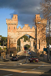
The Long Gully Bridge, also known as Northbridge, Suspension Bridge, and Cammeray Bridge, is a concrete arch road bridge that carries Strathallen Avenue across Flat Rock Creek and Tunks Park, and connects the suburbs of Cammeray, in the North Sydney Council local government area to its south, with Northbridge in the City of Willoughby local government area to its north, in Sydney, New South Wales, Australia.
Coordinates: 28°19′54″S152°58′22″E / 28.3318°S 152.9729°E