Ramsar sites in Northern Ireland are wetlands of international importance designated under the Ramsar Convention. In the United Kingdom, the first Ramsar sites were designated in 1976. Designated and proposed sites in Northern Ireland are listed below: [1] [2] [3]
A Special Protection Area (SPA) is a designation under the European Union Directive on the Conservation of Wild Birds. Under the Directive, Member States of the European Union (EU) have a duty to safeguard the habitats of migratory birds and certain particularly threatened birds. Together with Special Areas of Conservation (SACs), the SPAs form a network of protected sites across the EU, called Natura 2000. Each SPA has an EU code – for example the North Norfolk Coast SPA has the code UK9009031.
A Ramsar site is a wetland site designated to be of international importance under the Ramsar Convention, also known as "The Convention on Wetlands", an intergovernmental environmental treaty established in 1971 by UNESCO, which came into force in 1975. It provides for national action and international cooperation regarding the conservation of wetlands, and wise sustainable use of their resources. Ramsar identifies wetlands of international importance, especially those providing waterfowl habitat.
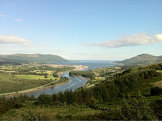
Carlingford Lough is a glacial fjord or sea inlet in northeastern Ireland, forming part of the border between Northern Ireland to the north and the Republic of Ireland to the south. On its northern shore is County Down, the Mourne Mountains, and the town of Warrenpoint; on its southern shore is County Louth, the Cooley Mountains and the village of Carlingford. The Newry River flows into the loch from the northwest.
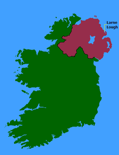
Larne Lough, historically Lough Larne, is a sea loch or inlet in County Antrim, Northern Ireland. It lies between the Islandmagee peninsula and the mainland. At its mouth is the town of Larne. It is designated as an area of special scientific interest, a special protection area, and a Ramsar site to protect the wetland environment, particularly due to the presence of certain bird species and shellfish.

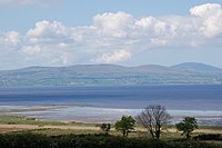
Belfast Lough is a large, intertidal sea inlet on the east coast of Northern Ireland. At its head is the city and port of Belfast, which sits at the mouth of the River Lagan. The lough opens into the North Channel and connects Belfast to the Irish Sea.
Ballynahone Bog is a raised bog, situated in County Londonderry, Northern Ireland, about 3 km south of Maghera, on low-lying ground immediately north of the Moyola River about 14 km from its mouth at Lough Neagh. It is one of the largest lowland raised bogs in Northern Ireland.

Cuilcagh is a mountain on the border between County Fermanagh and County Cavan. With a height of 665 metres (2,182 ft) it is the highest point in both counties. It is also the 170th highest peak on the island of Ireland, and Ireland's only cross-border county top. Water from the southern slope flows underground until it emerges some miles away in the Shannon Pot, the traditional source of the River Shannon. The area is sometimes referred to as the Cuilcagh Mountains.

North Roe is a village, and protected area at the northern tip in the large Northmavine peninsula of the Mainland of Shetland, Scotland. It is a small village, with a school with less than a dozen pupils in 2011. The moorland plateau to the south-west of the settlement is part of the Ronas Hill-North Roe and Tingon internationally recognised wetland site, protected under the terms of the Ramsar Convention on Wetlands, and also a Special Protection Area under the Birds Directive. The village is served by the A970 road which runs the length of the Shetland mainland from south to north and is a single-carriageway for the final nine miles.
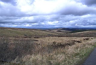
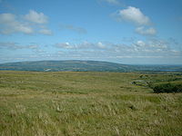
Slieve Beagh is a mountainous area straddling the border between County Monaghan in the Republic of Ireland and County Fermanagh and County Tyrone in Northern Ireland. A point just east of its summit is the highest point in Monaghan; however the true summit is on the Fermanagh-Tyrone border. The point where the three counties meet, is referred to as the "Three County Hollow".

Old Crow Flats is a 6,170 km2 (2,382 sq mi) wetland complex in northern Yukon, Canada along the Old Crow River. It is north of the Arctic Circle and south of the Beaufort Sea, and is nearly surrounded by mountains.
Black Bog is a raised bog in County Tyrone, Northern Ireland, situated about 17km west of Cookstown.

The Marble Arch Caves Global Geopark straddles the border between Northern Ireland and the Republic of Ireland. It is centred on the Marble Arch Caves and in 2001 it became one of the first geoparks to be designated in Europe.
Jocks Lagoon is an 18-hectare (44-acre) freshwater coastal lagoon in north-eastern Tasmania, Australia. In 1982 it was designated a wetland of international importance under the Ramsar Convention.