This article relies largely or entirely on a single source .(September 2024) |
The Scheduled Tribes in Uttarakhand comprise 5 tribes, with a population of 2,91,903, constituting 2.9% of the state's population according to the 2011 census. [1]
This article relies largely or entirely on a single source .(September 2024) |
The Scheduled Tribes in Uttarakhand comprise 5 tribes, with a population of 2,91,903, constituting 2.9% of the state's population according to the 2011 census. [1]
Tribes in bold indicate Particularly Vulnerable Tribal Group (Primitive Tribe).
| # | Tribe | Region | Language | Population |
|---|---|---|---|---|
| 1. | Bhotiya | Bhoti | 39,106 | |
| 2. | Buksa | Buksa | 46,771 | |
| 3. | Jaunsari | Jaunsari | 1,37,000 | |
| 4. | Raji | Raji | ||
| 5. | Tharu | Tharu | 91,342 |

Champawat is a town and a Nagar Palika Parishad in Champawat district in the state of Uttarakhand, India. It is the administrative headquarters of Champawat district. The town was the former capital of the Kumaon Kingdom.

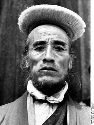
Bhotiya or Bhot is an Indian and Nepali exonym lumping together various ethnic groups speaking Tibetic languages, as well as some groups speaking other Tibeto-Burman languages living in the Transhimalayan region that divides India from Tibet. The word Bhotiya comes from the classical Tibetan name for Tibet, བོད, bod. The Bhotiya speak numerous languages including Ladakhi, Drejongke, Yolmo and Sherpa. The Indian recognition of such language is Bhoti / Bhotia having Tibetan scripts and it lies in the Parliament of India to become one of the official languages through Eighth Schedule of the Indian Constitution.

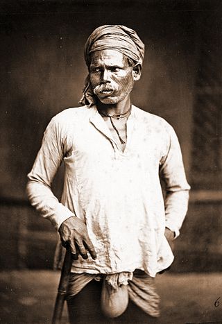
The Dom, also known as Domra, Domba, Domaka, Dombara and Dombari, are castes, or groups, scattered across India. Dom were a caste of drummer. According to Tantra scriptures, the Dom were engaged in the occupations of singing and playing music. Historically, they were considered an untouchable caste called the Dalits and their traditional occupation was the disposal and cremation of dead bodies. They are in the list of Scheduled caste for Reservation in India in the Indian states of Uttar Pradesh, Bihar, Odisha, Andhra Pradesh, Jharkhand and West Bengal.

Udham Singh Nagar is a district of Uttarakhand state in northern India. Rudrapur is the district headquarter. The district consists of nine Tehsils named Bajpur, Gadarpur, Jaspur, Kashipur, Khatima, Kichha, Nanakmatta, Rudrapur, Sitarganj. The district is located in the Terai region, and is part of Kumaon Division. It is bounded on the north by Nainital District, on the northeast by Champawat District, on the east by Nepal, and on the south and west by Bareilly, Rampur, Moradabad, Pilibhit and Bijnor District of Uttar Pradesh state. The district was created on 29 September 1995, by Mayawati government out of Nainital District. It is named for freedom fighter and Indian revolutionary Udham Singh.

Pithoragarh district is the easternmost district in the state of Uttarakhand. It is located in the Himalayas and has an area of 7,110 km2 (2,750 sq mi) and a population of 483,439. The city of Pithoragarh, located in Saur Valley, is its headquarters. The district is within the Kumaon division of Uttarakhand state. The Tibet plateau is situated to the north and Nepal is to the east. The Kali River which originates from the Kalagiri Mountain flows south, forming the eastern border with Nepal. The Hindu pilgrimage route for Mount Kailash-Lake Manasarovar passes through this district via Lipulekh Pass in the greater Himalayas. The district is administratively divided into six Tehsils: Munsyari; Dharchula; Didihat; Berinag; Gangolihat; and Pithoragarh. Naini Saini Airport is the nearest civil airport, but it does not have a regular scheduled commercial passenger service. The mineral deposits present in the district are magnesium ore, copper ore, limestone, and slate. There are 11 tehsils.

Didihat is a town and a Nagar Palika in Pithoragarh District in the state of Uttarakhand, India. It is one of the eleven administrative subdivisions of Pithoragarh district and also serves as its administrative headquarter. With a population of 6522, Didihat is located at a distance of 415 km (258 mi) from the state capital Dehradun.

Dehradun district is a district in Garhwal which is a part of Uttarakhand state in northern India. The district headquarters is Dehradun, which has also served as the interim capital of Uttarakhand since its founding in 2000. The district has 6 tehsils, 6 community development blocks, 17 towns and 764 inhabited villages, and 18 unpopulated villages. As of 2011, it is the second most populous district of Uttarakhand, after Haridwar. Dehradun district also includes the prominent towns of Rishikesh, Mussoorie, Landour and Chakrata. The district stretches from the Ganges river in the east to the Yamuna river in the west, and from the Terai and Shivaliks in the south and southeast to the Great Himalaya in the northwest. During the days of British Raj, the official name of the district was Dehra Dun. In 1842, Dun was attached to Saharanpur district and placed under an officer subordinate to the Collector of the district but since 1871 it is being administered as separate district.

Nainital district is a district in Kumaon division which is a part of Uttarakhand state in India. The headquarters is at Nainital.

Tehri Garhwal is a district in the hill state of Uttarakhand, India. Its administrative headquarters is at New Tehri. The district has a population of 618, 931, a 2.35% increase over the previous decade. It is surrounded by Rudraprayag District in the east, Dehradun District in the west, Uttarkashi District in the north, and Pauri Garhwal District in the south. Tehri Garhwal is a part of the Himalayas.

Rudraprayag is a district of the state of Uttarakhand of northern India. The district occupies an area of 1984 km2. The town of Rudraprayag is the administrative headquarters of the district. The district is bounded by Uttarkashi District on the north, Chamoli District on the east, Pauri Garhwal District on the south, and Tehri Garhwal District on the west.

Champawat district is a district of Uttarakhand state in northern India. The town of Champawat is the administrative headquarters. The district of Champawat constituted in the year 1997. The district is divided into five tehsils: Barakot, Lohaghat, Pati, Purnagiri, and Champawat. There is 2 Sub Tehsil: Pulla and Munch. The largest and the main city of the district is Tanakpur.

Bageshwar is a district of Uttarakhand state in northern India. The town of Bageshwar is the district headquarters. Prior to its establishment as a district in 1997 it was part of Almora district.

Khatima is a city and a municipal board in Udham Singh Nagar district in the Indian state of Uttarakhand.

Chaukori is a hill station in the Pithoragarh district set among the lofty peaks of the western Himalayan Range in the Kumaon Division of Uttarakhand, India. To its north is Tibet and to its south is Terai. The Mahakali River, running along its eastern boundary, forms the Indo-Nepal international border. This place has become a prominent tourist place and from here a wide and picturesque view of Himalayan range can be viewed. The golden yellow colour of sun rays falling on the Himalayan range in the morning time is really worth seeing. There are cottages available here where one can stay and enjoy the serene surroundings. Tourists coming to this place generally also visit the nearby tourist places like Patal Bhuvaneshwar, Kausani, Bageshwar and Almora.
Chamba is a town and a hill station, nearby New Tehri City in Tehri Garhwal district in the state of Uttarakhand, India. It is situated at a junction of roads connecting Mussoorie and Rishikesh with the Tehri Dam reservoir and New Tehri. The town is about 50 km from Mussoorie and also near Dhanaulti, Surkanda Devi Temple, Ranichauri, New Tehri, and Kanatal, tipri halfway between Chamba and Dhanaulti.Chamba is situated at an altitude of 1600m above sea level. One can reach Chamba in about 7-8 hrs from Delhi via Haridwar, Rishikesh and Narendranagar (290 km).

Kausani is a hill station and Village situated in Bageshwar district in the state of Uttarakhand, India. It is known for its scenery and its 300 km-wide panoramic view of Himalayan peaks like Trisul, Nanda Devi and Panchchuli. Mahatma Gandhi called this place the 'Switzerland of India', due to similarity in landscapes.
Bhoksa, also known as Buksa/Bukhasiya, are indigenous peoples living mainly in the Indian states of Uttarakhand and Uttar Pradesh. They are mostly concentrated in Dehradun and Nainital districts in the foothills of the outer Himalayas. They are also found in the Bijnor district of Uttar Pradesh, where they are known as Khas. Both communities have been granted Scheduled Tribe status.
Bhotiyas are people of presumed Tibetan heritage that live along the Indo-Tibetan border in the upper reaches of the Great Himalayas, at elevations ranging from 6,500 feet (2,000 m) to 13,000 feet (4,000 m). In Uttarakhand, they inhabit seven river valleys, three in the Garhwal division and four in the Kumaon division. They follow Hinduism with Buddhism and traditionally speak West Himalayish languages related to the old Zhangzhung language. Their main traditional occupation used to be Indo-Tibetan trade, with limited amounts of agriculture and pastoralism. The Indo-Tibetan trade came to a halt following the 1962 Sino-Indian war, and was resumed only in the early 1990s under state-regulated mechanisms. Their major livelihood at present is the collection of medicinal and aromatic plants in the Himalayas. Many have also migrated out of their traditional habitats to towns at lower elevations. The traditional transhumance and pastoralism have also drastically reduced.
The Raji people are a community found in Uttarakhand, India and some parts of western Nepal. As of 2001, the Raji people are classified as a Scheduled Tribe under the Indian government's reservation program of positive discrimination.